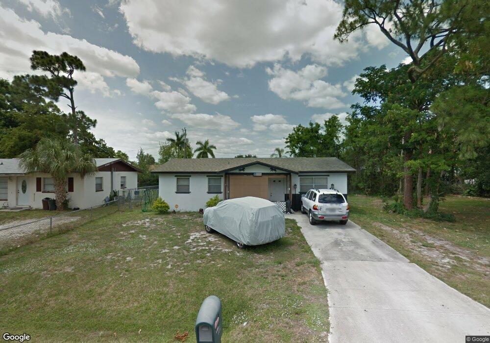
289 Byron Ave North Fort Myers, FL 33917
Estimated Value: $201,263 - $224,000
3
Beds
2
Baths
1,050
Sq Ft
$200/Sq Ft
Est. Value
About This Home
This home is located at 289 Byron Ave, North Fort Myers, FL 33917 and is currently estimated at $209,566, approximately $199 per square foot. 289 Byron Ave is a home located in Lee County with nearby schools including J. Colin English Elementary School, Dr. Carrie D. Robinson Littleton Elementary School, and Tropic Isles Elementary School.
Ownership History
Date
Name
Owned For
Owner Type
Purchase Details
Closed on
Aug 12, 2024
Sold by
Leblanc Robert F
Bought by
Leblanc Robert F and Arndt Robert
Current Estimated Value
Purchase Details
Closed on
Dec 27, 2002
Sold by
Johnson Veronica M and Johnson William J
Bought by
Leblanc Robert F and Leblanc Elva J
Home Financials for this Owner
Home Financials are based on the most recent Mortgage that was taken out on this home.
Original Mortgage
$86,148
Interest Rate
5.99%
Mortgage Type
FHA
Create a Home Valuation Report for This Property
The Home Valuation Report is an in-depth analysis detailing your home's value as well as a comparison with similar homes in the area
Home Values in the Area
Average Home Value in this Area
Purchase History
| Date | Buyer | Sale Price | Title Company |
|---|---|---|---|
| Leblanc Robert F | $100 | None Listed On Document | |
| Leblanc Robert F | $87,600 | -- |
Source: Public Records
Mortgage History
| Date | Status | Borrower | Loan Amount |
|---|---|---|---|
| Previous Owner | Leblanc Robert F | $86,148 |
Source: Public Records
Tax History Compared to Growth
Tax History
| Year | Tax Paid | Tax Assessment Tax Assessment Total Assessment is a certain percentage of the fair market value that is determined by local assessors to be the total taxable value of land and additions on the property. | Land | Improvement |
|---|---|---|---|---|
| 2025 | $499 | $182,320 | $19,622 | $127,830 |
| 2024 | $467 | $36,058 | -- | -- |
| 2023 | $467 | $35,008 | $0 | $0 |
| 2022 | $545 | $33,988 | $0 | $0 |
| 2021 | $481 | $119,112 | $16,566 | $102,546 |
| 2020 | $470 | $32,542 | $0 | $0 |
| 2019 | $448 | $31,810 | $0 | $0 |
| 2018 | $441 | $31,217 | $0 | $0 |
| 2017 | $426 | $30,575 | $0 | $0 |
| 2016 | $375 | $68,939 | $4,857 | $64,082 |
| 2015 | $365 | $58,400 | $4,695 | $53,705 |
| 2014 | -- | $51,101 | $6,172 | $44,929 |
| 2013 | -- | $42,593 | $4,951 | $37,642 |
Source: Public Records
Map
Nearby Homes
- 1404 Keuka Ave
- 293 Byron Ave
- 1338 Old Bridge Rd
- 1322 Old Bridge Rd
- 1287 Arapahoe St
- 208 Lakeview Dr
- 298 Lakeview Dr
- 1275 Old Bridge Rd
- 245 Hubbard Ave
- 1271 Gramac Dr
- 1685 Daniels Dr
- 174 Santa fe Trail
- 372 Park Lane Dr
- 300 Hubbard Ave
- 210 Cobblestone Ln
- 4921 Bayshore Rd
- 209 Captains Walk Unit 6
- 287 Poe Ave
- 1616 Daniels Dr
- 210 Brandywine Ln