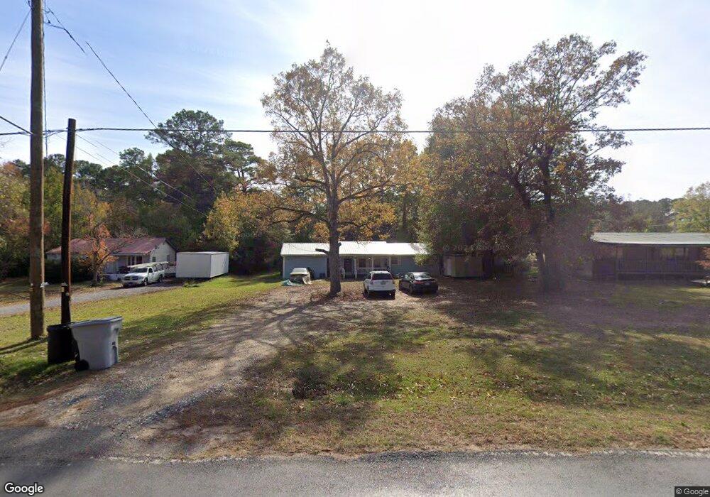
289 Caples Rd West Monroe, LA 71292
Estimated Value: $47,000 - $128,000
2
Beds
1
Bath
1,204
Sq Ft
$72/Sq Ft
Est. Value
About This Home
This home is located at 289 Caples Rd, West Monroe, LA 71292 and is currently estimated at $86,347, approximately $71 per square foot. 289 Caples Rd is a home located in Ouachita Parish with nearby schools including Woodlawn Elementary School, Woodlawn Middle School, and West Ouachita High School.
Ownership History
Date
Name
Owned For
Owner Type
Purchase Details
Closed on
Jun 27, 2019
Sold by
Vallery Michael A
Bought by
Jgs Rental Proeperty Llc
Current Estimated Value
Home Financials for this Owner
Home Financials are based on the most recent Mortgage that was taken out on this home.
Original Mortgage
$57,217
Outstanding Balance
$49,780
Interest Rate
4%
Mortgage Type
Purchase Money Mortgage
Estimated Equity
$36,567
Purchase Details
Closed on
Oct 21, 2009
Sold by
Gegeyter Billy Ray and Gegeyter Peggy Sue Johnson
Bought by
Vallery Michael Anthony
Home Financials for this Owner
Home Financials are based on the most recent Mortgage that was taken out on this home.
Original Mortgage
$20,000
Interest Rate
5.03%
Mortgage Type
Future Advance Clause Open End Mortgage
Create a Home Valuation Report for This Property
The Home Valuation Report is an in-depth analysis detailing your home's value as well as a comparison with similar homes in the area
Purchase History
| Date | Buyer | Sale Price | Title Company |
|---|---|---|---|
| Jgs Rental Proeperty Llc | $40,000 | -- | |
| Vallery Michael Anthony | $25,000 | Title West |
Source: Public Records
Mortgage History
| Date | Status | Borrower | Loan Amount |
|---|---|---|---|
| Open | Jgs Rental Proeperty Llc | $57,217 | |
| Previous Owner | Vallery Michael Anthony | $20,000 |
Source: Public Records
Tax History
| Year | Tax Paid | Tax Assessment Tax Assessment Total Assessment is a certain percentage of the fair market value that is determined by local assessors to be the total taxable value of land and additions on the property. | Land | Improvement |
|---|---|---|---|---|
| 2025 | $243 | $2,578 | $300 | $2,278 |
| 2024 | $243 | $2,578 | $300 | $2,278 |
| 2023 | $246 | $2,578 | $300 | $2,278 |
| 2022 | $229 | $2,578 | $300 | $2,278 |
| 2021 | $232 | $2,578 | $300 | $2,278 |
| 2020 | $232 | $2,578 | $300 | $2,278 |
| 2019 | $224 | $2,500 | $300 | $2,200 |
| 2018 | $224 | $2,500 | $300 | $2,200 |
| 2017 | $224 | $2,500 | $300 | $2,200 |
| 2016 | $224 | $2,500 | $300 | $2,200 |
| 2015 | $223 | $2,500 | $300 | $2,200 |
| 2014 | $223 | $2,500 | $300 | $2,200 |
| 2013 | $223 | $2,500 | $300 | $2,200 |
Source: Public Records
Map
Nearby Homes
- 314 Karen Ln
- 152 Jim Arrant Rd
- 366 Sangria St
- 329 Jim Arrant Rd
- TBD Jim Arrant Rd
- 708 Little Lake Rd
- 1039 Tidwell Rd
- 5856 Jonesboro Rd
- 219 Dogwood Cir
- 107 Z St
- 139 Candy Cane Ln
- 494 Lapine Rd
- 125 Chatham Ln
- 0 Howard Brown Rd Unit 215550
- 152 Fannin Rd
- 015 Caples Rd
- 017 Caples Rd
- 013 Caples Rd
- 04 Caples Rd
- 05 Caples Rd
Your Personal Tour Guide
Ask me questions while you tour the home.