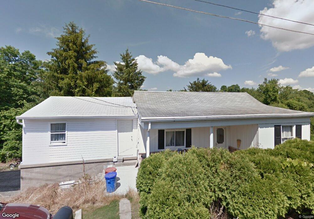
289 Colvin Run Rd Grindstone, PA 15442
Redstone Township NeighborhoodEstimated Value: $85,000 - $119,000
2
Beds
2
Baths
742
Sq Ft
$135/Sq Ft
Est. Value
About This Home
This home is located at 289 Colvin Run Rd, Grindstone, PA 15442 and is currently estimated at $100,399, approximately $135 per square foot. 289 Colvin Run Rd is a home located in Fayette County with nearby schools including Brownsville Area Elementary School, Brownsville Area Middle School, and Brownsville Area High School.
Ownership History
Date
Name
Owned For
Owner Type
Purchase Details
Closed on
Sep 27, 2024
Sold by
Holt Shirley Ann and Mitchell Herbert G
Bought by
Sebeck Joseph L and Sebeck Nancy J
Current Estimated Value
Home Financials for this Owner
Home Financials are based on the most recent Mortgage that was taken out on this home.
Original Mortgage
$84,000
Outstanding Balance
$83,140
Interest Rate
6.49%
Mortgage Type
Credit Line Revolving
Estimated Equity
$17,259
Purchase Details
Closed on
Jan 1, 1968
Bought by
Holt William J and Holt Shirley
Create a Home Valuation Report for This Property
The Home Valuation Report is an in-depth analysis detailing your home's value as well as a comparison with similar homes in the area
Home Values in the Area
Average Home Value in this Area
Purchase History
| Date | Buyer | Sale Price | Title Company |
|---|---|---|---|
| Sebeck Joseph L | $80,000 | None Listed On Document | |
| Holt William J | -- | -- |
Source: Public Records
Mortgage History
| Date | Status | Borrower | Loan Amount |
|---|---|---|---|
| Open | Sebeck Joseph L | $84,000 |
Source: Public Records
Tax History Compared to Growth
Tax History
| Year | Tax Paid | Tax Assessment Tax Assessment Total Assessment is a certain percentage of the fair market value that is determined by local assessors to be the total taxable value of land and additions on the property. | Land | Improvement |
|---|---|---|---|---|
| 2025 | $773 | $28,275 | $11,500 | $16,775 |
| 2024 | $773 | $28,277 | $11,500 | $16,777 |
| 2023 | $1,547 | $28,277 | $11,500 | $16,777 |
| 2022 | $1,547 | $28,277 | $11,500 | $16,777 |
| 2021 | $1,499 | $28,277 | $11,500 | $16,777 |
| 2020 | $1,498 | $28,277 | $11,500 | $16,777 |
| 2019 | $1,415 | $28,277 | $11,500 | $16,777 |
| 2018 | $1,415 | $28,277 | $11,500 | $16,777 |
| 2017 | $1,381 | $28,277 | $11,500 | $16,777 |
| 2016 | -- | $28,277 | $11,500 | $16,777 |
| 2015 | -- | $28,277 | $11,500 | $16,777 |
| 2014 | -- | $56,554 | $23,000 | $33,554 |
Source: Public Records
Map
Nearby Homes
- 104 Royal Rd
- 1161 1st St
- 107 Madison St
- 120 E 1st St
- 419 2nd St
- 100 Bank St
- 6020 National Pike
- 645 National Pike E
- Braznell Concrete Rd
- 225 Lynn Rd
- 411 East Ave
- 431 1st St
- 414 Middle Ave
- TR326 Simpson Rd
- 300 Stone Church Rd
- 185 Main St
- 84 Union St
- 428 Grindstone Rd
- 213 Stone Church Rd
- 218 Hatfield Rd
- 319 Colvin Run Rd
- 262 Colvin Run Rd
- 283 Colvin Run Rd
- 258 Colvin Run Rd
- 331 Colvin Run Rd
- 277 Colvin Run Rd
- 337 Colvin Run Rd
- 232 Colvin Run Rd
- 219 Fords Hill Rd
- 221 Fords Hill Rd
- 266 Colvin Run Rd
- 198 Fords Hill Rd
- 187 Fords Hill Rd
- 291 Fords Hill Rd
- 245 Fords Hill Rd
- 534 Davidson Rd
- 520 Davidson Rd
- 592 Davidson Rd
- 602 Davidson Rd
- 203 Colvin Run Rd