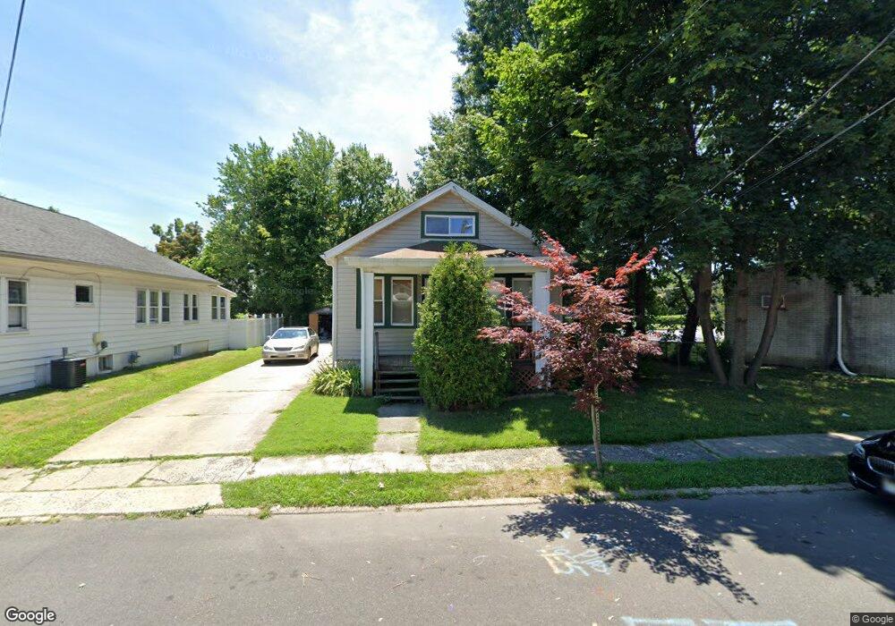
289 Homecrest Ave Ewing, NJ 08638
Prospect NeighborhoodEstimated Value: $258,000 - $347,000
2
Beds
1
Bath
1,198
Sq Ft
$249/Sq Ft
Est. Value
About This Home
This home is located at 289 Homecrest Ave, Ewing, NJ 08638 and is currently estimated at $297,854, approximately $248 per square foot. 289 Homecrest Ave is a home located in Mercer County with nearby schools including Ewing High School and Trenton Stem-To-Civics Charter School.
Ownership History
Date
Name
Owned For
Owner Type
Purchase Details
Closed on
May 30, 1997
Sold by
Winnick Stanley
Bought by
Hagins Betty
Current Estimated Value
Home Financials for this Owner
Home Financials are based on the most recent Mortgage that was taken out on this home.
Original Mortgage
$74,000
Outstanding Balance
$10,489
Interest Rate
7.87%
Mortgage Type
FHA
Estimated Equity
$287,365
Purchase Details
Closed on
Mar 19, 1997
Sold by
White Ruth
Bought by
Winnick Stanley
Home Financials for this Owner
Home Financials are based on the most recent Mortgage that was taken out on this home.
Original Mortgage
$31,000
Interest Rate
7.76%
Create a Home Valuation Report for This Property
The Home Valuation Report is an in-depth analysis detailing your home's value as well as a comparison with similar homes in the area
Home Values in the Area
Average Home Value in this Area
Purchase History
We collect this data history from publicly available records. To have your information removed, we recommend requesting removal directly through your county’s website.
| Date | Buyer | Sale Price | Title Company |
|---|---|---|---|
| Hagins Betty | $74,100 | -- | |
| Winnick Stanley | $38,706 | -- |
Source: Public Records
Mortgage History
We collect this data history from publicly available records. To have your information removed, we recommend requesting removal directly through your county’s website.
| Date | Status | Borrower | Loan Amount |
|---|---|---|---|
| Open | Hagins Betty | $74,000 | |
| Previous Owner | Winnick Stanley | $31,000 |
Source: Public Records
Tax History
| Year | Tax Paid | Tax Assessment Tax Assessment Total Assessment is a certain percentage of the fair market value that is determined by local assessors to be the total taxable value of land and additions on the property. | Land | Improvement |
|---|---|---|---|---|
| 2025 | $4,849 | $123,300 | $41,000 | $82,300 |
| 2024 | $4,558 | $123,300 | $41,000 | $82,300 |
| 2023 | $4,558 | $123,300 | $41,000 | $82,300 |
| 2022 | $4,435 | $123,300 | $41,000 | $82,300 |
| 2021 | $4,327 | $123,300 | $41,000 | $82,300 |
| 2020 | $4,265 | $123,300 | $41,000 | $82,300 |
| 2019 | $4,154 | $123,300 | $41,000 | $82,300 |
| 2018 | $3,962 | $75,000 | $32,300 | $42,700 |
| 2017 | $4,054 | $75,000 | $32,300 | $42,700 |
| 2016 | $3,999 | $75,000 | $32,300 | $42,700 |
| 2015 | $3,946 | $75,000 | $32,300 | $42,700 |
| 2014 | $3,935 | $75,000 | $32,300 | $42,700 |
Source: Public Records
Map
Nearby Homes
- 268 Weber Ave
- 5 Pershing Ave
- 321 Parkway Ave
- 131 Homecrest Ave
- 108 Homecrest Ave
- 100 Homecrest Ave
- 239 Huff Ave
- 222 Oliver Ave
- 116 Oliver Ave
- 344 Gardner Ave
- 213 Oliver Ave
- 87 Pennwood Dr
- 584 Parkway Ave
- 318 Gardner Ave
- 0 Dryden Ave
- 355 Oakland St Unit 1F
- 1048-1052 Prospect St
- 365 Concord Ave
- 363 Concord Ave
- 530 Greenway Ave
- 275 Weber Ave
- 273 Weber Ave
- 271 Weber Ave
- 1196 Pennington Rd
- 1198 Pennington Rd
- 1200 Pennington Rd
- 269 Weber Ave
- 1194 Pennington Rd
- 298 Homecrest Ave
- 1202 Pennington Rd
- 267 Weber Ave
- 296 Homecrest Ave
- 278 Weber Ave
- 292 Homecrest Ave
- 270 Weber Ave
- 272 Weber Ave
- 263 Weber Ave
- 286 Homecrest Ave
- 268 Weber Ave Unit 2ND FLOOR
- 284 Homecrest Ave
Your Personal Tour Guide
Ask me questions while you tour the home.