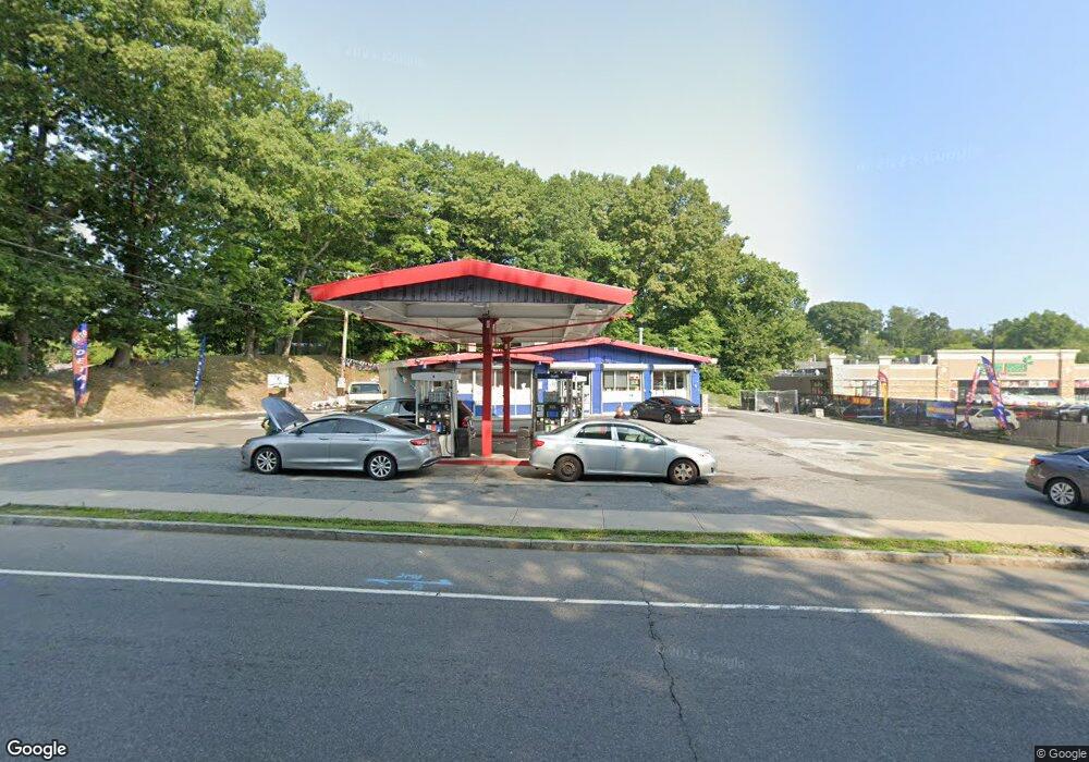
289 Huntington Turnpike Bridge Port, CT 06610
North Bridgeport Neighborhood
--
Bed
--
Bath
1,933
Sq Ft
0.82
Acres
About This Home
This home is located at 289 Huntington Turnpike, Bridge Port, CT 06610. 289 Huntington Turnpike is a home located in Fairfield County with nearby schools including Hooker School, Harding High School, and Achievement First Bridgeport Academy Elementary School.
Ownership History
Date
Name
Owned For
Owner Type
Purchase Details
Closed on
Sep 9, 2013
Sold by
Ct Reo Properties Llc
Bought by
Moksha Llc
Purchase Details
Closed on
Jun 13, 2007
Sold by
Aj & R Petroleum Llc
Bought by
Chowdhury & Rahman Llc
Purchase Details
Closed on
Feb 22, 1999
Sold by
Shell Oil Co
Bought by
Motiva Ent Llc
Create a Home Valuation Report for This Property
The Home Valuation Report is an in-depth analysis detailing your home's value as well as a comparison with similar homes in the area
Home Values in the Area
Average Home Value in this Area
Purchase History
| Date | Buyer | Sale Price | Title Company |
|---|---|---|---|
| Moksha Llc | $320,000 | -- | |
| Moksha Llc | $320,000 | -- | |
| Chowdhury & Rahman Llc | $900,000 | -- | |
| Chowdhury & Rahman Llc | $900,000 | -- | |
| Motiva Ent Llc | $564,897 | -- | |
| Motiva Ent Llc | $564,897 | -- |
Source: Public Records
Mortgage History
| Date | Status | Borrower | Loan Amount |
|---|---|---|---|
| Open | Motiva Ent Llc | $250,000 | |
| Closed | Motiva Ent Llc | $350,000 |
Source: Public Records
Tax History Compared to Growth
Tax History
| Year | Tax Paid | Tax Assessment Tax Assessment Total Assessment is a certain percentage of the fair market value that is determined by local assessors to be the total taxable value of land and additions on the property. | Land | Improvement |
|---|---|---|---|---|
| 2025 | $24,262 | $558,390 | $338,370 | $220,020 |
| 2024 | $24,262 | $558,390 | $338,370 | $220,020 |
| 2023 | $24,262 | $558,390 | $338,370 | $220,020 |
| 2022 | $24,262 | $558,390 | $338,370 | $220,020 |
| 2021 | $24,262 | $558,390 | $338,370 | $220,020 |
| 2020 | $30,242 | $560,140 | $325,810 | $234,330 |
| 2019 | $30,242 | $560,140 | $325,810 | $234,330 |
| 2018 | $30,455 | $560,140 | $325,810 | $234,330 |
| 2017 | $30,455 | $560,140 | $325,810 | $234,330 |
| 2016 | $30,455 | $560,140 | $325,810 | $234,330 |
| 2015 | $26,618 | $630,750 | $390,970 | $239,780 |
| 2014 | $26,618 | $630,750 | $390,970 | $239,780 |
Source: Public Records
Map
Nearby Homes
- 206 Huntington Turnpike
- 120 Huntington Turnpike Unit 202
- 120 Huntington Turnpike Unit 606
- 120 Huntington Turnpike Unit 801
- 132 Virginia Ave Unit 132
- 94 Virginia Ave Unit 94
- 165 Nutmeg Rd
- 50 Pilgrim Rd
- 33 Louisiana Ave Unit 35
- 53 Beverly Dr
- 11 Nob Hill Cir
- 197 Dupont Place Unit 199
- 123 Beverly Dr
- 2463 E Main St
- 217 Hillcrest Rd
- 69 Glen Cir
- 250 Dayton Rd
- 374 Mapledale Place
- 149 Edna Ave Unit 153
- 275 Roger Williams Rd
- 184 Jennings Ave
- 170 Jennings Ave
- 156 Jennings Ave
- 10 Knoll Place Unit 12
- 140 Jennings Ave
- 13 Knoll Place Unit 15
- 9 Knoll Place Unit 11
- 314 Huntington Turnpike
- 124 Jennings Ave
- 175 Jennings Ave
- 205 Jennings Ave
- 30 Knoll Place Unit 32
- 161 Jennings Ave
- 25 Knoll Place Unit 27
- 33 Knoll Place Unit 35
- 221 Jennings Ave
- 38 Knoll Place Unit 40
- 25-27 Knoll Place
- 110 Jennings Ave
- 17 Knoll Place Unit 19