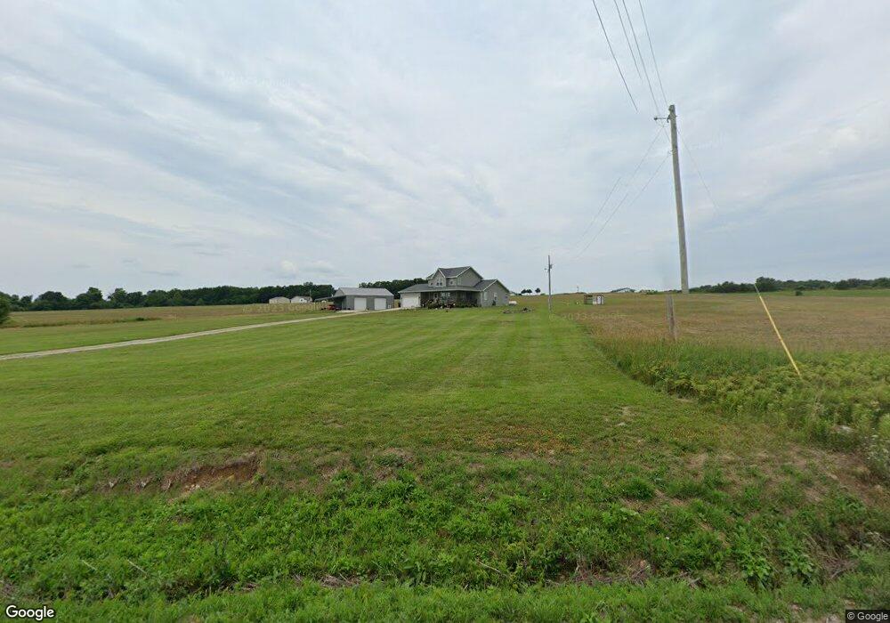
289 Olive Rd Fair Grove, MO 65648
Estimated Value: $181,000 - $366,000
--
Bed
--
Bath
1,291
Sq Ft
$225/Sq Ft
Est. Value
About This Home
This home is located at 289 Olive Rd, Fair Grove, MO 65648 and is currently estimated at $289,955, approximately $224 per square foot. 289 Olive Rd is a home with nearby schools including Fair Grove Elementary School, Fair Grove Middle School, and Fair Grove High School.
Ownership History
Date
Name
Owned For
Owner Type
Purchase Details
Closed on
Jun 6, 2016
Sold by
Hill Ramona G
Bought by
Hill Cory and Hill Molly
Current Estimated Value
Home Financials for this Owner
Home Financials are based on the most recent Mortgage that was taken out on this home.
Original Mortgage
$28,250
Interest Rate
3.59%
Mortgage Type
Commercial
Purchase Details
Closed on
Nov 19, 2009
Sold by
Hill Hill Ramona G Ramona G
Bought by
Hill Cory David
Create a Home Valuation Report for This Property
The Home Valuation Report is an in-depth analysis detailing your home's value as well as a comparison with similar homes in the area
Home Values in the Area
Average Home Value in this Area
Purchase History
| Date | Buyer | Sale Price | Title Company |
|---|---|---|---|
| Hill Cory | -- | None Available | |
| Hill Cory David | -- | None Available |
Source: Public Records
Mortgage History
| Date | Status | Borrower | Loan Amount |
|---|---|---|---|
| Closed | Hill Cory | $28,250 |
Source: Public Records
Tax History Compared to Growth
Tax History
| Year | Tax Paid | Tax Assessment Tax Assessment Total Assessment is a certain percentage of the fair market value that is determined by local assessors to be the total taxable value of land and additions on the property. | Land | Improvement |
|---|---|---|---|---|
| 2024 | $1,406 | $29,290 | $0 | $0 |
| 2023 | $1,392 | $26,890 | $0 | $0 |
| 2022 | $1,328 | $27,860 | $0 | $0 |
| 2021 | $1,328 | $25,130 | $0 | $0 |
| 2020 | $1,381 | $25,130 | $0 | $0 |
| 2019 | $1,384 | $25,160 | $0 | $0 |
| 2018 | $987 | $17,800 | $0 | $0 |
| 2014 | -- | $16,150 | $0 | $0 |
Source: Public Records
Map
Nearby Homes
- 5 Alyssa Hills Ln
- 195 Cumberland Rd
- Tbd Tr 2 N Farm Rd 215
- 4 Somerset Rd
- 458 Cumberland Rd
- 78 Karen Dr
- 21 Missouri 215
- 1236 State Road Aa
- 000 Lot 5 Sheridan Rd
- 000 Lot 4 Sheridan Rd
- 000 Lot 3 Sheridan Rd
- 000 Lot 1 Sheridan Rd
- 000 Lot 2 Sheridan Rd
- 2494 E 548th
- 64 State Highway 215
- 128 Somerset Rd
- 68 Sunnybrook Cir
- 0000 Junior Ln
- 0000 State Highway 38
- 8 Slater Rd
- 28 Alyssa Hills Ln
- 26 Alyssa Hills Ln
- 167 Woodstock Rd
- 100 Chadwick Rd
- 22 Alyssa Hills Ln
- 34 Alyssa Hills Ln
- 4 Alyssa Hills Ln
- 0 Lot 11 Alyssa Unit 11014002
- 261 Olive Rd
- 261 Olive Rd
- 261 Olive Rd
- 38 Alyssa Hills Ln
- 0 Woodstock Rd Unit 21522
- 0 Woodstock Rd Unit 21521
- 0 Woodstock Rd Unit 10803612
- 0 Woodstock Rd Unit 10803613
- 0 Woodstock Rd Unit 10803610
- 0 Woodstock Rd Unit 10813841
- 0 Woodstock Rd Unit 10813843
- 0 Woodstock Rd Unit 10813869