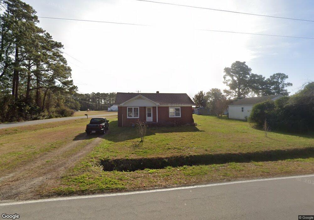
289 Otway Farm Rd Beaufort, NC 28516
Estimated Value: $210,000 - $244,000
4
Beds
1
Bath
1,568
Sq Ft
$147/Sq Ft
Est. Value
About This Home
This home is located at 289 Otway Farm Rd, Beaufort, NC 28516 and is currently estimated at $231,131, approximately $147 per square foot. 289 Otway Farm Rd is a home located in Carteret County with nearby schools including Down East Middle School and East Carteret High School.
Ownership History
Date
Name
Owned For
Owner Type
Purchase Details
Closed on
Sep 20, 2021
Sold by
Bcp Otway Farm Llc
Bought by
Bbh Otway Farm Llc
Current Estimated Value
Purchase Details
Closed on
Nov 2, 2020
Sold by
Babcock Richard and Babcock Kay
Bought by
Bcp Otway Farm Llc
Purchase Details
Closed on
Jun 1, 2005
Sold by
Lawrence Tilton Steve
Bought by
Babcock Richard J and Babcock Kay B
Home Financials for this Owner
Home Financials are based on the most recent Mortgage that was taken out on this home.
Original Mortgage
$60,000
Interest Rate
5.74%
Mortgage Type
Purchase Money Mortgage
Create a Home Valuation Report for This Property
The Home Valuation Report is an in-depth analysis detailing your home's value as well as a comparison with similar homes in the area
Home Values in the Area
Average Home Value in this Area
Purchase History
| Date | Buyer | Sale Price | Title Company |
|---|---|---|---|
| Bbh Otway Farm Llc | -- | None Available | |
| Bcp Otway Farm Llc | -- | None Available | |
| Babcock Richard J | $85,000 | None Available |
Source: Public Records
Mortgage History
| Date | Status | Borrower | Loan Amount |
|---|---|---|---|
| Previous Owner | Babcock Richard J | $60,000 |
Source: Public Records
Tax History Compared to Growth
Tax History
| Year | Tax Paid | Tax Assessment Tax Assessment Total Assessment is a certain percentage of the fair market value that is determined by local assessors to be the total taxable value of land and additions on the property. | Land | Improvement |
|---|---|---|---|---|
| 2025 | $1,158 | $298,629 | $19,513 | $279,116 |
| 2024 | $636 | $99,657 | $21,546 | $78,111 |
| 2023 | $650 | $99,657 | $21,546 | $78,111 |
| 2022 | $670 | $99,657 | $21,546 | $78,111 |
| 2021 | $650 | $99,657 | $21,546 | $78,111 |
| 2020 | $658 | $99,657 | $21,546 | $78,111 |
| 2019 | $732 | $120,025 | $26,717 | $93,308 |
| 2017 | $726 | $120,025 | $26,717 | $93,308 |
| 2016 | $714 | $120,025 | $26,717 | $93,308 |
| 2015 | $672 | $120,025 | $26,717 | $93,308 |
| 2014 | $639 | $114,862 | $30,723 | $84,139 |
Source: Public Records
Map
Nearby Homes
- 265 Otway Farm Rd
- 177 Otway Farm Rd
- 158 Channel Rock Rd
- 358 Gillikin Rd
- 310 Anson Rd
- 125 Dixie St
- 315 Amos Gillikin Rd
- 202 Leeward
- 311 Anson Rd
- 315 Anson Rd
- 195 Firetower Rd
- 325 Anson Rd
- 324 Anson Rd
- 603 Gillikin Rd
- 145 Elnora Jones Rd
- 102 Jade St
- 111 Jade
- 477 Harkers Island Rd
- 413 Pelican Harbor Rd
- 0 Highway 70 Unit 100377588
- 223 Gillikin Rd
- 273 Otway Farm Rd
- 243 Gillikin Rd
- 187 Gillikin Rd
- 188 Gillikin Rd
- 255 Gillikin Rd
- 256 Gillikin Rd
- 241 Otway Farm Rd
- 234 Otway Farm Rd
- 269 Gillikin Rd
- 266 Gillikin Rd
- 229 Otway Farm Rd
- 275 Gillikin Rd
- 272 Gillikin Rd
- 282 Gillikin Rd
- 285 Gillikin Rd
- 560 Hwy 70 Otway
- 290 Gillikin Rd
- 205 Otway Farm Rd
- 299 Gillikin Rd