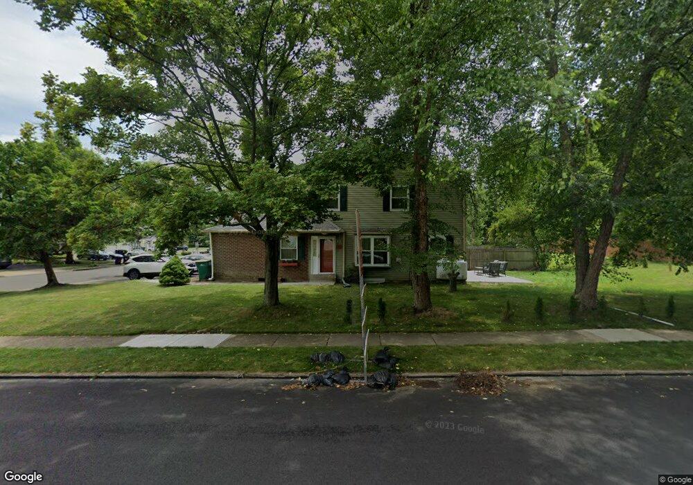
289 S Flint Ct Yardley, PA 19067
Estimated Value: $430,000 - $507,311
3
Beds
3
Baths
--
Sq Ft
4,225
Sq Ft Lot
About This Home
This home is located at 289 S Flint Ct, Yardley, PA 19067 and is currently estimated at $480,078. 289 S Flint Ct is a home located in Bucks County with nearby schools including Eleanor Roosevelt Elementary School, Pennwood Middle School, and Pennsbury High School.
Ownership History
Date
Name
Owned For
Owner Type
Purchase Details
Closed on
Jun 25, 2012
Sold by
Patel Kiran
Bought by
Patel Kiran and Patel Meghavi
Current Estimated Value
Home Financials for this Owner
Home Financials are based on the most recent Mortgage that was taken out on this home.
Original Mortgage
$204,000
Outstanding Balance
$30,084
Interest Rate
2.98%
Mortgage Type
New Conventional
Estimated Equity
$449,994
Purchase Details
Closed on
Aug 12, 2009
Sold by
Deutsche Bank National Trust Company
Bought by
Patel Kiran
Home Financials for this Owner
Home Financials are based on the most recent Mortgage that was taken out on this home.
Original Mortgage
$254,125
Interest Rate
5.12%
Mortgage Type
FHA
Purchase Details
Closed on
Jan 30, 2009
Sold by
Murray Andrew and Murray Stacey
Bought by
Deutsche Bank National Trust Company
Create a Home Valuation Report for This Property
The Home Valuation Report is an in-depth analysis detailing your home's value as well as a comparison with similar homes in the area
Home Values in the Area
Average Home Value in this Area
Purchase History
| Date | Buyer | Sale Price | Title Company |
|---|---|---|---|
| Patel Kiran | -- | None Available | |
| Patel Kiran | $230,000 | None Available | |
| Deutsche Bank National Trust Company | $892 | None Available |
Source: Public Records
Mortgage History
| Date | Status | Borrower | Loan Amount |
|---|---|---|---|
| Open | Patel Kiran | $204,000 | |
| Previous Owner | Patel Kiran | $254,125 |
Source: Public Records
Tax History Compared to Growth
Tax History
| Year | Tax Paid | Tax Assessment Tax Assessment Total Assessment is a certain percentage of the fair market value that is determined by local assessors to be the total taxable value of land and additions on the property. | Land | Improvement |
|---|---|---|---|---|
| 2025 | $6,706 | $28,320 | $3,520 | $24,800 |
| 2024 | $6,706 | $28,320 | $3,520 | $24,800 |
| 2023 | $6,369 | $28,320 | $3,520 | $24,800 |
| 2022 | $6,231 | $28,320 | $3,520 | $24,800 |
| 2021 | $6,132 | $28,320 | $3,520 | $24,800 |
| 2020 | $6,132 | $28,320 | $3,520 | $24,800 |
| 2019 | $6,011 | $28,320 | $3,520 | $24,800 |
| 2018 | $5,905 | $28,320 | $3,520 | $24,800 |
| 2017 | $5,723 | $28,320 | $3,520 | $24,800 |
| 2016 | $5,656 | $28,320 | $3,520 | $24,800 |
| 2015 | -- | $28,320 | $3,520 | $24,800 |
| 2014 | -- | $28,320 | $3,520 | $24,800 |
Source: Public Records
Map
Nearby Homes
- 250 Wild Orchid Ct
- 389 Twig Ln
- 1265 Barclay Crescent
- 302 Frazer Dr
- 1561 Applewood Cir
- 1090 Bancroft Ln
- 1578 Willow Pond Dr
- 200 Clover Hill Ct
- 432 Schindler Dr
- 184 Crestview Way
- 1517 Derbyshire Rd
- 290 Oxford Valley Rd
- 620 Grindan Dr
- 971 Weber Dr
- 571 Heritage Oak Dr
- 1605 Covington Rd
- 195 Roosevelt Dr
- 164 Tyler Way
- 229 Walton Dr
- 332 Dunhill Way
- 281 S Flint Ct
- 273 S Flint Ct
- 257 S Flint Ct
- 249 S Flint Ct
- 301 N Flint Ct
- 290 Crystal Ct
- 288 S Flint Ct
- 280 S Flint Ct
- 241 S Flint Ct
- 272 S Flint Ct
- 300 N Flint Ct
- 256 S Flint Ct
- 233 S Flint Ct
- 260 Crystal Ct
- 248 S Flint Ct
- 240 S Flint Ct
- 225 S Flint Ct
- 331 N Flint Ct
- 1270 Bluestone Dr
- 217 S Flint Ct