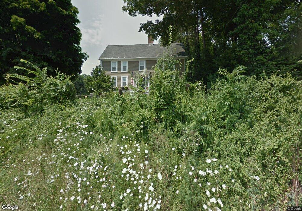
289 S Main St Cheshire, CT 06410
Estimated Value: $586,000 - $636,000
4
Beds
2
Baths
2,156
Sq Ft
$283/Sq Ft
Est. Value
About This Home
This home is located at 289 S Main St, Cheshire, CT 06410 and is currently estimated at $610,010, approximately $282 per square foot. 289 S Main St is a home located in New Haven County with nearby schools including Darcey School, Doolittle School, and Dodd Middle School.
Ownership History
Date
Name
Owned For
Owner Type
Purchase Details
Closed on
May 15, 2006
Sold by
Est Talbot Mary C and Talbot Richard K
Bought by
Talbot James R and Talbot Susan J
Current Estimated Value
Home Financials for this Owner
Home Financials are based on the most recent Mortgage that was taken out on this home.
Original Mortgage
$89,000
Interest Rate
6.4%
Purchase Details
Closed on
Dec 10, 2004
Sold by
Est Talbot Mary C and Talbot Richard R
Bought by
Peccini Norman B and Peccini Noreen B
Create a Home Valuation Report for This Property
The Home Valuation Report is an in-depth analysis detailing your home's value as well as a comparison with similar homes in the area
Home Values in the Area
Average Home Value in this Area
Purchase History
| Date | Buyer | Sale Price | Title Company |
|---|---|---|---|
| Talbot James R | $400,000 | -- | |
| Talbot James R | $400,000 | -- | |
| Peccini Norman B | $10,000 | -- | |
| Peccini Norman B | $10,000 | -- |
Source: Public Records
Mortgage History
| Date | Status | Borrower | Loan Amount |
|---|---|---|---|
| Closed | Peccini Norman B | $89,000 |
Source: Public Records
Tax History Compared to Growth
Tax History
| Year | Tax Paid | Tax Assessment Tax Assessment Total Assessment is a certain percentage of the fair market value that is determined by local assessors to be the total taxable value of land and additions on the property. | Land | Improvement |
|---|---|---|---|---|
| 2025 | $9,483 | $318,850 | $65,870 | $252,980 |
| 2024 | $8,756 | $318,850 | $65,870 | $252,980 |
| 2023 | $7,537 | $214,780 | $65,900 | $148,880 |
| 2022 | $7,371 | $214,780 | $65,900 | $148,880 |
| 2021 | $8,185 | $214,780 | $65,900 | $148,880 |
| 2020 | $7,135 | $214,780 | $65,900 | $148,880 |
| 2019 | $7,135 | $214,780 | $65,900 | $148,880 |
| 2018 | $7,011 | $214,930 | $66,200 | $148,730 |
| 2017 | $7,572 | $214,930 | $66,200 | $148,730 |
| 2016 | $6,596 | $214,930 | $66,200 | $148,730 |
| 2015 | $6,596 | $214,930 | $66,200 | $148,730 |
| 2014 | $6,502 | $214,930 | $66,200 | $148,730 |
Source: Public Records
Map
Nearby Homes
- 23 Melrose Dr
- 6 Melrose Dr Unit Lot 10
- 9 Melrose Dr Unit 6
- 167 Spring St
- 130 Edwards Rd
- 30 Elmwood Dr
- 478 Oak Ave Unit 68
- 471 E Mitchell Ave
- 471 Spring St
- 41 Surrey Dr
- 70 Warren St
- 64 Warren St
- 3 Melrose Dr Unit Lot 9
- 50 Heritage Dr
- 332 Academy Rd
- 50 Wintergreen Ln
- 288 Argyle Rd
- 4 Brookfield Ct
- 435 Maple Ave
- 37 Ives Hill Ct
- 311 S Main St
- 273 S Main St
- 264 Platt Ln
- 28 Lanyon Dr
- 250 Platt Ln
- 325 S Main St
- 245 S Main St
- 330 S Main St
- 56 Lanyon Dr
- 243 S Main St
- 357 S Main St
- Site 2 Platt Ln
- Site 3 Platt Ln
- 246 Platt Ln
- 345 S Main St
- 242 S Main St Unit 270
- 242 S Main St Unit 264
- 242 S Main St Unit 260
- 242 S Main St Unit 254
- 242 S Main St Unit 250