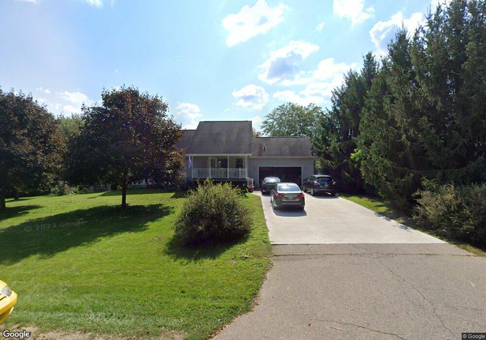
289 Second St Concord, MI 49237
Estimated Value: $208,000 - $292,000
Studio
--
Bath
1,344
Sq Ft
$190/Sq Ft
Est. Value
About This Home
This home is located at 289 Second St, Concord, MI 49237 and is currently estimated at $255,842, approximately $190 per square foot. 289 Second St is a home located in Jackson County with nearby schools including Concord Elementary School, Concord Middle School, and Concord High School.
Ownership History
Date
Name
Owned For
Owner Type
Purchase Details
Closed on
Feb 21, 2000
Sold by
Murdock Larry L and Murdock Pamela E
Bought by
Winter Charles Rocky and Winter Mary Josephine
Current Estimated Value
Purchase Details
Closed on
Feb 15, 2000
Sold by
Rutz Donald J and Rutz Marilyn M
Bought by
Murdock Larry L and Murdock Pamela E
Purchase Details
Closed on
Aug 28, 1998
Sold by
Murdock Larry L and Murdock Pamela E
Bought by
Murdock Larry L and Murdock Pamela E
Create a Home Valuation Report for This Property
The Home Valuation Report is an in-depth analysis detailing your home's value as well as a comparison with similar homes in the area
Purchase History
| Date | Buyer | Sale Price | Title Company |
|---|---|---|---|
| Winter Charles Rocky | $14,000 | -- | |
| Murdock Larry L | $9,500 | -- | |
| Murdock Larry L | $8,500 | -- |
Source: Public Records
Tax History
| Year | Tax Paid | Tax Assessment Tax Assessment Total Assessment is a certain percentage of the fair market value that is determined by local assessors to be the total taxable value of land and additions on the property. | Land | Improvement |
|---|---|---|---|---|
| 2025 | $3,275 | $117,100 | $117,100 | $0 |
| 2024 | $25 | $122,300 | $122,300 | $0 |
| 2023 | $1,853 | $106,800 | $106,800 | $0 |
| 2022 | $3,270 | $93,800 | $93,800 | $0 |
| 2021 | $3,218 | $89,800 | $89,800 | $0 |
| 2020 | $3,184 | $78,000 | $0 | $0 |
| 2019 | $3,107 | $74,900 | $0 | $0 |
| 2018 | $2,104 | $71,400 | $0 | $0 |
| 2017 | $1,887 | $65,700 | $0 | $0 |
| 2016 | $685 | $67,950 | $67,950 | $0 |
| 2015 | -- | $71,650 | $71,650 | $0 |
| 2014 | -- | $59,850 | $59,850 | $0 |
| 2013 | -- | $59,850 | $59,850 | $0 |
Source: Public Records
Map
Nearby Homes
- 190 Maple St
- 0 River Bend Drive Lot #11
- 0 River Bend Drive Lot #4
- 0 River Bend Drive Lot #3
- 0 River Bend Drive Lot #5
- 0 River Bend Drive Lot #9
- 0 River Bend Drive Lot #10
- 313 Michigan St
- 213 Railroad St
- 0 Aldrich St Unit 26012143
- 125 Coxon St
- 731 Sears Rd
- 201 Lake Hills Dr
- 0 Albion Rd
- 270 Wood Hills Dr
- 7210 Pulaski Rd Rd
- 340 Wood Hills Dr
- 13330 Cornell Rd
- 0 River Bend Drive Lot #1
- 0 River Bend Drive Lot #2
- 290 Third St
- 269 Second St
- 293 Second St
- 270 Third St
- 270 Third St
- 270 Second St
- 270 2nd St
- Lot 22 3rd St
- 0 2nd St
- 289 Third St
- 265 Second St
- 289 3rd St
- 295 Second St
- 275 First St
- 294 Third St
- 294 Third St Unit THIRD
- 293 Third St
- 297 First St
- 0 Lot 16 Second St Unit 1055276
- 0 Lot 13 Second St Unit 20000789
Your Personal Tour Guide
Ask me questions while you tour the home.