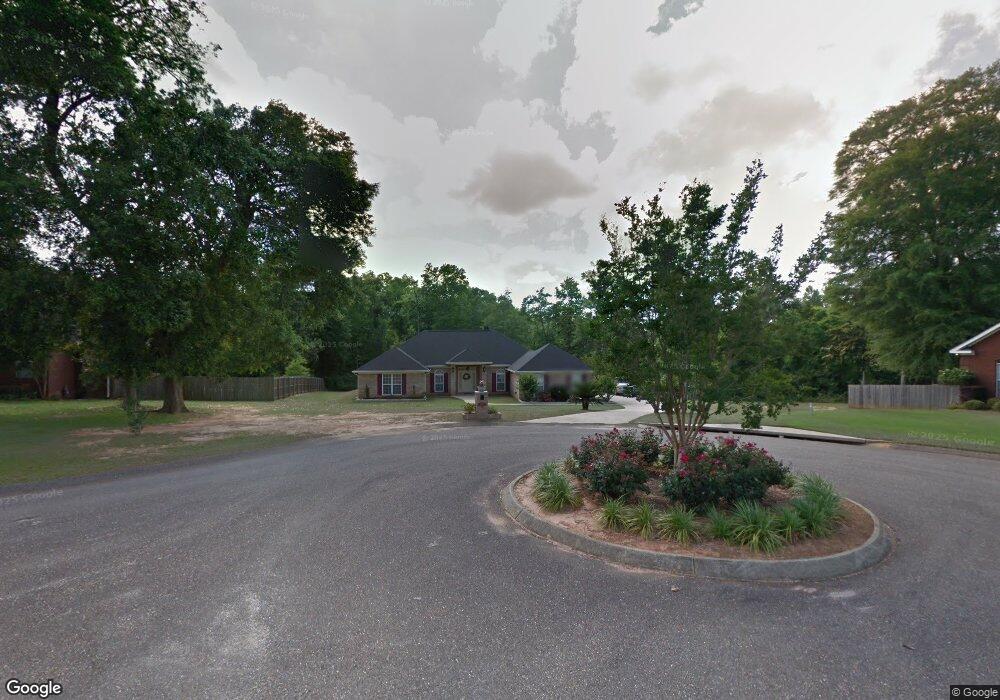
2890 Branson Rd W Mobile, AL 36695
Outer West Mobile NeighborhoodEstimated Value: $315,995 - $393,000
3
Beds
2
Baths
2,640
Sq Ft
$133/Sq Ft
Est. Value
About This Home
This home is located at 2890 Branson Rd W, Mobile, AL 36695 and is currently estimated at $349,999, approximately $132 per square foot. 2890 Branson Rd W is a home located in Mobile County with nearby schools including Hutchens Elementary School, Dawes Intermediate School, and Bernice J Causey Middle School.
Ownership History
Date
Name
Owned For
Owner Type
Purchase Details
Closed on
Dec 9, 2004
Sold by
Simmons Horace
Bought by
Simmons Horace and Mccloud Kim R
Current Estimated Value
Purchase Details
Closed on
Feb 12, 2003
Sold by
Coastal Enterprises Inc
Bought by
Simmons Horace
Home Financials for this Owner
Home Financials are based on the most recent Mortgage that was taken out on this home.
Original Mortgage
$176,355
Outstanding Balance
$79,512
Interest Rate
5.93%
Mortgage Type
Construction
Estimated Equity
$270,487
Create a Home Valuation Report for This Property
The Home Valuation Report is an in-depth analysis detailing your home's value as well as a comparison with similar homes in the area
Home Values in the Area
Average Home Value in this Area
Purchase History
| Date | Buyer | Sale Price | Title Company |
|---|---|---|---|
| Simmons Horace | -- | -- | |
| Simmons Horace | -- | -- |
Source: Public Records
Mortgage History
| Date | Status | Borrower | Loan Amount |
|---|---|---|---|
| Open | Simmons Horace | $176,355 |
Source: Public Records
Tax History Compared to Growth
Tax History
| Year | Tax Paid | Tax Assessment Tax Assessment Total Assessment is a certain percentage of the fair market value that is determined by local assessors to be the total taxable value of land and additions on the property. | Land | Improvement |
|---|---|---|---|---|
| 2024 | -- | $28,040 | $4,000 | $24,040 |
| 2023 | $0 | $24,850 | $4,000 | $20,850 |
| 2022 | $0 | $23,080 | $4,000 | $19,080 |
| 2021 | $0 | $23,310 | $4,000 | $19,310 |
| 2020 | $0 | $21,800 | $4,000 | $17,800 |
| 2019 | $0 | $21,940 | $0 | $0 |
| 2018 | $0 | $22,140 | $0 | $0 |
| 2017 | $0 | $21,980 | $0 | $0 |
| 2016 | -- | $21,640 | $0 | $0 |
| 2013 | -- | $23,660 | $0 | $0 |
Source: Public Records
Map
Nearby Homes
- 2760 Wildflower Dr W
- 0 Newman Rd Unit 7652668
- 0 Newman Rd Unit 7559711
- 0 Newman Rd Unit 7559708
- 0 Newman Rd Unit 7559706
- 0 Newman Rd Unit 7559705
- 0 Newman Rd Unit 7559703
- 0 Newman Rd Unit 22348697
- 0 Newman Rd Unit 22348691
- 0 Newman Rd Unit 21040182
- 0 Newman Rd Unit 21040073
- 0 Newman Rd Unit 13 20683522
- 0 Newman Rd Unit 7499863
- 0 Newman Rd Unit 7493775
- 0 Newman Rd Unit 7427944
- 0 Newman Rd Unit 3 365680
- 12171 Yancey Glen Dr
- 0 Busby Rd
- 00 Deer Crest Ln
- 12652 Cedar Wood Cir N
- 2910 Branson Rd W
- 12458 Branson Rd N
- 12448 Branson Rd N
- 2930 Branson Rd W
- 2915 Branson Rd W
- 2950 Branson Rd W
- 2925 Branson Rd W
- 12438 Branson Rd N
- 2965 Branson Ct E
- 2945 Branson Rd W
- 12437 Branson Rd N
- 12428 Branson Rd N
- 2970 Branson Rd W
- 2975 Branson Ct E
- 2965 Branson Rd W
- 12427 Branson Rd N
- 2990 Branson Rd W
- 12418 Branson Rd N
- 2985 Branson Rd W
- 2995 Branson Ct E