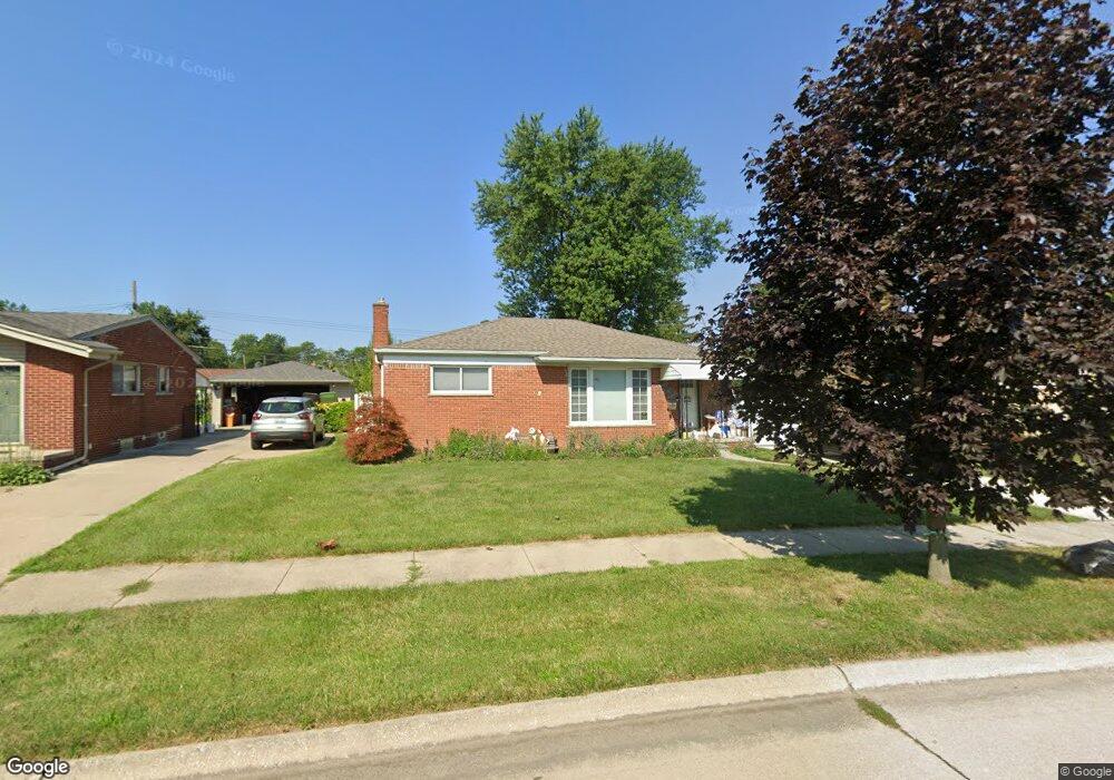
2890 Maxwell St Unit Bldg-Unit Trenton, MI 48183
Estimated Value: $238,000 - $246,000
3
Beds
2
Baths
1,102
Sq Ft
$220/Sq Ft
Est. Value
About This Home
This home is located at 2890 Maxwell St Unit Bldg-Unit, Trenton, MI 48183 and is currently estimated at $242,771, approximately $220 per square foot. 2890 Maxwell St Unit Bldg-Unit is a home located in Wayne County with nearby schools including Richard C. Hedke Elementary School, Boyd W. Arthurs Middle School, and Trenton High School.
Ownership History
Date
Name
Owned For
Owner Type
Purchase Details
Closed on
Jul 21, 2025
Sold by
Crabb Kathryn
Bought by
Murray Robert H
Current Estimated Value
Purchase Details
Closed on
Jul 27, 2018
Sold by
Legut Andrew
Bought by
Crabb Kathryn
Purchase Details
Closed on
Jan 23, 2013
Sold by
Corless Debra M
Bought by
Legut Andrew
Home Financials for this Owner
Home Financials are based on the most recent Mortgage that was taken out on this home.
Original Mortgage
$78,551
Interest Rate
4.4%
Mortgage Type
FHA
Purchase Details
Closed on
Apr 10, 2003
Sold by
Lucidi Kevin Q
Bought by
Corless Debra M
Create a Home Valuation Report for This Property
The Home Valuation Report is an in-depth analysis detailing your home's value as well as a comparison with similar homes in the area
Home Values in the Area
Average Home Value in this Area
Purchase History
| Date | Buyer | Sale Price | Title Company |
|---|---|---|---|
| Murray Robert H | $242,500 | First American Title | |
| Crabb Kathryn | $145,000 | Michigan Title Ins Agency In | |
| Legut Andrew | $80,000 | Michigan Title Insurance Age | |
| Corless Debra M | $156,000 | Michigan Title Insurance Age |
Source: Public Records
Mortgage History
| Date | Status | Borrower | Loan Amount |
|---|---|---|---|
| Previous Owner | Legut Andrew | $78,551 | |
| Closed | Crabb Kathryn | $0 |
Source: Public Records
Tax History Compared to Growth
Tax History
| Year | Tax Paid | Tax Assessment Tax Assessment Total Assessment is a certain percentage of the fair market value that is determined by local assessors to be the total taxable value of land and additions on the property. | Land | Improvement |
|---|---|---|---|---|
| 2025 | $3,435 | $110,800 | $0 | $0 |
| 2024 | $3,435 | $101,700 | $0 | $0 |
| 2023 | $3,221 | $90,800 | $0 | $0 |
| 2022 | $4,379 | $82,000 | $0 | $0 |
| 2021 | $4,233 | $77,000 | $0 | $0 |
| 2020 | $4,279 | $74,600 | $0 | $0 |
| 2019 | $4,214 | $70,400 | $0 | $0 |
| 2018 | $2,378 | $66,400 | $0 | $0 |
| 2017 | $1,963 | $64,800 | $0 | $0 |
| 2016 | $3,062 | $63,300 | $0 | $0 |
| 2015 | $5,415 | $58,400 | $0 | $0 |
| 2013 | $5,300 | $53,000 | $0 | $0 |
| 2012 | $2,741 | $50,700 | $11,700 | $39,000 |
Source: Public Records
Map
Nearby Homes
- Vacant West Rd
- 3085 Grange Rd
- 2970 Lafayette Dr
- 3125 Patton St
- 3236 S Margarette Ct
- 3158 Lafayette Dr
- 3256 Terry St
- 3548 Woodmont Ave
- 3161 Blaine St
- 3285 Patton St
- 2999 Norwood Dr
- 3307 Norwood Dr
- 3367 Norwood Dr
- 2430 Middlefield Rd
- 3458 Norwood Dr
- 2800 Marian Dr
- 3365 Syckelmoore St
- 3900 Norwood Dr
- 2330 Ashby St
- 2387 Ashby St
- 2900 Maxwell St
- 2880 Maxwell St
- 2905 Concord St
- 2895 Concord St
- 2910 Maxwell St
- 2860 Maxwell St
- 2881 Maxwell St
- 2861 Maxwell St
- 2920 Maxwell St
- 2901 Maxwell St
- 2915 Concord St
- 2885 Concord St
- 2841 Maxwell St
- 2911 Maxwell St
- 2925 Concord St
- 2930 Maxwell St
- 2926 Manning St
- 2920 Manning St
- 2921 Maxwell St
- 2930 Manning St