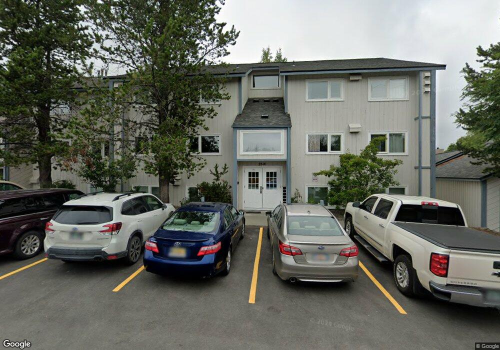
2891 W Intl Airport Rd Anchorage, AK 99502
Spenard NeighborhoodEstimated Value: $106,000 - $237,000
2
Beds
2
Baths
907
Sq Ft
$205/Sq Ft
Est. Value
About This Home
This home is located at 2891 W Intl Airport Rd, Anchorage, AK 99502 and is currently estimated at $185,725, approximately $204 per square foot. 2891 W Intl Airport Rd is a home located in Anchorage Municipality with nearby schools including Northwood Elementary School, Romig Middle School, and West High School.
Ownership History
Date
Name
Owned For
Owner Type
Purchase Details
Closed on
Sep 5, 2014
Sold by
Russin Alexander J and Russin Tamara S
Bought by
Crunkleton John F
Current Estimated Value
Home Financials for this Owner
Home Financials are based on the most recent Mortgage that was taken out on this home.
Original Mortgage
$125,520
Outstanding Balance
$41,317
Interest Rate
4.1%
Estimated Equity
$144,408
Purchase Details
Closed on
Jul 21, 2006
Sold by
Schafer Allan L and Schafer Rene A
Bought by
Russin Alexander J and Russin Tamara S
Home Financials for this Owner
Home Financials are based on the most recent Mortgage that was taken out on this home.
Original Mortgage
$145,000
Interest Rate
6.57%
Create a Home Valuation Report for This Property
The Home Valuation Report is an in-depth analysis detailing your home's value as well as a comparison with similar homes in the area
Home Values in the Area
Average Home Value in this Area
Purchase History
| Date | Buyer | Sale Price | Title Company |
|---|---|---|---|
| Crunkleton John F | -- | Stewart Title Company | |
| Russin Alexander J | -- | None Available |
Source: Public Records
Mortgage History
| Date | Status | Borrower | Loan Amount |
|---|---|---|---|
| Open | Crunkleton John F | $125,520 | |
| Previous Owner | Russin Alexander J | $145,000 |
Source: Public Records
Tax History Compared to Growth
Tax History
| Year | Tax Paid | Tax Assessment Tax Assessment Total Assessment is a certain percentage of the fair market value that is determined by local assessors to be the total taxable value of land and additions on the property. | Land | Improvement |
|---|---|---|---|---|
| 2025 | -- | $211,600 | -- | $211,600 |
| 2024 | $2,670 | $175,616 | $0 | $175,616 |
| 2023 | $2,670 | $156,800 | $0 | $156,800 |
| 2022 | $2,405 | $142,800 | $0 | $142,800 |
| 2021 | $2,680 | $148,700 | $0 | $148,700 |
| 2020 | $1,980 | $145,800 | $0 | $145,800 |
| 2019 | $1,876 | $143,300 | $0 | $143,300 |
| 2018 | $1,762 | $134,300 | $0 | $134,300 |
| 2017 | $2,069 | $146,800 | $0 | $146,800 |
| 2016 | $2,339 | $158,100 | $0 | $158,100 |
| 2015 | $2,339 | $147,800 | $0 | $147,800 |
| 2014 | $2,339 | $142,800 | $0 | $142,800 |
Source: Public Records
Map
Nearby Homes
- 2891 W Intl Airport Rd Unit C108
- 2801 W International Airport Rd Unit A202
- 2820 Malibu Meadows Way Unit 3B
- 2808 Iris Dr
- 3333 Lakeshore Dr Unit 5
- 3333 Lakeshore Dr Unit 2
- 6017 Collins Way
- 6305 Blackberry St
- 2040 Wenmatt Cir
- NHN Northwood Dr
- 5000 Northwood Dr
- 1808 W 47th Ave
- 3223 W 62nd Ave
- 6140 Collins Way
- 3913 Barbara Dr
- 4000 Iowa Dr
- 2202 Lincoln Ave
- 3900 Crosson Dr
- 2105 Mckinley Ave
- 2820 Wiley Post Ave
- 2891 W Intl Airport Rd
- 2891 W Intl Airport Rd
- 2891 W Intl Airport Rd
- 2891 W Intl Airport Rd
- 2891 W Intl Airport Rd
- 2891 W Intl Airport Rd
- 2891 W Intl Airport Rd
- 2891 W Intl Airport Rd
- 2891 W Intl Airport Rd
- 2891 W Intl Airport Rd
- 2891 W Intl Airport Rd
- 2891 W Intl Airport Rd
- 2891 W Intl Airport Rd
- 2891 W Intl Airport Rd
- 2891 W Intl Airport Rd
- 2891 W Intl Airport Rd
- 2891 W Intl Airport Rd
- 2891 W Intl Airport Rd
- 2891 W Intl Airport Rd
- 2891 W Intl Airport Rd