Estimated Value: $487,000 - $522,000
4
Beds
3
Baths
2,200
Sq Ft
$229/Sq Ft
Est. Value
About This Home
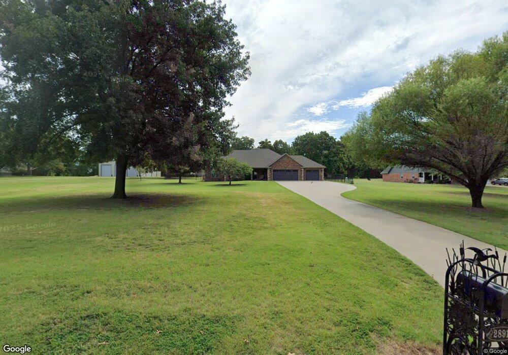
This home is located at 28910 S 594 Ln, Grove, OK 74344 and is currently estimated at $504,082, approximately $229 per square foot. 28910 S 594 Ln is a home located in Delaware County with nearby schools including Grove Lower Elementary School, Grove Upper Elementary School, and Grove Middle School.
Ownership History
Date
Name
Owned For
Owner Type
Purchase Details
Closed on
Mar 1, 2019
Sold by
Bronson Chad A and Bronson Baille M
Bought by
Sisco Leo Neal and Sisco Phyllis Marie
Current Estimated Value
Purchase Details
Closed on
Mar 14, 2017
Sold by
Bronson Richard D and Bronson Kathleen S
Bought by
Bronson Chad A and Bronson Bailee M
Purchase Details
Closed on
Dec 13, 2010
Sold by
Bernhart Phillip and Bernhart Catherine
Bought by
Bronson Richar D and Bronson Chad A
Purchase Details
Closed on
Apr 19, 2010
Sold by
Newton Joey and Newton Jackle
Bought by
Barhart Phillip and Barhart Catherine
Purchase Details
Closed on
Oct 14, 2009
Sold by
Newton Joseph O and Newton Jackie E
Bought by
Newton Joey and Newton Jackie
Purchase Details
Closed on
Aug 28, 2006
Sold by
Towry Gayle E
Bought by
Newton Joseph O and Newton Jackie E
Create a Home Valuation Report for This Property
The Home Valuation Report is an in-depth analysis detailing your home's value as well as a comparison with similar homes in the area
Home Values in the Area
Average Home Value in this Area
Purchase History
| Date | Buyer | Sale Price | Title Company |
|---|---|---|---|
| Sisco Leo Neal | $240,000 | Grand River Abstract & Title | |
| Bronson Chad A | -- | None Available | |
| Bronson Richar D | $210,000 | -- | |
| Barhart Phillip | $18,000 | -- | |
| Newton Joey | -- | -- | |
| Newton Joseph O | $11,666 | -- |
Source: Public Records
Tax History Compared to Growth
Tax History
| Year | Tax Paid | Tax Assessment Tax Assessment Total Assessment is a certain percentage of the fair market value that is determined by local assessors to be the total taxable value of land and additions on the property. | Land | Improvement |
|---|---|---|---|---|
| 2025 | $2,353 | $30,964 | $2,168 | $28,796 |
| 2024 | $2,353 | $30,063 | $2,105 | $27,958 |
| 2023 | $2,353 | $27,601 | $2,013 | $25,588 |
| 2022 | $2,305 | $27,601 | $2,013 | $25,588 |
| 2021 | $2,299 | $27,601 | $2,013 | $25,588 |
| 2020 | $2,338 | $27,601 | $2,013 | $25,588 |
| 2019 | $2,221 | $27,117 | $1,991 | $25,126 |
| 2018 | $2,149 | $27,117 | $1,996 | $25,121 |
| 2017 | $2,176 | $26,838 | $1,986 | $24,852 |
| 2016 | $2,071 | $25,561 | $1,999 | $23,562 |
| 2015 | $2,001 | $23,185 | $1,898 | $21,287 |
| 2014 | $2,011 | $23,185 | $1,898 | $21,287 |
Source: Public Records
Map
Nearby Homes
- 59399 E 288 Ct
- 59386 E 288 Ct
- Lot 1 & 2 E 288 Ct
- 4949 Lost Cove Rd
- 4943 Lighthouse Springs Dr
- 4926 Lost Cove Rd
- 5020 Lake Breeze Rd
- 402 Fairway Cir
- 5041 Lake Breeze Rd
- 507 Mulberry
- 816 Chatsworth Dr
- 822 Chatsworth Dr
- 827 Chatsworth Dr
- 827 Apple Dr
- 6026 Lake Breeze Rd
- 622 Alpine Dr
- 1515 St Joseph Dr
- 5070 Lake Breeze Rd
- TBD S 592 Place
- 29901 S 595 Rd
- 28920 S 594 Ln
- 28801 S 595 Rd
- 0 S 594 Ln
- 59321 E 289 Ct
- 28940 S 594 Ln
- 28802 S 595 Rd
- 28800 S 594 Ln
- 28800 S 595 Rd
- 28950 S 594 Ln
- 59397 E 288 Ct
- 0 E 288 Ct Unit 2137130
- 28875 S 595 Cir
- 59361 E 289 Ct
- 59301 E 289 Ct
- 59418 E 288 Place
- 59341 E 289 Ct
- 59398 E 288 Ct
- 59414 E 288 Place
- Lot 9 Lindsey Place
- 59410 E 288 Place