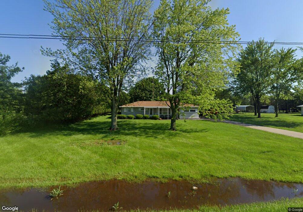
28913 State Route 281 Defiance, OH 43512
Estimated Value: $167,000 - $190,000
3
Beds
1
Bath
1,380
Sq Ft
$129/Sq Ft
Est. Value
About This Home
This home is located at 28913 State Route 281, Defiance, OH 43512 and is currently estimated at $178,691, approximately $129 per square foot. 28913 State Route 281 is a home located in Defiance County with nearby schools including Ayersville Elementary School and Ayersville High School.
Ownership History
Date
Name
Owned For
Owner Type
Purchase Details
Closed on
May 6, 2015
Sold by
Crossland Franklin P and Crossland Cornie Lu
Bought by
Crossland Lisa R
Current Estimated Value
Home Financials for this Owner
Home Financials are based on the most recent Mortgage that was taken out on this home.
Original Mortgage
$59,300
Outstanding Balance
$44,883
Interest Rate
3.68%
Mortgage Type
New Conventional
Estimated Equity
$133,808
Purchase Details
Closed on
Jan 13, 2012
Sold by
Rau Louella V and Rau Luella V
Bought by
Crossland Franklin P and Crossland Lisa R
Create a Home Valuation Report for This Property
The Home Valuation Report is an in-depth analysis detailing your home's value as well as a comparison with similar homes in the area
Purchase History
| Date | Buyer | Sale Price | Title Company |
|---|---|---|---|
| Crossland Lisa R | -- | None Available | |
| Crossland Franklin P | -- | None Available |
Source: Public Records
Mortgage History
| Date | Status | Borrower | Loan Amount |
|---|---|---|---|
| Open | Crossland Lisa R | $59,300 |
Source: Public Records
Tax History
| Year | Tax Paid | Tax Assessment Tax Assessment Total Assessment is a certain percentage of the fair market value that is determined by local assessors to be the total taxable value of land and additions on the property. | Land | Improvement |
|---|---|---|---|---|
| 2025 | $1,190 | $31,820 | $2,300 | $29,520 |
| 2024 | $1,190 | $31,820 | $2,300 | $29,520 |
| 2023 | $1,176 | $31,820 | $2,300 | $29,520 |
| 2022 | $1,238 | $27,910 | $2,290 | $25,620 |
| 2021 | $1,238 | $27,910 | $2,290 | $25,620 |
| 2020 | $1,262 | $27,910 | $2,290 | $25,620 |
| 2019 | $1,118 | $25,160 | $2,280 | $22,880 |
| 2018 | $1,107 | $25,160 | $2,280 | $22,880 |
| 2017 | $1,029 | $25,151 | $2,275 | $22,876 |
| 2016 | $1,004 | $23,219 | $2,275 | $20,944 |
| 2015 | -- | $23,219 | $2,275 | $20,944 |
| 2014 | -- | $23,219 | $2,275 | $20,944 |
| 2013 | -- | $23,219 | $2,275 | $20,944 |
| 2012 | -- | $23,219 | $2,275 | $20,944 |
Source: Public Records
Map
Nearby Homes
- 28643 Standley Rd
- 8205 Independence Rd
- 28656 Steinmaier Rd
- 1506 Bristow Ct
- 0 Domersville Rd
- 1459 Deerwood Dr
- 1365 Heatherdowns Dr
- 1408 Heatherdowns Dr
- 649 Burning Tree Dr
- 673 Burning Tree Dr
- 655 Burning Tree Dr
- 29024 Ayersville Pleasant Bend Rd
- 13205 Oris Ave
- 1744 Lora Ln
- 13331 Dohoney Rd
- 00 Carpenter Rd
- 512 Tiedeman Ave
- H011 County Road 17
- 1650 Fairlawn St
- 996 County Road 17
- 28949 State Route 281
- 28875 State Route 281
- 28965 State Route 281
- 28985 State Route 281
- 28835 State Route 281
- 28970 State Route 281
- 29013 State Route 281
- 11017 Harris Rd
- 28799 State Route 281
- 28777 Ohio 281
- 29059 State Route 281
- 28755 State Route 281
- 29095 State Route 281
- 10900 Stevens Rd
- 28657 State Route 281
- 28614 State Route 281
- 28549 State Route 281
- 29257 State Route 281
- 29268 State Route 281
- 28527 State Route 281
Your Personal Tour Guide
Ask me questions while you tour the home.