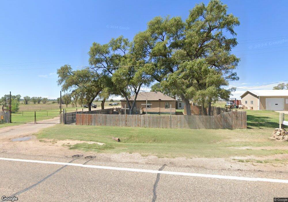
28927 State Highway 101 Las Animas, CO 81054
Estimated Value: $63,517 - $105,000
3
Beds
1
Bath
927
Sq Ft
$92/Sq Ft
Est. Value
About This Home
This home is located at 28927 State Highway 101, Las Animas, CO 81054 and is currently estimated at $85,379, approximately $92 per square foot. 28927 State Highway 101 is a home located in Bent County with nearby schools including Las Animas Elementary School, Las Animas Junior High School, and Las Animas High School.
Ownership History
Date
Name
Owned For
Owner Type
Purchase Details
Closed on
Jul 13, 2009
Sold by
Morlan Susan and Morlan Dale
Bought by
Morlan Aaron D
Current Estimated Value
Home Financials for this Owner
Home Financials are based on the most recent Mortgage that was taken out on this home.
Original Mortgage
$41,600
Outstanding Balance
$13,484
Interest Rate
7.66%
Mortgage Type
Adjustable Rate Mortgage/ARM
Estimated Equity
$71,895
Create a Home Valuation Report for This Property
The Home Valuation Report is an in-depth analysis detailing your home's value as well as a comparison with similar homes in the area
Home Values in the Area
Average Home Value in this Area
Purchase History
| Date | Buyer | Sale Price | Title Company |
|---|---|---|---|
| Morlan Aaron D | $33,400 | -- |
Source: Public Records
Mortgage History
| Date | Status | Borrower | Loan Amount |
|---|---|---|---|
| Open | Morlan Aaron D | $41,600 |
Source: Public Records
Tax History Compared to Growth
Tax History
| Year | Tax Paid | Tax Assessment Tax Assessment Total Assessment is a certain percentage of the fair market value that is determined by local assessors to be the total taxable value of land and additions on the property. | Land | Improvement |
|---|---|---|---|---|
| 2024 | $158 | $1,000 | $175 | $825 |
| 2023 | $158 | $1,000 | $175 | $825 |
| 2022 | $287 | $3,870 | $680 | $3,190 |
| 2021 | $285 | $3,010 | $715 | $2,295 |
| 2020 | $274 | $2,862 | $715 | $2,147 |
| 2019 | $276 | $2,862 | $715 | $2,147 |
| 2018 | $276 | $2,842 | $720 | $2,122 |
| 2017 | $278 | $2,842 | $720 | $2,122 |
| 2016 | $293 | $3,061 | $796 | $2,265 |
| 2015 | -- | $3,061 | $796 | $2,265 |
| 2014 | -- | $3,042 | $796 | $2,246 |
| 2013 | -- | $3,042 | $796 | $2,246 |
Source: Public Records
Map
Nearby Homes
- 134 11th St
- 705 Locust Ave
- 643&645 Ambassador Thompson Blvd Unit 2
- 629 St Vrain Ave
- 1032 Locust Ave
- 1046 Locust Ave
- 626 St Vrain St
- 626 St Vrain Ave
- 509 5th St
- TBD Ash Ave
- 1103 Ambassador Thompson Blvd
- 535 Moore Ave
- 651 Ash Ave
- 428 Elm Ave
- 433 Grove Ave
- 312 Carson Ave
- 422 Grove Ave
- 10525 County Rd Ee
- 243 Elm Ave
- 426 Poplar Ave
- 28981 State Highway 101
- 28980 State Highway 101
- 28827 State Highway 101
- 28827 Colorado 101
- 28819 Hwy 101
- 29135 State Highway 101
- 28727 State Highway 101
- 1409 Grand Ave
- 1156 Bent Ave
- 1129 Bent Ave
- 1149 Carson Ave
- 1140 Carson Ave
- 28633 State Highway 101
- 1147 Carson Ave
- 1127 Bent Unit 26
- 1125 Bent Ave Unit 24
- 1125 Bent Ave
- 1135 Carson Ave
- 1100 Block Elm Ave
- 1126 Bent Ave