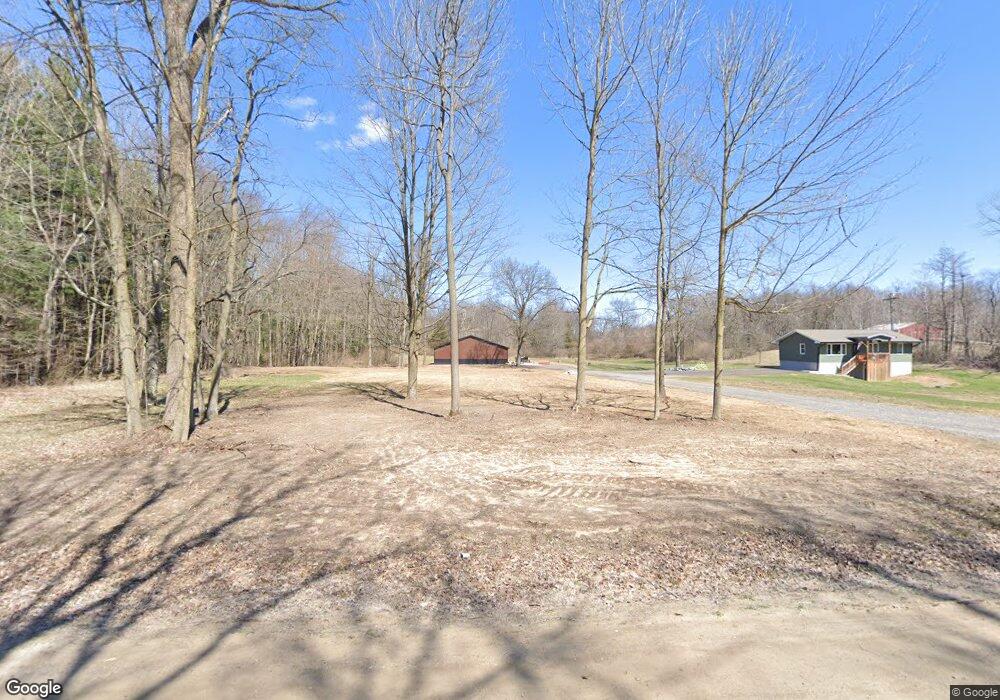
2895 Pardee Rd Howell, MI 48843
Estimated Value: $351,000 - $444,000
3
Beds
4
Baths
1,075
Sq Ft
$355/Sq Ft
Est. Value
About This Home
This home is located at 2895 Pardee Rd, Howell, MI 48843 and is currently estimated at $381,561, approximately $354 per square foot. 2895 Pardee Rd is a home located in Livingston County with nearby schools including Parker Middle School and Howell High School.
Ownership History
Date
Name
Owned For
Owner Type
Purchase Details
Closed on
Jul 21, 2023
Sold by
Built Tight Properties Llc
Bought by
Villeneuve Brett and Ely Katie
Current Estimated Value
Home Financials for this Owner
Home Financials are based on the most recent Mortgage that was taken out on this home.
Original Mortgage
$280,000
Outstanding Balance
$273,196
Interest Rate
6.69%
Mortgage Type
New Conventional
Estimated Equity
$108,365
Purchase Details
Closed on
Jul 19, 2023
Sold by
Built Tight Properties Llc
Bought by
Villeneuve Brett and Ely Katie
Home Financials for this Owner
Home Financials are based on the most recent Mortgage that was taken out on this home.
Original Mortgage
$280,000
Outstanding Balance
$273,196
Interest Rate
6.69%
Mortgage Type
New Conventional
Estimated Equity
$108,365
Purchase Details
Closed on
Jun 17, 2022
Sold by
Gerald Backus
Bought by
Built Tight Properties Llc
Home Financials for this Owner
Home Financials are based on the most recent Mortgage that was taken out on this home.
Original Mortgage
$228,200
Interest Rate
5.3%
Mortgage Type
Construction
Create a Home Valuation Report for This Property
The Home Valuation Report is an in-depth analysis detailing your home's value as well as a comparison with similar homes in the area
Home Values in the Area
Average Home Value in this Area
Purchase History
| Date | Buyer | Sale Price | Title Company |
|---|---|---|---|
| Villeneuve Brett | $320,000 | None Listed On Document | |
| Villeneuve Brett | $320,000 | None Listed On Document | |
| Built Tight Properties Llc | $145,000 | None Listed On Document |
Source: Public Records
Mortgage History
| Date | Status | Borrower | Loan Amount |
|---|---|---|---|
| Open | Villeneuve Brett | $280,000 | |
| Closed | Villeneuve Brett | $280,000 | |
| Previous Owner | Built Tight Properties Llc | $228,200 |
Source: Public Records
Tax History
| Year | Tax Paid | Tax Assessment Tax Assessment Total Assessment is a certain percentage of the fair market value that is determined by local assessors to be the total taxable value of land and additions on the property. | Land | Improvement |
|---|---|---|---|---|
| 2025 | $2,863 | $177,700 | $0 | $0 |
| 2024 | $2,802 | $173,600 | $0 | $0 |
| 2023 | $4,045 | $117,700 | $0 | $0 |
| 2022 | $4,198 | $102,600 | $0 | $0 |
| 2021 | $2,331 | $111,100 | $0 | $0 |
| 2020 | $2,377 | $108,900 | $0 | $0 |
| 2019 | $2,337 | $102,600 | $0 | $0 |
| 2018 | $2,218 | $103,600 | $0 | $0 |
| 2017 | $2,237 | $103,600 | $0 | $0 |
| 2016 | $2,165 | $99,000 | $0 | $0 |
| 2014 | $1,947 | $99,100 | $0 | $0 |
| 2012 | $1,947 | $94,900 | $0 | $0 |
Source: Public Records
Map
Nearby Homes
- 2551 Pardee Rd
- 2950 Chilson Rd
- 1047 Weatherstone Ln
- 2805 Acorn Ln
- Parcel 1 E Coon Lake Rd
- Parcel 2 E Coon Lake Rd
- 3530 Kipling Cir
- 0000 Crooked Lake Rd
- 2146 Webster Park Dr
- 2105 Webster Park Dr
- 1066 Kemperwood Ct
- 4525 Mapleton Dr
- 4227 Colonial Ct
- 4681 Roya Trail
- 8 Sleaford-Parcel 8 - 2 12 Acres Rd
- 4 Sleaford-Parcel 4 - 32 92 Acres Rd
- Lot 5 Misty Meadows
- 6 Sleaford-Parcel 6 - 2 1 Acres Rd
- 3 Sleaford-Parcel 3-3 17 Acres Rd
- 5 Sleaford-Parcel 5 - 2 5 Acres Rd
- 2899 Pardee Rd
- 2890 Pardee Rd
- 3550 Westphal Rd
- 0 Westphal Rd Unit 28053088
- 0 Westphal Rd Unit 28121367
- 0 Westphal Rd Unit 210020903
- 0 Westphal Rd Unit 29107535
- 0 Westphal Rd Unit 212125301
- 0 Westphal Rd
- 3541 Westphal Rd
- 2820 Pardee Rd
- 3590 Westphal Rd
- 3023 Pardee Rd
- 3553 Westphal Rd
- 3654 Westphal Rd
- 3674 Westphal Rd
- 3629 Westphal Rd
- 3529 Westphal Rd
- 3611 Westphal Rd
- 2776 Crooked Lake Rd
