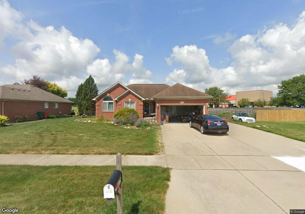
28975 Oakmont Dr Unit Bldg-Unit Chesterfield, MI 48051
Estimated Value: $393,000 - $452,000
3
Beds
4
Baths
1,624
Sq Ft
$253/Sq Ft
Est. Value
About This Home
This home is located at 28975 Oakmont Dr Unit Bldg-Unit, Chesterfield, MI 48051 and is currently estimated at $411,107, approximately $253 per square foot. 28975 Oakmont Dr Unit Bldg-Unit is a home located in Macomb County with nearby schools including Joseph M. Carkenord Elementary School, L'Anse Creuse High School - North, and Merritt Academy.
Ownership History
Date
Name
Owned For
Owner Type
Purchase Details
Closed on
Jul 23, 2018
Sold by
Crosby Lindsay and Crosby Linda D
Bought by
Rini Mary
Current Estimated Value
Home Financials for this Owner
Home Financials are based on the most recent Mortgage that was taken out on this home.
Original Mortgage
$240,562
Outstanding Balance
$208,483
Interest Rate
4.5%
Mortgage Type
FHA
Estimated Equity
$202,624
Create a Home Valuation Report for This Property
The Home Valuation Report is an in-depth analysis detailing your home's value as well as a comparison with similar homes in the area
Home Values in the Area
Average Home Value in this Area
Purchase History
| Date | Buyer | Sale Price | Title Company |
|---|---|---|---|
| Rini Mary | $245,000 | First American Title Insuran |
Source: Public Records
Mortgage History
| Date | Status | Borrower | Loan Amount |
|---|---|---|---|
| Open | Rini Mary | $240,562 |
Source: Public Records
Tax History Compared to Growth
Tax History
| Year | Tax Paid | Tax Assessment Tax Assessment Total Assessment is a certain percentage of the fair market value that is determined by local assessors to be the total taxable value of land and additions on the property. | Land | Improvement |
|---|---|---|---|---|
| 2025 | $4,574 | $161,400 | $0 | $0 |
| 2024 | $2,921 | $158,100 | $0 | $0 |
| 2023 | $2,770 | $144,300 | $0 | $0 |
| 2022 | $4,117 | $127,800 | $0 | $0 |
| 2021 | $3,994 | $121,800 | $0 | $0 |
| 2020 | $2,543 | $114,500 | $0 | $0 |
| 2019 | $3,461 | $105,800 | $0 | $0 |
| 2018 | $4,040 | $104,000 | $18,700 | $85,300 |
| 2017 | $3,923 | $95,650 | $18,650 | $77,000 |
| 2016 | $2,531 | $95,650 | $0 | $0 |
| 2015 | $856 | $90,550 | $0 | $0 |
| 2014 | $856 | $76,950 | $14,850 | $62,100 |
| 2012 | -- | $0 | $0 | $0 |
Source: Public Records
Map
Nearby Homes
- 52823 Muirfield Dr
- 0 Gratiot Ave
- 29008 Pinehurst Dr
- N W Corner 24 Mile & Gratiot Ave
- 53064 Barberry Cir
- 51817 Lionel Ln Unit 12
- 53153 Gratiot Ave
- 51768 Adler Park Dr W Unit 23
- 51857 Adler Park Dr E Unit 44
- 29402 Georgetown Dr
- 51719 Adler Park Dr W Unit 77
- 51848 Adler Park Dr E Unit 75
- 29310 Jamestown Dr
- 51630 Hale Ln Unit 86
- 51592 Stern Ln
- 28338 Adler Park Dr S
- 28372 Adler Park Dr S
- 51616 Hale Ln Unit 204
- 29321 Debbie Dr Unit 43
- 29636 Cambridge Ct
- 28975 Oakmont Dr
- 28971 Oakmont Dr
- 0 Bates Unit 212024166
- 0 Bates Unit 210058658
- 0 Bates Unit 211066197
- 0 Bates Unit 212031953
- 0 Bates Unit 215039399
- 0 Bates Unit 4918695
- 0 Bates Unit 4911597
- 0 Bates Unit 4251731
- 0 Bates Unit 4911610
- 0 Bates Unit 4409508
- 0 Bates Unit 4442575
- 0 Bates Unit 4918327
- 0 Bates Unit 4955284
- 0 Bates Unit 4698813
- 0 Bates Unit 31005850
- 0 Bates Unit 31061920
- 0 Bates Unit 31096575
- 0 Bates Unit 31239795