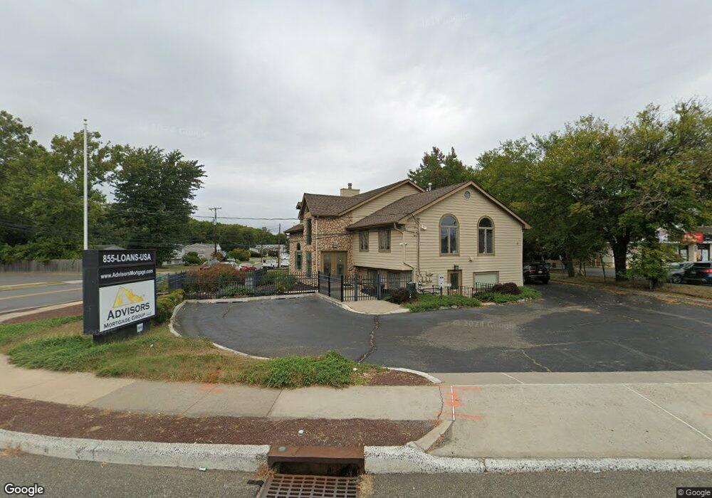
2899 State Route 35 Hazlet, NJ 07730
Estimated Value: $1,149,690
--
Bed
--
Bath
2,941
Sq Ft
$391/Sq Ft
Est. Value
About This Home
This home is located at 2899 State Route 35, Hazlet, NJ 07730 and is currently estimated at $1,149,690, approximately $390 per square foot. 2899 State Route 35 is a home located in Monmouth County with nearby schools including Raritan High School.
Ownership History
Date
Name
Owned For
Owner Type
Purchase Details
Closed on
Apr 3, 2019
Sold by
Castle Enterprises Limited Inc
Bought by
2899 Higway 35 Llc
Current Estimated Value
Home Financials for this Owner
Home Financials are based on the most recent Mortgage that was taken out on this home.
Original Mortgage
$540,000
Outstanding Balance
$474,756
Interest Rate
4.3%
Mortgage Type
Commercial
Estimated Equity
$674,934
Purchase Details
Closed on
Dec 22, 1998
Sold by
Barkkume Donald
Bought by
Castle Enterprise Limited
Home Financials for this Owner
Home Financials are based on the most recent Mortgage that was taken out on this home.
Original Mortgage
$365,000
Interest Rate
6.74%
Mortgage Type
Commercial
Purchase Details
Closed on
Jul 14, 1995
Sold by
Cenpipprd Inc
Bought by
Barkkume Donald and Barkkume Sharon
Home Financials for this Owner
Home Financials are based on the most recent Mortgage that was taken out on this home.
Original Mortgage
$180,000
Interest Rate
7.7%
Mortgage Type
Commercial
Create a Home Valuation Report for This Property
The Home Valuation Report is an in-depth analysis detailing your home's value as well as a comparison with similar homes in the area
Home Values in the Area
Average Home Value in this Area
Purchase History
| Date | Buyer | Sale Price | Title Company |
|---|---|---|---|
| 2899 Higway 35 Llc | $675,000 | Chicago Title Insurance Co | |
| Castle Enterprise Limited | $365,000 | -- | |
| Barkkume Donald | $225,000 | -- |
Source: Public Records
Mortgage History
| Date | Status | Borrower | Loan Amount |
|---|---|---|---|
| Open | 2899 Higway 35 Llc | $540,000 | |
| Previous Owner | Castle Enterprise Limited | $365,000 | |
| Previous Owner | Barkkume Donald | $180,000 |
Source: Public Records
Tax History Compared to Growth
Tax History
| Year | Tax Paid | Tax Assessment Tax Assessment Total Assessment is a certain percentage of the fair market value that is determined by local assessors to be the total taxable value of land and additions on the property. | Land | Improvement |
|---|---|---|---|---|
| 2025 | $13,703 | $680,300 | $430,300 | $250,000 |
| 2024 | $13,617 | $651,600 | $401,600 | $250,000 |
| 2023 | $13,617 | $637,200 | $387,200 | $250,000 |
| 2022 | $15,426 | $615,700 | $365,700 | $250,000 |
| 2021 | $15,426 | $601,400 | $351,400 | $250,000 |
| 2020 | $15,143 | $586,500 | $349,000 | $237,500 |
| 2019 | $15,258 | $581,700 | $344,200 | $237,500 |
| 2018 | $15,135 | $572,200 | $334,700 | $237,500 |
| 2017 | $14,881 | $562,600 | $325,100 | $237,500 |
| 2016 | $14,698 | $557,800 | $320,300 | $237,500 |
| 2015 | $14,533 | $553,000 | $315,500 | $237,500 |
| 2014 | $14,691 | $524,300 | $286,800 | $237,500 |
Source: Public Records
Map
Nearby Homes
- 3 Duke Ln
- 544 Lane F
- 239 Lane c
- 127 Lane b
- 156 Lane b
- 77 Shorehaven Dr Unit 77
- 1 Panagias Astadiotissis Agios Theodoros
- 4 Lafayette Dr
- 52 Monique Cir
- 53 Lafayette Dr
- 59 Ron Rd
- 11 Lammers St
- 8 Lynn Blvd
- 7 Red Coach Ln
- 26 Nevada Dr
- 4 Templer Way
- 13 Irwin Place
- 1 Boyd Rd
- 29 Telegraph Hill Rd
- 788 Poole Ave
- 84 Fleetwood Dr
- 82 Fleetwood Dr
- 83 Fleetwood Dr
- 81 Fleetwood Dr
- 80 Fleetwood Dr
- 78 Fleetwood Dr
- 79 Fleetwood Dr
- 76 Fleetwood Dr
- 77 Fleetwood Dr
- 75 Fleetwood Dr
- 73 Fleetwood Dr
- 75 Cornell Dr
- 74 Fleetwood Dr
- 71 Fleetwood Dr
- 73 Cornell Dr
- 70 Cornell Dr
- 72 Fleetwood Dr
- 71 Cornell Dr
- 69 Fleetwood Dr
- 68 Cornell Dr