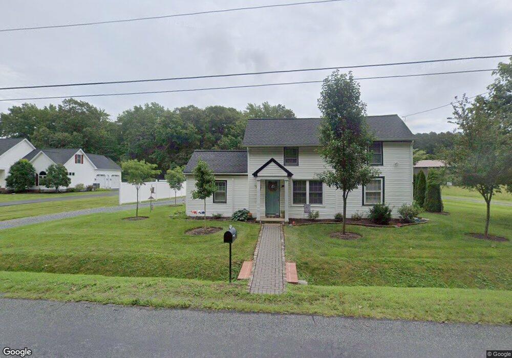
28991 Sanderstown Rd Trappe, MD 21673
Estimated Value: $125,000 - $230,000
--
Bed
1
Bath
1,072
Sq Ft
$163/Sq Ft
Est. Value
About This Home
This home is located at 28991 Sanderstown Rd, Trappe, MD 21673 and is currently estimated at $174,402, approximately $162 per square foot. 28991 Sanderstown Rd is a home located in Talbot County with nearby schools including White Marsh Elementary School, Easton Middle School, and Easton High School.
Ownership History
Date
Name
Owned For
Owner Type
Purchase Details
Closed on
Jun 20, 2025
Sold by
Anderson Holly K and Milligan Chloe Elizabeth
Bought by
Anderson Holly K
Current Estimated Value
Purchase Details
Closed on
May 22, 2020
Sold by
Milligan Jeffrey A
Bought by
Milligan Chloe Elizabeth
Purchase Details
Closed on
Aug 11, 2004
Sold by
Johnson Fred H
Bought by
Anderson Holly K and Milligan Jeffrey A
Purchase Details
Closed on
Oct 16, 2002
Sold by
Conseco Financing Servicing Corp
Bought by
Johnson Fred H and Cecil William H
Purchase Details
Closed on
Sep 13, 2001
Sold by
Cephas Helen
Bought by
Conseco Financing Servicing
Purchase Details
Closed on
Jun 9, 1998
Sold by
Brooks Ardella S
Bought by
Cephas Helen and Cephas George
Create a Home Valuation Report for This Property
The Home Valuation Report is an in-depth analysis detailing your home's value as well as a comparison with similar homes in the area
Home Values in the Area
Average Home Value in this Area
Purchase History
| Date | Buyer | Sale Price | Title Company |
|---|---|---|---|
| Anderson Holly K | -- | None Listed On Document | |
| Anderson Holly K | -- | None Listed On Document | |
| Milligan Chloe Elizabeth | -- | Accommodation | |
| Anderson Holly K | $115,000 | -- | |
| Johnson Fred H | $17,500 | -- | |
| Conseco Financing Servicing | $50,000 | -- | |
| Cephas Helen | $42,000 | -- |
Source: Public Records
Tax History Compared to Growth
Tax History
| Year | Tax Paid | Tax Assessment Tax Assessment Total Assessment is a certain percentage of the fair market value that is determined by local assessors to be the total taxable value of land and additions on the property. | Land | Improvement |
|---|---|---|---|---|
| 2025 | $488 | $97,300 | $0 | $0 |
| 2024 | $488 | $91,000 | $0 | $0 |
| 2023 | $462 | $84,700 | $37,300 | $47,400 |
| 2022 | $436 | $84,700 | $37,300 | $47,400 |
| 2021 | $419 | $84,700 | $37,300 | $47,400 |
| 2020 | $419 | $85,600 | $40,300 | $45,300 |
| 2019 | $418 | $85,167 | $0 | $0 |
| 2018 | $408 | $84,733 | $0 | $0 |
| 2017 | $392 | $84,300 | $0 | $0 |
| 2016 | $376 | $84,300 | $0 | $0 |
| 2015 | $298 | $84,300 | $0 | $0 |
| 2014 | $298 | $88,600 | $0 | $0 |
Source: Public Records
Map
Nearby Homes
- 1219 Loch Ness Ln
- 1433 Lake Geneva Dr
- 1213 Loch Ness Ln
- 1213 Loch Ness Ln Unit SITE 463
- 1435 Lake Geneva Dr
- 1308 Lake Lucerne Ln
- 1217 Loch Ness Ln
- 1431 Lake Geneva Dr
- 1215 Loch Ness Ln
- Matisse Plan at Lakeside at Trappe - Single Family Homes Collection
- Rembrandt Plan at Lakeside at Trappe - Single Family Homes Collection
- Torrington Plan at Lakeside at Trappe - Single Family Homes Collection
- Douglas Plan at Lakeside at Trappe - Single Family Homes Collection
- Beckham Plan at Lakeside at Trappe - Single Family Homes Collection
- 1262 Lake Michigan
- 1007 Champlain Ct
- 1009 Champlain Ct
- 1015 Champlain Ct
- 1549 Lake Tahoe Dr
- 1555 Lake Tahoe Dr
- 28995 Sanderstown Rd
- 28967 Sanderstown Rd
- 1114 Lakeside Blvd
- 1277 Lake Michigan Dr
- 1120 Lakeside Blvd
- 1134 Lakeside Blvd
- 1128 Lakeside Blvd
- 1257 Lake Michigan Dr
- 1126 Lakeside Blvd
- 1130 Lakeside Blvd
- 1251 Lake Michigan Dr
- 1116 Lakeside Blvd
- 1102 Lakeside Blvd
- 1132 Lakeside Blvd
- 1253 Lake Michigan Dr
- 1104 Lakeside Blvd
- 1108 Lakeside Blvd
- 1275 Lake Michigan Dr
- 1005 Champlain Ct
- 1255 Lake Michigan Dr