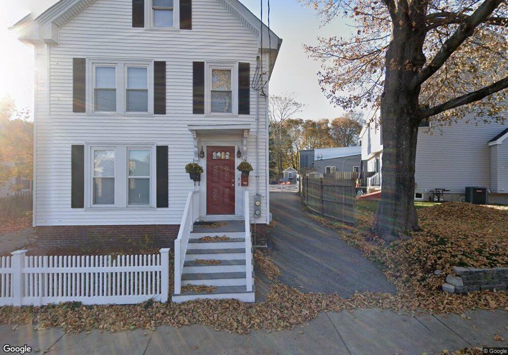
29 1/2 Pine St Stoneham, MA 02180
Colonial Park NeighborhoodEstimated Value: $550,000 - $649,000
2
Beds
2
Baths
977
Sq Ft
$626/Sq Ft
Est. Value
About This Home
This home is located at 29 1/2 Pine St, Stoneham, MA 02180 and is currently estimated at $611,578, approximately $625 per square foot. 29 1/2 Pine St is a home located in Middlesex County with nearby schools including Stoneham High School, St. Patrick Elementary School, and Greater Boston Academy.
Ownership History
Date
Name
Owned For
Owner Type
Purchase Details
Closed on
Mar 31, 2005
Sold by
Pires Adao R and Ferrari-Pires Cheryl A
Bought by
Mansfield Margaret L
Current Estimated Value
Home Financials for this Owner
Home Financials are based on the most recent Mortgage that was taken out on this home.
Original Mortgage
$213,000
Outstanding Balance
$108,701
Interest Rate
5.61%
Mortgage Type
Purchase Money Mortgage
Estimated Equity
$502,877
Purchase Details
Closed on
Apr 23, 1998
Sold by
Cronin Blanche F
Bought by
Pires Adao and Ferrari-Pires Cheryl
Home Financials for this Owner
Home Financials are based on the most recent Mortgage that was taken out on this home.
Original Mortgage
$96,000
Interest Rate
7.11%
Mortgage Type
Purchase Money Mortgage
Create a Home Valuation Report for This Property
The Home Valuation Report is an in-depth analysis detailing your home's value as well as a comparison with similar homes in the area
Home Values in the Area
Average Home Value in this Area
Purchase History
| Date | Buyer | Sale Price | Title Company |
|---|---|---|---|
| Mansfield Margaret L | $312,750 | -- | |
| Pires Adao | $120,000 | -- |
Source: Public Records
Mortgage History
| Date | Status | Borrower | Loan Amount |
|---|---|---|---|
| Open | Mansfield Margaret L | $213,000 | |
| Previous Owner | Pires Adao | $96,000 |
Source: Public Records
Tax History Compared to Growth
Tax History
| Year | Tax Paid | Tax Assessment Tax Assessment Total Assessment is a certain percentage of the fair market value that is determined by local assessors to be the total taxable value of land and additions on the property. | Land | Improvement |
|---|---|---|---|---|
| 2025 | $5,142 | $502,600 | $284,700 | $217,900 |
| 2024 | $4,900 | $462,700 | $262,200 | $200,500 |
| 2023 | $4,757 | $428,600 | $239,800 | $188,800 |
| 2022 | $4,105 | $394,300 | $217,300 | $177,000 |
| 2021 | $4,073 | $376,400 | $202,300 | $174,100 |
| 2020 | $3,891 | $360,600 | $187,000 | $173,600 |
| 2019 | $3,951 | $352,100 | $187,100 | $165,000 |
| 2018 | $3,673 | $313,700 | $158,200 | $155,500 |
| 2017 | $3,651 | $294,700 | $138,300 | $156,400 |
| 2016 | $3,306 | $260,300 | $138,300 | $122,000 |
| 2015 | $3,123 | $241,000 | $125,200 | $115,800 |
| 2014 | $3,139 | $232,700 | $105,400 | $127,300 |
Source: Public Records
Map
Nearby Homes
- 35 Wright St
- 20 Pond St
- 12 Cottage St
- 137 Franklin St Unit 102
- 21 Tremont St Unit B
- 21 Tremont St Unit A
- 6 Everett St
- 17 Franklin St
- 1 Tremont St
- 49 Butler Ave
- 7 Carol St
- 159 Franklin St Unit D2
- 159 Franklin St Unit C2
- 159 Franklin St Unit E6
- 100 Ledgewood Dr Unit 117
- 146 Marble St Unit 408
- 39 Tamarock Terrace
- 588 Main St Unit 3C
- 3 Veterans Ln
- 5 Rockville Park
- 29 Pine St
- 27 Emerson St
- 27 Emerson St Unit 1
- 31 Pine St
- 25 Emerson St
- 25 Emerson St Unit 2
- 33 Pine St
- 35 Pine St
- 21 Emerson St
- 30 Pine St
- 23 Pine St
- 20 Emerson St Unit 1
- 22 Emerson St Unit 1
- 20 Emerson St Unit 22
- 22 Emerson St Unit 22
- 20 Emerson St Unit 20
- 20-22 Emerson St
- 19 Emerson St
- 18 Emerson St
- 60 Franklin St Unit 11