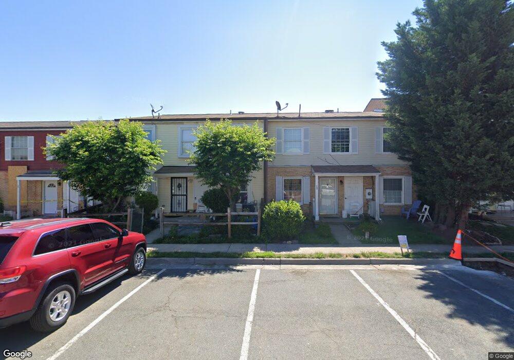
29 Adams Dr NE Unit 96 Leesburg, VA 20176
Estimated Value: $273,000 - $339,000
2
Beds
2
Baths
1,176
Sq Ft
$265/Sq Ft
Est. Value
About This Home
This home is located at 29 Adams Dr NE Unit 96, Leesburg, VA 20176 and is currently estimated at $311,606, approximately $264 per square foot. 29 Adams Dr NE Unit 96 is a home located in Loudoun County with nearby schools including Leesburg Elementary School, Smart's Mill Middle School, and Tuscarora High School.
Ownership History
Date
Name
Owned For
Owner Type
Purchase Details
Closed on
Jan 21, 2011
Sold by
Paige Hilton D
Bought by
Wang Wei and Zhang Yaping
Current Estimated Value
Purchase Details
Closed on
May 31, 2005
Sold by
Paige Hilton D
Bought by
Burgan Eugene G
Home Financials for this Owner
Home Financials are based on the most recent Mortgage that was taken out on this home.
Original Mortgage
$142,650
Interest Rate
5.83%
Mortgage Type
New Conventional
Purchase Details
Closed on
Oct 14, 2003
Sold by
Stewart Julia
Bought by
Burgan Eugene
Home Financials for this Owner
Home Financials are based on the most recent Mortgage that was taken out on this home.
Original Mortgage
$97,650
Interest Rate
6.35%
Mortgage Type
New Conventional
Create a Home Valuation Report for This Property
The Home Valuation Report is an in-depth analysis detailing your home's value as well as a comparison with similar homes in the area
Home Values in the Area
Average Home Value in this Area
Purchase History
| Date | Buyer | Sale Price | Title Company |
|---|---|---|---|
| Wang Wei | $85,000 | -- | |
| Burgan Eugene G | $230,000 | -- | |
| Burgan Eugene | $108,500 | -- |
Source: Public Records
Mortgage History
| Date | Status | Borrower | Loan Amount |
|---|---|---|---|
| Previous Owner | Burgan Eugene G | $142,650 | |
| Previous Owner | Burgan Eugene | $97,650 |
Source: Public Records
Tax History Compared to Growth
Tax History
| Year | Tax Paid | Tax Assessment Tax Assessment Total Assessment is a certain percentage of the fair market value that is determined by local assessors to be the total taxable value of land and additions on the property. | Land | Improvement |
|---|---|---|---|---|
| 2025 | $2,402 | $298,440 | $100,000 | $198,440 |
| 2024 | $2,367 | $273,690 | $80,000 | $193,690 |
| 2023 | $2,120 | $242,300 | $80,000 | $162,300 |
| 2022 | $2,153 | $241,940 | $55,000 | $186,940 |
| 2021 | $2,065 | $210,720 | $55,000 | $155,720 |
| 2020 | $2,008 | $193,980 | $45,000 | $148,980 |
| 2019 | $1,875 | $179,470 | $45,000 | $134,470 |
| 2018 | $1,900 | $175,080 | $45,000 | $130,080 |
| 2017 | $1,702 | $151,290 | $45,000 | $106,290 |
| 2016 | $1,512 | $132,080 | $0 | $0 |
| 2015 | $294 | $115,440 | $0 | $115,440 |
| 2014 | $125 | $96,910 | $0 | $96,910 |
Source: Public Records
Map
Nearby Homes
- 251 Meadows Ln NE
- 1102 Huntmaster Terrace NE Unit 301
- 710 North St NE
- BIRKHALL Plan at Brickyard
- BALMORAL Plan at Brickyard
- HIGHGROVE Plan at Brickyard
- 1129 Huntmaster Terrace NE Unit 301
- 1148 Keokuk Terrace NE
- 412 Blue Ridge Ave NE
- 101 Fort Evans Rd SE Unit F
- 1636 Field Sparrow Terrace NE
- 1504 Shields Terrace NE
- 1515 Artillery Terrace NE
- 514 Covington Terrace NE
- 1616 Chickasaw Place NE
- 589 Rockbridge Dr SE
- 1204 James Rifle Ct NE
- 523 Currant Terrace NE
- 581 Kalmia Square NE
- 216 Wildman St NE
- 29 Adams Dr NE
- 28 Adams Dr NE
- 38 Adams Dr NE
- 38 Adams Dr NE Unit 95
- 30 Adams Dr NE
- 35 Adams Dr NE
- 27 Adams Dr NE
- 39 Adams Dr NE
- 37 Adams Dr NE Unit 97
- 37 Adams Dr NE
- 40 Adams Dr NE Unit 91
- 40 Adams Dr NE
- 31 Adams Dr NE
- 31 Adams Dr NE Unit 100
- 36 Adams Dr NE Unit 99
- 26 Adams Dr NE
- 41 Adams Dr NE Unit 89
- 32 Adams Dr NE
- 32 Adams Dr NE Unit 102
- 43 Adams Dr NE