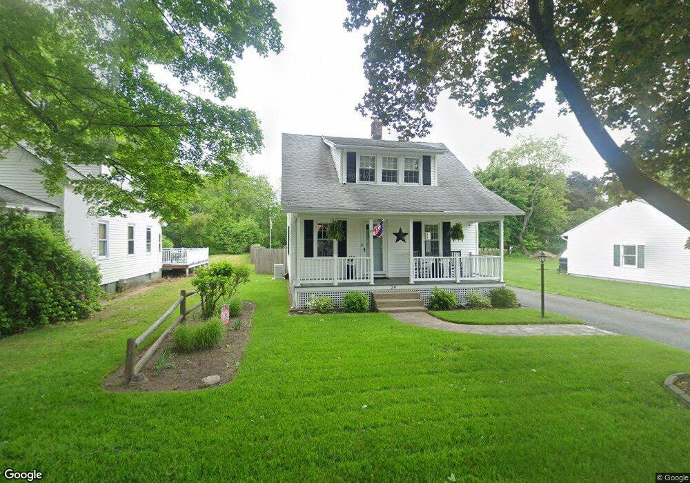
29 Adams St Westfield, MA 01085
Estimated Value: $287,000 - $310,431
3
Beds
2
Baths
1,265
Sq Ft
$237/Sq Ft
Est. Value
About This Home
This home is located at 29 Adams St, Westfield, MA 01085 and is currently estimated at $299,608, approximately $236 per square foot. 29 Adams St is a home located in Hampden County with nearby schools including Westfield High School and Saint Mary High School.
Ownership History
Date
Name
Owned For
Owner Type
Purchase Details
Closed on
Jul 12, 2022
Sold by
Sadowski Raymond and Sadowski Christine S
Bought by
Bloomer Julie and Sadowski Michael
Current Estimated Value
Purchase Details
Closed on
Jul 1, 1975
Bought by
Sadowski Raymond and Sadowski Christine S
Create a Home Valuation Report for This Property
The Home Valuation Report is an in-depth analysis detailing your home's value as well as a comparison with similar homes in the area
Home Values in the Area
Average Home Value in this Area
Purchase History
| Date | Buyer | Sale Price | Title Company |
|---|---|---|---|
| Bloomer Julie | -- | None Available | |
| Sadowski Raymond | -- | -- |
Source: Public Records
Mortgage History
| Date | Status | Borrower | Loan Amount |
|---|---|---|---|
| Previous Owner | Sadowski Raymond | $13,385 | |
| Previous Owner | Sadowski Raymond | $75,000 | |
| Previous Owner | Sadowski Raymond | $50,000 | |
| Previous Owner | Sadowski Raymond | $65,000 |
Source: Public Records
Tax History Compared to Growth
Tax History
| Year | Tax Paid | Tax Assessment Tax Assessment Total Assessment is a certain percentage of the fair market value that is determined by local assessors to be the total taxable value of land and additions on the property. | Land | Improvement |
|---|---|---|---|---|
| 2025 | $3,830 | $252,300 | $97,400 | $154,900 |
| 2024 | $3,689 | $231,000 | $88,600 | $142,400 |
| 2023 | $3,419 | $209,600 | $84,400 | $125,200 |
| 2022 | $3,419 | $184,900 | $75,300 | $109,600 |
| 2021 | $4,006 | $174,300 | $71,000 | $103,300 |
| 2020 | $3,205 | $166,500 | $71,000 | $95,500 |
| 2019 | $3,116 | $158,400 | $67,600 | $90,800 |
| 2018 | $3,067 | $158,400 | $67,600 | $90,800 |
| 2017 | $3,545 | $156,300 | $68,600 | $87,700 |
| 2016 | $3,038 | $156,300 | $68,600 | $87,700 |
| 2015 | $2,898 | $156,300 | $68,600 | $87,700 |
| 2014 | $2,165 | $156,300 | $68,600 | $87,700 |
Source: Public Records
Map
Nearby Homes
- 13 Furrow St
- 226 Notre Dame St
- 10 Ethan Ave
- 351 N Elm St
- 19 Arch Rd
- 70 Yeoman Ave
- 4 Columbia St
- 9 Montgomery St
- Lot 3 Montgomery
- 49 Pochassic St
- 99 Woodmont St
- 28 Union St
- 194 Lockhouse Rd
- 163 Barbara St
- 125 Barbara St
- 118 Woodside Terrace
- 52 Orange St
- 28 Orange St
- 119 Union St Unit 4
- 10 Day Lily Ln