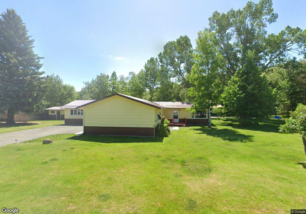
29 Alison Dr Absarokee, MT 59001
Estimated Value: $327,725 - $413,000
3
Beds
2
Baths
1,742
Sq Ft
$224/Sq Ft
Est. Value
About This Home
This home is located at 29 Alison Dr, Absarokee, MT 59001 and is currently estimated at $389,431, approximately $223 per square foot. 29 Alison Dr is a home with nearby schools including Absarokee School, Absarokee Junior High School, and Absarokee High School.
Create a Home Valuation Report for This Property
The Home Valuation Report is an in-depth analysis detailing your home's value as well as a comparison with similar homes in the area
Tax History
| Year | Tax Paid | Tax Assessment Tax Assessment Total Assessment is a certain percentage of the fair market value that is determined by local assessors to be the total taxable value of land and additions on the property. | Land | Improvement |
|---|---|---|---|---|
| 2025 | $1,143 | $366,600 | $0 | $0 |
| 2024 | $1,251 | $308,400 | $0 | $0 |
| 2023 | $2,026 | $308,400 | $0 | $0 |
| 2022 | $2,246 | $222,100 | $0 | $0 |
| 2021 | $1,317 | $222,100 | $0 | $0 |
| 2020 | $1,827 | $208,100 | $0 | $0 |
| 2019 | $1,848 | $208,100 | $0 | $0 |
| 2018 | $1,723 | $180,000 | $0 | $0 |
| 2017 | $1,142 | $180,000 | $0 | $0 |
| 2016 | $1,566 | $180,900 | $0 | $0 |
| 2015 | $1,126 | $180,900 | $0 | $0 |
| 2014 | $887 | $75,525 | $0 | $0 |
Source: Public Records
Map
Nearby Homes
- 10 Alison Dr
- 30 Henry St
- A Johnson Dr Unit A
- 107 Brook Ave
- 21 & 23 S Woodard Ave Unit 2 -HOMES For Price o
- 12 Avis St
- 2994 Highway 78
- 12 Crow Child Trail
- 20 Crow Child Trail
- 41 Crow Child Trail
- 15.9 Ac Buck Creek Rd
- 2825 & 2830 Highway 78 S
- 91 Upper Hawk Valley Rd
- 37 Barham Rd
- 79 Meyers Rd
- 79 Myers Rd
- 42 Bozeman Trail
- TBD Brumfield RD Brumfield Rd
- 26 Yates Rd
- 26 O'Dare Dr
Your Personal Tour Guide
Ask me questions while you tour the home.