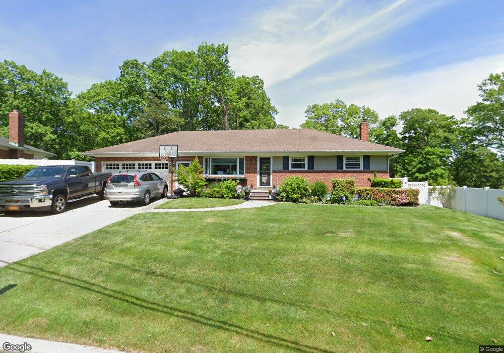
29 Ambrose Ln Northport, NY 11768
Estimated Value: $771,043 - $866,000
--
Bed
--
Bath
--
Sq Ft
0.75
Acres
About This Home
This home is located at 29 Ambrose Ln, Northport, NY 11768 and is currently estimated at $824,011. 29 Ambrose Ln is a home located in Suffolk County with nearby schools including Northport Senior High School, The School House, and Trinity Regional School-East Northport Campus.
Ownership History
Date
Name
Owned For
Owner Type
Purchase Details
Closed on
Jun 3, 2003
Sold by
Mcdonald Michael C
Bought by
Mcdonald Michael C and Mcdonald Anne
Current Estimated Value
Purchase Details
Closed on
Jan 17, 2003
Sold by
Burke Lynn
Bought by
Mcdonald Michael C
Home Financials for this Owner
Home Financials are based on the most recent Mortgage that was taken out on this home.
Original Mortgage
$322,700
Outstanding Balance
$138,570
Interest Rate
6.11%
Estimated Equity
$685,441
Purchase Details
Closed on
Jul 9, 2002
Sold by
Burke Lynn and Girolamo Roy
Bought by
Burke Lynn
Create a Home Valuation Report for This Property
The Home Valuation Report is an in-depth analysis detailing your home's value as well as a comparison with similar homes in the area
Home Values in the Area
Average Home Value in this Area
Purchase History
| Date | Buyer | Sale Price | Title Company |
|---|---|---|---|
| Mcdonald Michael C | -- | -- | |
| Mcdonald Michael C | $410,000 | Commonwealth Land Title Ins | |
| Burke Lynn | -- | Commonwealth Land Title Ins |
Source: Public Records
Mortgage History
| Date | Status | Borrower | Loan Amount |
|---|---|---|---|
| Open | Mcdonald Michael C | $322,700 |
Source: Public Records
Tax History Compared to Growth
Tax History
| Year | Tax Paid | Tax Assessment Tax Assessment Total Assessment is a certain percentage of the fair market value that is determined by local assessors to be the total taxable value of land and additions on the property. | Land | Improvement |
|---|---|---|---|---|
| 2024 | $12,039 | $3,500 | $500 | $3,000 |
| 2023 | $6,020 | $3,500 | $500 | $3,000 |
| 2022 | $10,616 | $3,500 | $500 | $3,000 |
| 2021 | $10,285 | $3,500 | $500 | $3,000 |
| 2020 | $10,121 | $3,500 | $500 | $3,000 |
| 2019 | $20,241 | $0 | $0 | $0 |
| 2018 | $9,504 | $3,500 | $500 | $3,000 |
| 2017 | $9,504 | $3,500 | $500 | $3,000 |
| 2016 | $9,347 | $3,500 | $500 | $3,000 |
| 2015 | -- | $3,500 | $500 | $3,000 |
| 2014 | -- | $3,500 | $500 | $3,000 |
Source: Public Records
Map
Nearby Homes
- 33 Alsace Place
- 107 Soper Ave
- 26 Gilbert St
- 27 Brittany Ct
- 44 Grant St
- 292 Laurel Rd
- 301 Laurel Rd
- 224 Catherine St
- 267 Laurel Rd
- 330 Scudder Ave
- 22 Middleville Rd
- 32 Vail St
- 30 Middleville Rd
- 32 Middleville Rd Unit 2
- 167 Vernon Valley Rd
- 119 Catherine St
- 7 Sun Valley Ct
- 36 Ripley Dr
- 18 Norton Dr
- 36 Seaview Ave