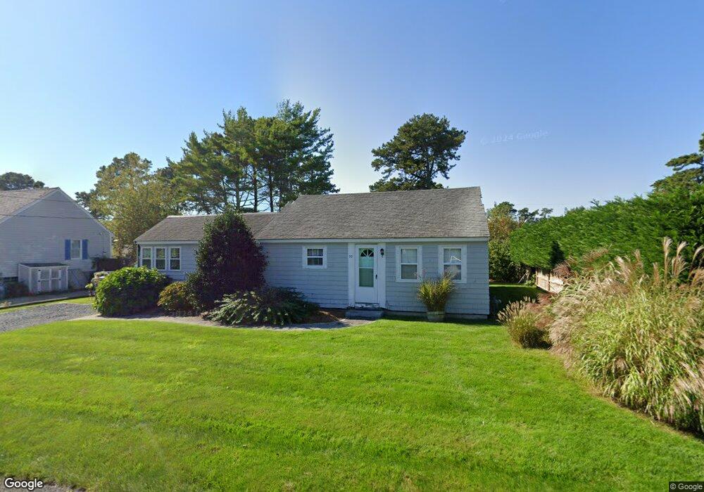
29 Bain Rd Dennis Port, MA 02639
Dennis Port NeighborhoodEstimated Value: $548,000 - $710,000
2
Beds
1
Bath
947
Sq Ft
$685/Sq Ft
Est. Value
About This Home
This home is located at 29 Bain Rd, Dennis Port, MA 02639 and is currently estimated at $648,884, approximately $685 per square foot. 29 Bain Rd is a home located in Barnstable County with nearby schools including Dennis-Yarmouth Regional High School.
Ownership History
Date
Name
Owned For
Owner Type
Purchase Details
Closed on
Jul 23, 2010
Sold by
Schwalm Paul M and Schwalm Julie A
Bought by
Fisher David B and Fisher Karyn B
Current Estimated Value
Home Financials for this Owner
Home Financials are based on the most recent Mortgage that was taken out on this home.
Original Mortgage
$208,844
Outstanding Balance
$139,057
Interest Rate
4.76%
Mortgage Type
Purchase Money Mortgage
Estimated Equity
$509,827
Purchase Details
Closed on
Jun 5, 1998
Sold by
Manzer Gladys S
Bought by
Schwalm Paul M and Schwalm Julie A
Home Financials for this Owner
Home Financials are based on the most recent Mortgage that was taken out on this home.
Original Mortgage
$90,400
Interest Rate
7.05%
Mortgage Type
Purchase Money Mortgage
Create a Home Valuation Report for This Property
The Home Valuation Report is an in-depth analysis detailing your home's value as well as a comparison with similar homes in the area
Home Values in the Area
Average Home Value in this Area
Purchase History
| Date | Buyer | Sale Price | Title Company |
|---|---|---|---|
| Fisher David B | $262,500 | -- | |
| Schwalm Paul M | $113,000 | -- |
Source: Public Records
Mortgage History
| Date | Status | Borrower | Loan Amount |
|---|---|---|---|
| Open | Fisher David B | $208,844 | |
| Previous Owner | Schwalm Paul M | $90,400 |
Source: Public Records
Tax History Compared to Growth
Tax History
| Year | Tax Paid | Tax Assessment Tax Assessment Total Assessment is a certain percentage of the fair market value that is determined by local assessors to be the total taxable value of land and additions on the property. | Land | Improvement |
|---|---|---|---|---|
| 2025 | $2,713 | $626,600 | $279,000 | $347,600 |
| 2024 | $2,575 | $586,500 | $268,300 | $318,200 |
| 2023 | $2,225 | $476,500 | $243,900 | $232,600 |
| 2022 | $2,029 | $362,300 | $192,200 | $170,100 |
| 2021 | $1,980 | $328,300 | $188,400 | $139,900 |
| 2020 | $1,924 | $315,400 | $188,400 | $127,000 |
| 2019 | $5,118 | $311,900 | $200,600 | $111,300 |
| 2018 | $1,845 | $291,000 | $191,000 | $100,000 |
| 2017 | $1,677 | $272,700 | $175,900 | $96,800 |
| 2016 | $1,604 | $245,600 | $165,800 | $79,800 |
| 2015 | $1,629 | $254,600 | $165,800 | $88,800 |
| 2014 | $1,553 | $244,600 | $155,800 | $88,800 |
Source: Public Records
Map
Nearby Homes
- 64 Beaten Rd
- 37 Ocean Dr Unit 2
- 112 Old Wharf Rd Unit E4
- 112 Old Wharf Rd Unit E1
- 154 Old Wharf Rd Unit 26
- 154 Old Wharf Rd Unit 14
- 120 Old Wharf Rd Unit 11
- 217 Old Wharf Rd Unit 64
- 80 Michaels Ave
- 31 Easy St
- 241 Old Wharf Rd Unit 82
- 241 Old Wharf Rd Unit 127
- 241 Old Wharf Rd Unit 90
- 262 Old Wharf Rd Unit 67
- 262 Old Wharf Rd Unit 5
- 262 Old Wharf Rd Unit 5
- 262 Old Wharf Rd Unit 20
- 262 Old Wharf Rd Unit 87
- 37 Beach Hills Rd
- 37-A Beach Hills Rd