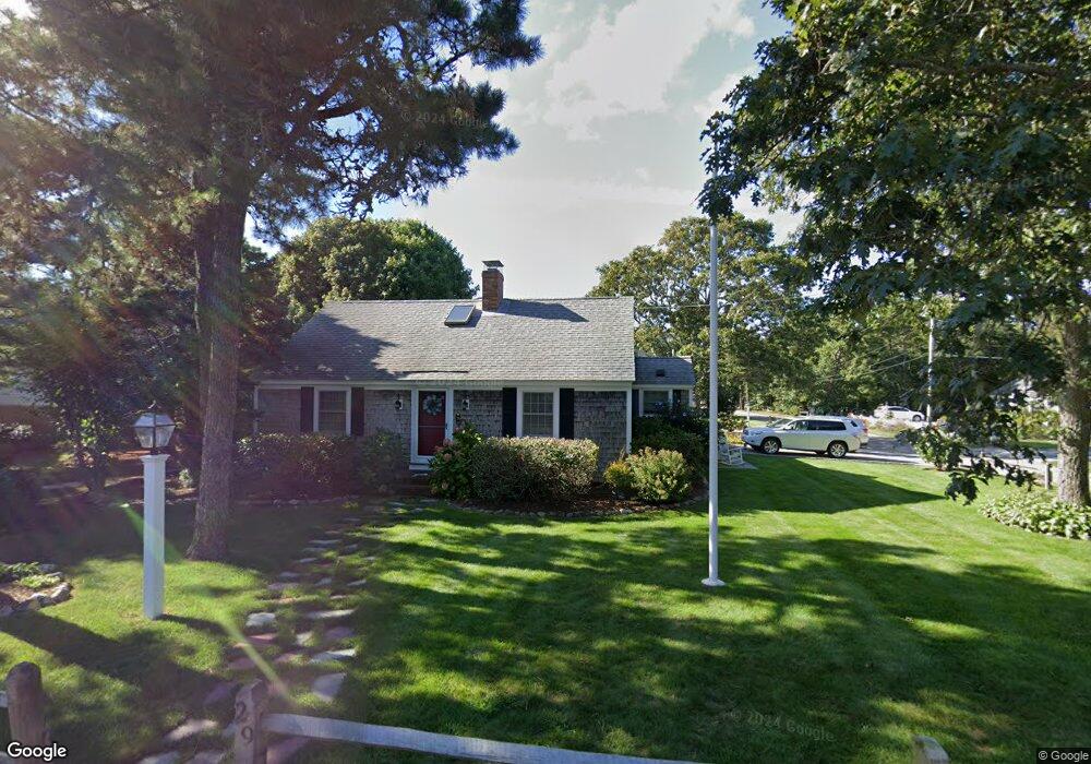
29 Beach Rd West Harwich, MA 02671
Northwest Harwich NeighborhoodEstimated Value: $1,204,000 - $1,929,000
4
Beds
2
Baths
2,207
Sq Ft
$731/Sq Ft
Est. Value
About This Home
This home is located at 29 Beach Rd, West Harwich, MA 02671 and is currently estimated at $1,614,251, approximately $731 per square foot. 29 Beach Rd is a home located in Barnstable County with nearby schools including Harwich Elementary School, Chatham Elementary School, and Monomoy Regional Middle School.
Ownership History
Date
Name
Owned For
Owner Type
Purchase Details
Closed on
Dec 14, 2011
Sold by
Barrett Lt
Bought by
Wbcbs Beach Road Llc
Current Estimated Value
Purchase Details
Closed on
May 21, 2010
Sold by
Patey Frederick R
Bought by
Barrett William R and Barrett Barbara Illner
Home Financials for this Owner
Home Financials are based on the most recent Mortgage that was taken out on this home.
Original Mortgage
$417,000
Interest Rate
5.23%
Mortgage Type
Purchase Money Mortgage
Purchase Details
Closed on
Jul 31, 2002
Sold by
Hackett Mary E
Bought by
Patey Frederick R and Patey Evangeline M
Home Financials for this Owner
Home Financials are based on the most recent Mortgage that was taken out on this home.
Original Mortgage
$340,000
Interest Rate
6.64%
Mortgage Type
Purchase Money Mortgage
Create a Home Valuation Report for This Property
The Home Valuation Report is an in-depth analysis detailing your home's value as well as a comparison with similar homes in the area
Home Values in the Area
Average Home Value in this Area
Purchase History
| Date | Buyer | Sale Price | Title Company |
|---|---|---|---|
| Wbcbs Beach Road Llc | -- | -- | |
| Barrett William R | $665,000 | -- | |
| Patey Frederick R | $576,000 | -- |
Source: Public Records
Mortgage History
| Date | Status | Borrower | Loan Amount |
|---|---|---|---|
| Previous Owner | Barrett William R | $417,000 | |
| Previous Owner | Patey Frederick R | $340,000 |
Source: Public Records
Tax History Compared to Growth
Tax History
| Year | Tax Paid | Tax Assessment Tax Assessment Total Assessment is a certain percentage of the fair market value that is determined by local assessors to be the total taxable value of land and additions on the property. | Land | Improvement |
|---|---|---|---|---|
| 2025 | $10,030 | $1,697,100 | $749,800 | $947,300 |
| 2024 | $9,116 | $1,511,700 | $707,400 | $804,300 |
| 2023 | $7,894 | $1,188,900 | $505,900 | $683,000 |
| 2022 | $7,783 | $959,700 | $439,900 | $519,800 |
| 2021 | $7,705 | $895,900 | $399,900 | $496,000 |
| 2020 | $7,630 | $874,000 | $392,200 | $481,800 |
| 2019 | $7,283 | $840,000 | $374,000 | $466,000 |
| 2018 | $6,928 | $764,300 | $340,000 | $424,300 |
| 2017 | $6,548 | $730,000 | $309,800 | $420,200 |
| 2016 | $6,456 | $711,800 | $309,800 | $402,000 |
| 2015 | $6,226 | $694,100 | $303,700 | $390,400 |
| 2014 | $5,119 | $583,700 | $330,900 | $252,800 |
Source: Public Records
Map
Nearby Homes
- 13 Osborne Rd
- 28 Patricia Ln
- 7 Dunes Rd
- 231 Roue 28 Unit 20
- 24 Chase St
- 24 Chase St
- 231 Route 28 Unit 20
- 231 Route 28 Unit 8
- 231 Route 28 Unit 15
- 16 Mirasol Ln
- 19 Riverway
- 19 Riverway
- 188 Massachusetts 28
- 264 Massachusetts 28
- 161 Massachusetts 28 Unit 7
- 292 Route 28 Unit 7
- 292 Massachusetts 28 Unit 1
- 292 Massachusetts 28 Unit 7
- 126 Massachusetts 28
- 6 Bayberry Ln
- 3 Pine Needle Ln
- 24 Green Needle Ln
- 14 Green Needle Ln
- 7 Pine Needle Ln
- 21 Green Needle Ln
- 26 Beach Rd
- 25 Green Needle Ln
- 17 Green Needle Ln
- 28 Green Needle Ln
- 6 Pine Needle Ln
- 11 Pine Needle Ln
- 22 Beach Rd
- 29 Green Needle Ln
- 18 Mother Goose Ln
- 62 Shore Rd
- 58 Shore Rd
- 9 Pinewood Ln
- 26 Grey Neck Rd Unit 2
- 26 Grey Neck Rd Unit 1
- 66 Shore Rd