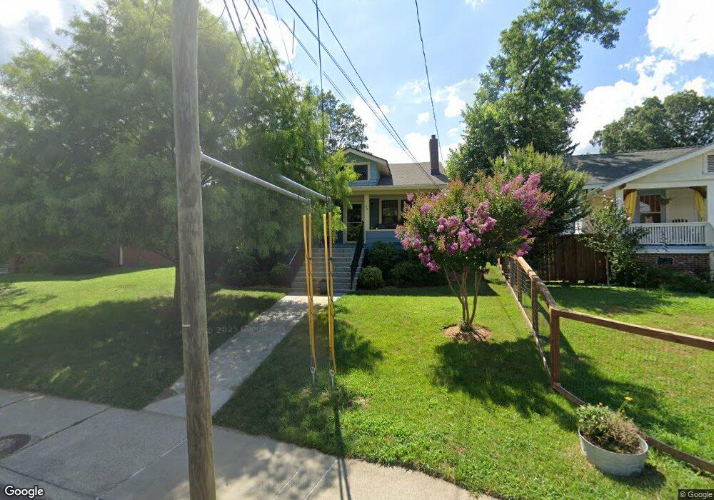
29 Brevard Rd Asheville, NC 28806
West Asheville NeighborhoodEstimated Value: $321,000 - $483,000
3
Beds
2
Baths
1,186
Sq Ft
$342/Sq Ft
Est. Value
About This Home
This home is located at 29 Brevard Rd, Asheville, NC 28806 and is currently estimated at $405,187, approximately $341 per square foot. 29 Brevard Rd is a home located in Buncombe County with nearby schools including Hall Fletcher Elementary, Isaac Dickson Elementary, and Ira B Jones Elementary.
Ownership History
Date
Name
Owned For
Owner Type
Purchase Details
Closed on
Jan 31, 2019
Sold by
Hutt William and Hutt Marleen Joy
Bought by
Hutt William and Hutt Marleen Joy
Current Estimated Value
Purchase Details
Closed on
Jan 28, 2011
Sold by
Mcglamery Edward Lee
Bought by
Hutt William H and Hutt Marleen B
Purchase Details
Closed on
Jan 24, 2011
Sold by
Roberts Jean M and Roberts Albert Samuel
Bought by
Hutt William H and Hutt Marleen B
Create a Home Valuation Report for This Property
The Home Valuation Report is an in-depth analysis detailing your home's value as well as a comparison with similar homes in the area
Home Values in the Area
Average Home Value in this Area
Purchase History
| Date | Buyer | Sale Price | Title Company |
|---|---|---|---|
| Hutt William | -- | None Available | |
| Hutt William H | $120,000 | None Available | |
| Hutt William H | -- | None Available |
Source: Public Records
Tax History Compared to Growth
Tax History
| Year | Tax Paid | Tax Assessment Tax Assessment Total Assessment is a certain percentage of the fair market value that is determined by local assessors to be the total taxable value of land and additions on the property. | Land | Improvement |
|---|---|---|---|---|
| 2025 | $2,090 | $207,800 | $113,900 | $93,900 |
| 2024 | $2,090 | $202,300 | $113,900 | $88,400 |
| 2023 | $2,090 | $202,300 | $113,900 | $88,400 |
| 2022 | $2,017 | $202,300 | $0 | $0 |
| 2021 | $2,017 | $202,300 | $0 | $0 |
| 2020 | $1,680 | $155,900 | $0 | $0 |
| 2019 | $1,680 | $155,900 | $0 | $0 |
| 2018 | $1,680 | $155,900 | $0 | $0 |
| 2017 | $1,696 | $126,800 | $0 | $0 |
| 2016 | $1,558 | $126,800 | $0 | $0 |
| 2015 | $1,558 | $126,800 | $0 | $0 |
| 2014 | $1,539 | $126,800 | $0 | $0 |
Source: Public Records
Map
Nearby Homes
- 56 Brevard Rd
- 18 Jarrett St
- 18 Sand Hill Rd
- 30 Sand Hill Rd
- 75 Nevada Ave
- 91 Virginia Ave
- 55 Herron Ave
- 99 Nevada Ave
- 54 Louisiana Ave
- 68 1/2 Nevada Ave
- 31 Oakwood St
- 43 Vermont Ct Unit D14
- 20 Cloyes St
- 32 Harnett St
- 197 Brucemont Cir
- 9999 Rex Dr
- 12 Rex Dr
- 12 & 9999 Rex Dr
- 60 Dorchester Ave
- 89 Galax Ave
- 35 Brevard Rd
- 25 Brevard Rd
- 41 Brevard Rd
- 44 Brevard Rd
- 21 Brevard Rd
- 24 Brevard Rd Unit 29
- 24 Brevard Rd Unit 29, 31, 32
- 24 Brevard Rd
- 43 Brevard Rd
- 11 McGlamery Ln
- 24 Vance Crescent St
- 16 Brevard Rd
- 17 McGlamery Ln
- 19 Brevard Rd
- 30 Vance Crescent St
- 67 Brevard Rd
- 52 Brevard Rd
- 20 Vance Crescent St
- 11 Olney Rd
- 16 Vance Crescent St