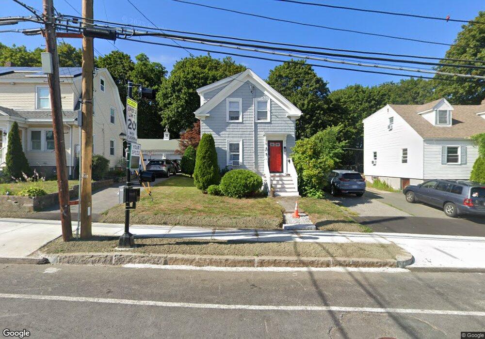
29 Bridge St Salem, MA 01970
Bridge Street Neighborhood
Studio
2
Baths
6,601
Sq Ft
0.26
Acres
About This Home
This home is located at 29 Bridge St, Salem, MA 01970. 29 Bridge St is a home located in Essex County with nearby schools including Carlton Elementary School, Saltonstall School, and Bates Elementary School.
Ownership History
Date
Name
Owned For
Owner Type
Purchase Details
Closed on
Nov 3, 2025
Sold by
29 Bridge St Llc
Bought by
Twenty 9 Bridge St Llc
Purchase Details
Closed on
Jul 1, 2009
Sold by
W Main Street Rt and Pioneer Capital Corp
Bought by
29 Bridge Street Llc
Home Financials for this Owner
Home Financials are based on the most recent Mortgage that was taken out on this home.
Original Mortgage
$375,000
Interest Rate
4.86%
Mortgage Type
Commercial
Purchase Details
Closed on
Jan 23, 2004
Sold by
Secondiani James D
Bought by
West Main Street Rt
Purchase Details
Closed on
Dec 31, 2001
Sold by
Heritage Coop Bk
Bought by
Secondiani James D
Purchase Details
Closed on
May 14, 1998
Sold by
Shakers Rt and Ustrust
Bought by
Thibault Daniel L and Marquis Gerald E
Create a Home Valuation Report for This Property
The Home Valuation Report is an in-depth analysis detailing your home's value as well as a comparison with similar homes in the area
Home Values in the Area
Average Home Value in this Area
Purchase History
| Date | Buyer | Sale Price | Title Company |
|---|---|---|---|
| Twenty 9 Bridge St Llc | $1,150,000 | -- | |
| 29 Bridge Street Llc | $405,000 | -- | |
| 29 Bridge Street Llc | $405,000 | -- | |
| West Main Street Rt | -- | -- | |
| West Main Street Rt | -- | -- | |
| Secondiani James D | $393,000 | -- | |
| Secondiani James D | $393,000 | -- | |
| Thibault Daniel L | $370,000 | -- | |
| Thibault Daniel L | $370,000 | -- |
Source: Public Records
Mortgage History
| Date | Status | Borrower | Loan Amount |
|---|---|---|---|
| Previous Owner | Thibault Daniel L | $375,000 |
Source: Public Records
Tax History
| Year | Tax Paid | Tax Assessment Tax Assessment Total Assessment is a certain percentage of the fair market value that is determined by local assessors to be the total taxable value of land and additions on the property. | Land | Improvement |
|---|---|---|---|---|
| 2025 | $16,603 | $734,000 | $393,100 | $340,900 |
| 2024 | $16,280 | $687,200 | $356,400 | $330,800 |
| 2023 | $16,955 | $671,500 | $340,700 | $330,800 |
| 2022 | $17,083 | $649,300 | $324,900 | $324,400 |
| 2021 | $17,487 | $633,600 | $309,200 | $324,400 |
| 2020 | $16,137 | $567,800 | $293,500 | $274,300 |
| 2019 | $15,851 | $536,400 | $262,100 | $274,300 |
| 2018 | $15,132 | $504,900 | $230,600 | $274,300 |
| 2017 | $14,050 | $468,500 | $188,700 | $279,800 |
| 2016 | $13,844 | $468,500 | $188,700 | $279,800 |
| 2015 | $14,472 | $467,000 | $176,100 | $290,900 |
Source: Public Records
Map
Nearby Homes
- 85 Bridge St Unit 4
- 12 Summit Ave Unit 4
- 7 Lothrop St
- 156 Bridge St Unit B
- 41 Dearborn St
- 14 Mall St Unit B
- 31 N Washington Square Unit 3
- 16 Williams St
- 7 Forrester St
- 40 Essex St Unit 2
- 11 Williams St Unit 2
- 16 Franklin St Unit 2403
- 16 Franklin St Unit 1303
- 44 Orne St Unit 44
- 21 Manning St
- 23 1/2 Lovett St
- 69 Essex St Unit 2
- 7 Curtis St Unit 1
- 131 Derby St Unit 3F
- 16 Crescent Ave