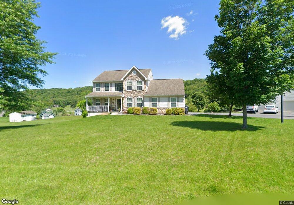
29 Brigham Way Kempton, PA 19529
Estimated Value: $427,000 - $604,000
4
Beds
4
Baths
2,452
Sq Ft
$219/Sq Ft
Est. Value
About This Home
This home is located at 29 Brigham Way, Kempton, PA 19529 and is currently estimated at $537,107, approximately $219 per square foot. 29 Brigham Way is a home located in Berks County with nearby schools including Kutztown Area Senior High School.
Ownership History
Date
Name
Owned For
Owner Type
Purchase Details
Closed on
Oct 26, 2007
Sold by
Mcweeber Llc
Bought by
Furlong Steven C and Furlong Angie D
Current Estimated Value
Home Financials for this Owner
Home Financials are based on the most recent Mortgage that was taken out on this home.
Original Mortgage
$240,000
Outstanding Balance
$151,929
Interest Rate
6.39%
Mortgage Type
New Conventional
Estimated Equity
$385,178
Create a Home Valuation Report for This Property
The Home Valuation Report is an in-depth analysis detailing your home's value as well as a comparison with similar homes in the area
Home Values in the Area
Average Home Value in this Area
Purchase History
| Date | Buyer | Sale Price | Title Company |
|---|---|---|---|
| Furlong Steven C | $318,441 | None Available |
Source: Public Records
Mortgage History
| Date | Status | Borrower | Loan Amount |
|---|---|---|---|
| Open | Furlong Steven C | $240,000 |
Source: Public Records
Tax History Compared to Growth
Tax History
| Year | Tax Paid | Tax Assessment Tax Assessment Total Assessment is a certain percentage of the fair market value that is determined by local assessors to be the total taxable value of land and additions on the property. | Land | Improvement |
|---|---|---|---|---|
| 2025 | $2,097 | $218,100 | $32,900 | $185,200 |
| 2024 | $8,484 | $218,100 | $32,900 | $185,200 |
| 2023 | $8,334 | $218,100 | $32,900 | $185,200 |
| 2022 | $8,334 | $218,100 | $32,900 | $185,200 |
| 2021 | $8,242 | $215,700 | $32,900 | $182,800 |
| 2020 | $8,242 | $215,700 | $32,900 | $182,800 |
| 2019 | $8,242 | $215,700 | $32,900 | $182,800 |
| 2018 | $8,242 | $215,700 | $32,900 | $182,800 |
| 2017 | $7,703 | $203,100 | $32,900 | $170,200 |
| 2016 | $1,587 | $203,100 | $32,900 | $170,200 |
| 2015 | $1,587 | $203,100 | $32,900 | $170,200 |
| 2014 | $1,587 | $203,100 | $32,900 | $170,200 |
Source: Public Records
Map
Nearby Homes
- 147 Scout Rd
- 1117 Hawk Mountain Rd
- 6168 Greenawalt Rd
- 529 Little Roundtop Rd
- 572 Old U S 22
- 21 Sunny Ridge Ct
- 8165 Weavers Ct
- 123 Kohlers Hill Rd
- 6 Green Acres Rd
- 333 New Bethel Church Rd
- 100 Kohlers Hill Rd
- 79 Daniel Rd W
- 7866 Brobst Hill Rd
- 7893 Leaser Rd
- 21 Blue Rocks Rd
- 45 Eagle St
- 82 Pheasant Dr
- 1563 Old Route 22
- 235 Stump Rd
- 2995 Sechler Ct