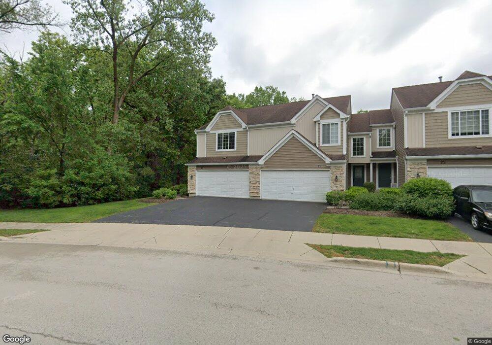
29 Cambridge Ave Streamwood, IL 60107
Estimated Value: $319,983 - $334,000
2
Beds
3
Baths
1,406
Sq Ft
$234/Sq Ft
Est. Value
About This Home
This home is located at 29 Cambridge Ave, Streamwood, IL 60107 and is currently estimated at $328,746, approximately $233 per square foot. 29 Cambridge Ave is a home located in Cook County with nearby schools including Heritage Elementary School, Tefft Middle School, and Streamwood High School.
Ownership History
Date
Name
Owned For
Owner Type
Purchase Details
Closed on
Apr 23, 1999
Sold by
Chapulis Martin G
Bought by
Fintak Robert A and Fintak Karen A
Current Estimated Value
Purchase Details
Closed on
Dec 7, 1994
Sold by
Pulte Home Corp
Bought by
Chapuis Martin G
Home Financials for this Owner
Home Financials are based on the most recent Mortgage that was taken out on this home.
Original Mortgage
$136,000
Interest Rate
8.5%
Create a Home Valuation Report for This Property
The Home Valuation Report is an in-depth analysis detailing your home's value as well as a comparison with similar homes in the area
Home Values in the Area
Average Home Value in this Area
Purchase History
| Date | Buyer | Sale Price | Title Company |
|---|---|---|---|
| Fintak Robert A | $159,000 | Chicago Title Insurance Co | |
| Chapuis Martin G | $145,500 | Intercounty Title |
Source: Public Records
Mortgage History
| Date | Status | Borrower | Loan Amount |
|---|---|---|---|
| Previous Owner | Chapuis Martin G | $136,000 |
Source: Public Records
Tax History Compared to Growth
Tax History
| Year | Tax Paid | Tax Assessment Tax Assessment Total Assessment is a certain percentage of the fair market value that is determined by local assessors to be the total taxable value of land and additions on the property. | Land | Improvement |
|---|---|---|---|---|
| 2024 | $5,683 | $22,777 | $3,499 | $19,278 |
| 2023 | $5,512 | $22,777 | $3,499 | $19,278 |
| 2022 | $5,512 | $22,777 | $3,499 | $19,278 |
| 2021 | $4,786 | $17,175 | $5,743 | $11,432 |
| 2020 | $4,786 | $17,175 | $5,743 | $11,432 |
| 2019 | $4,739 | $19,084 | $5,743 | $13,341 |
| 2018 | $4,385 | $16,593 | $5,025 | $11,568 |
| 2017 | $4,350 | $16,593 | $5,025 | $11,568 |
| 2016 | $4,330 | $16,593 | $5,025 | $11,568 |
| 2015 | $3,465 | $12,935 | $4,546 | $8,389 |
| 2014 | $3,427 | $12,935 | $4,546 | $8,389 |
| 2013 | $3,303 | $12,935 | $4,546 | $8,389 |
Source: Public Records
Map
Nearby Homes
- 2056 Essex Ct
- 2073 Essex Ct
- 53 Samuel Dr Unit 163
- 55 Samuel Dr Unit 162
- 2104 Falmouth Ct
- 134 Virginia Ct
- 406 Locksley Dr
- 8 Lasalle Ct
- 113 Samuel Ct Unit 263
- 434 Locksley Dr
- 6 Wild Rose Ct
- 4018 Oxford Ct
- 3098 Lynnwood Ct
- 3075 Kingston Ct
- 9N Merry Oaks Rd
- 600 W Lake St
- 4077 Club Tree Dr
- 650 W Old Lake St
- 106 Brittany Dr Unit 17E1
- 121 E Briarwood Dr
- 27 Cambridge Ave
- 25 Cambridge Ave
- 23 Cambridge Ave
- 15 Cambridge Ave
- 9 Cambridge Ave
- 2039 Duxbury Ct
- 2038 Duxbury Ct
- 2037 Duxbury Ct Unit 1
- 2036 Duxbury Ct
- 2035 Duxbury Ct Unit 1
- 2034 Duxbury Ct
- 2033 Duxbury Ct
- 2032 Duxbury Ct Unit 1
- 2031 Duxbury Ct Unit 1
- 53 Cambridge Ave
- 5 Cambridge Ave
- 55 Cambridge Ave
- 57 Cambridge Ave
- 57 Cambridge Ave Unit AVE
- 59 Cambridge Ave