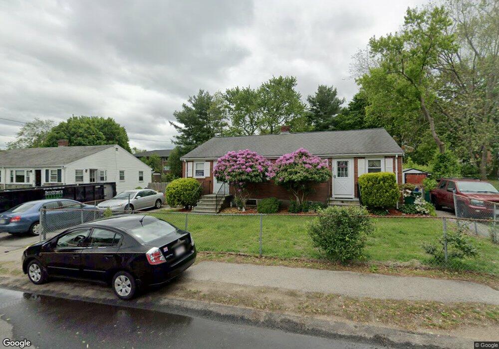
29 Cambridge Rd Unit 31 Norwood, MA 02062
North Norwood NeighborhoodEstimated Value: $678,340 - $789,000
2
Beds
1
Bath
688
Sq Ft
$1,078/Sq Ft
Est. Value
About This Home
This home is located at 29 Cambridge Rd Unit 31, Norwood, MA 02062 and is currently estimated at $741,835, approximately $1,078 per square foot. 29 Cambridge Rd Unit 31 is a home located in Norfolk County with nearby schools including Norwood High School, St Catherine Of Siena School, and Norwood Montessori School.
Ownership History
Date
Name
Owned For
Owner Type
Purchase Details
Closed on
Jul 2, 2025
Sold by
Serratore Francesco
Bought by
Serratore Giacomo and Serratore Anthony
Current Estimated Value
Purchase Details
Closed on
May 1, 1990
Sold by
Kuczin Walter W
Bought by
Serratore Francesco
Home Financials for this Owner
Home Financials are based on the most recent Mortgage that was taken out on this home.
Original Mortgage
$120,000
Interest Rate
10.26%
Mortgage Type
Purchase Money Mortgage
Create a Home Valuation Report for This Property
The Home Valuation Report is an in-depth analysis detailing your home's value as well as a comparison with similar homes in the area
Home Values in the Area
Average Home Value in this Area
Purchase History
| Date | Buyer | Sale Price | Title Company |
|---|---|---|---|
| Serratore Giacomo | -- | -- | |
| Serratore Giacomo | -- | -- | |
| Serratore Francesco | $185,000 | -- | |
| Serratore Francesco | $185,000 | -- |
Source: Public Records
Mortgage History
| Date | Status | Borrower | Loan Amount |
|---|---|---|---|
| Previous Owner | Serratore Francesco | $120,000 |
Source: Public Records
Tax History Compared to Growth
Tax History
| Year | Tax Paid | Tax Assessment Tax Assessment Total Assessment is a certain percentage of the fair market value that is determined by local assessors to be the total taxable value of land and additions on the property. | Land | Improvement |
|---|---|---|---|---|
| 2025 | $6,050 | $575,100 | $273,700 | $301,400 |
| 2024 | $5,258 | $502,200 | $273,700 | $228,500 |
| 2023 | $4,751 | $460,400 | $238,000 | $222,400 |
| 2022 | $4,717 | $438,800 | $216,400 | $222,400 |
| 2021 | $4,485 | $395,500 | $208,600 | $186,900 |
| 2020 | $4,249 | $381,100 | $208,600 | $172,500 |
| 2019 | $4,027 | $369,800 | $198,700 | $171,100 |
| 2018 | $3,901 | $351,800 | $189,200 | $162,600 |
| 2017 | $3,746 | $336,000 | $189,200 | $146,800 |
| 2016 | $3,763 | $338,400 | $189,200 | $149,200 |
| 2015 | $3,723 | $324,600 | $180,600 | $144,000 |
| 2014 | $3,151 | $272,100 | $163,800 | $108,300 |
Source: Public Records
Map
Nearby Homes
- 232 Rock St
- 301 Neponset St Unit 25
- 49 Railroad Ave
- 68-70 Adams St
- 42 Queensboro Ct Unit 42
- 1 Lenox St Unit 312
- 1 Lenox St Unit 115
- 86 Hill St
- 1 Walkhill Rd
- 105 E Cross St
- 28 Shaw St
- 232-234 Nahatan St
- 253 Nahatan St Unit 11
- 365 Washington St Unit 4
- 785 Washington St Unit 206
- 785 Washington St Unit 207
- 19-21
- 22 Hillside Ave
- 85 Casey St
- 11 Beacon Park Rd
- 21 Cambridge Rd Unit 23
- 21 Cambridge Rd Unit 21
- 21-23 Cambridge Rd
- 23 Cambridge Rd Unit 23
- 23 Cambridge Rd
- 33 Cambridge Rd Unit 35
- 17-19 Cambridge Rd
- 19 Cambridge Rd
- 17 Cambridge Rd
- 19 Cambridge Rd Unit 2
- 17 Cambridge Rd Unit 1
- 39 Cambridge Rd Unit 41
- 30 Cambridge Rd Unit 30
- 78 Pleasant St Unit N
- 78 Pleasant St Unit M
- 78 Pleasant St Unit L
- 78 Pleasant St Unit K
- 78 Pleasant St Unit J
- 78 Pleasant St Unit I
- 78 Pleasant St Unit H