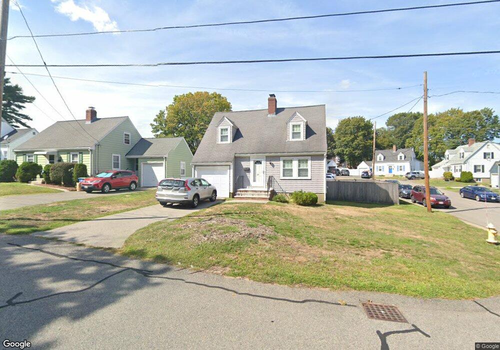
29 Cedar Cliff Rd Braintree, MA 02184
East Braintree NeighborhoodEstimated Value: $587,000 - $678,000
3
Beds
3
Baths
1,196
Sq Ft
$536/Sq Ft
Est. Value
About This Home
This home is located at 29 Cedar Cliff Rd, Braintree, MA 02184 and is currently estimated at $640,789, approximately $535 per square foot. 29 Cedar Cliff Rd is a home located in Norfolk County with nearby schools including Braintree High School, Sacred Heart Elementary School, and South Shore Christian Academy.
Ownership History
Date
Name
Owned For
Owner Type
Purchase Details
Closed on
Aug 6, 2024
Sold by
Abreu Ernest P and Abreu Maura B
Bought by
Areu Rt and Abreu
Current Estimated Value
Purchase Details
Closed on
Feb 16, 1994
Sold by
Cronan Margaret
Bought by
Adreu Ernest P and Adreu Maura B
Home Financials for this Owner
Home Financials are based on the most recent Mortgage that was taken out on this home.
Original Mortgage
$130,500
Interest Rate
7.18%
Mortgage Type
Purchase Money Mortgage
Create a Home Valuation Report for This Property
The Home Valuation Report is an in-depth analysis detailing your home's value as well as a comparison with similar homes in the area
Home Values in the Area
Average Home Value in this Area
Purchase History
| Date | Buyer | Sale Price | Title Company |
|---|---|---|---|
| Areu Rt | -- | None Available | |
| Areu Rt | -- | None Available | |
| Adreu Ernest P | $145,000 | -- | |
| Adreu Ernest P | $145,000 | -- |
Source: Public Records
Mortgage History
| Date | Status | Borrower | Loan Amount |
|---|---|---|---|
| Previous Owner | Adreu Ernest P | $183,000 | |
| Previous Owner | Adreu Ernest P | $25,000 | |
| Previous Owner | Adreu Ernest P | $121,300 | |
| Previous Owner | Adreu Ernest P | $130,500 |
Source: Public Records
Tax History
| Year | Tax Paid | Tax Assessment Tax Assessment Total Assessment is a certain percentage of the fair market value that is determined by local assessors to be the total taxable value of land and additions on the property. | Land | Improvement |
|---|---|---|---|---|
| 2025 | $5,747 | $575,900 | $325,200 | $250,700 |
| 2024 | $5,144 | $542,600 | $295,200 | $247,400 |
| 2023 | $4,880 | $500,000 | $265,300 | $234,700 |
| 2022 | $4,719 | $474,300 | $239,600 | $234,700 |
| 2021 | $4,299 | $432,100 | $216,500 | $215,600 |
| 2020 | $4,066 | $412,400 | $196,800 | $215,600 |
| 2019 | $3,897 | $386,200 | $188,300 | $197,900 |
| 2018 | $3,809 | $361,400 | $171,100 | $190,300 |
| 2017 | $3,709 | $345,300 | $162,600 | $182,700 |
| 2016 | $3,642 | $331,700 | $154,000 | $177,700 |
| 2015 | $3,318 | $299,700 | $128,400 | $171,300 |
| 2014 | $3,219 | $281,900 | $123,200 | $158,700 |
Source: Public Records
Map
Nearby Homes
- 16 Beechwood Rd
- 312 Shaw St
- 41 Lantern Ln
- 37 Lantern Ln
- 122 Washington St Unit Twenty-two
- 26 Tingley Rd
- 11 Richmond St
- 25 Richmond St
- 30 Skyline Dr Unit 6
- 46 Roosevelt Rd
- 15 Summer St
- 19 Vine St Unit 3
- 19 Vine St Unit 2
- 70 Biscayne Ave
- 25 W Howard St Unit C3
- 211 Roosevelt Rd
- 107 Summer St
- 33 Congress St
- 255 River St
- 298 Lisle St
- 35 Cedar Cliff Rd
- 10 Cape Cod Ln
- 30 Cedar Cliff Rd
- 38 Cedar Cliff Rd
- 39 Cedar Cliff Rd
- 7 Cape Cod Ln
- 24 Cedarcliff Rd
- 14 Cape Cod Ln
- 21 Cedar Cliff Rd
- 24 Cedar Cliff Rd
- 45 Cedar Cliff Rd
- 16 Cedar Cliff Rd
- 15 Cape Cod Ln
- 12 Atlas Rd
- 18 Cape Cod Ln
- 49 Cedar Cliff Rd
- 15 Cedar Cliff Rd
- 19 Cape Cod Ln
- 50 Cedar Cliff Rd
- 55 Cedar Cliff Rd
Your Personal Tour Guide
Ask me questions while you tour the home.