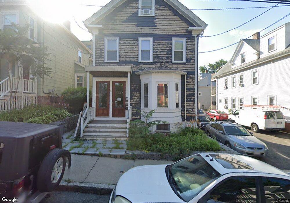
29 Chandler St Somerville, MA 02144
Davis Square NeighborhoodEstimated Value: $1,915,000 - $2,458,429
6
Beds
5
Baths
3,650
Sq Ft
$591/Sq Ft
Est. Value
About This Home
This home is located at 29 Chandler St, Somerville, MA 02144 and is currently estimated at $2,156,607, approximately $590 per square foot. 29 Chandler St is a home located in Middlesex County with nearby schools including Somerville High School, St. Clement Elementary School, and Wild Rose Montessori School.
Ownership History
Date
Name
Owned For
Owner Type
Purchase Details
Closed on
Dec 14, 2006
Sold by
New Chandler Rt and Callahan Diane M
Bought by
Cafferky Stephen P
Current Estimated Value
Home Financials for this Owner
Home Financials are based on the most recent Mortgage that was taken out on this home.
Original Mortgage
$528,800
Outstanding Balance
$316,158
Interest Rate
6.31%
Mortgage Type
Purchase Money Mortgage
Estimated Equity
$1,840,449
Create a Home Valuation Report for This Property
The Home Valuation Report is an in-depth analysis detailing your home's value as well as a comparison with similar homes in the area
Home Values in the Area
Average Home Value in this Area
Purchase History
| Date | Buyer | Sale Price | Title Company |
|---|---|---|---|
| Cafferky Stephen P | $661,000 | -- |
Source: Public Records
Mortgage History
| Date | Status | Borrower | Loan Amount |
|---|---|---|---|
| Open | Cafferky Stephen P | $528,800 |
Source: Public Records
Tax History Compared to Growth
Tax History
| Year | Tax Paid | Tax Assessment Tax Assessment Total Assessment is a certain percentage of the fair market value that is determined by local assessors to be the total taxable value of land and additions on the property. | Land | Improvement |
|---|---|---|---|---|
| 2025 | $22,633 | $2,074,500 | $927,000 | $1,147,500 |
| 2024 | $18,964 | $1,802,700 | $927,000 | $875,700 |
| 2023 | $13,355 | $1,291,600 | $927,000 | $364,600 |
| 2022 | $16,997 | $1,669,600 | $882,800 | $786,800 |
| 2021 | $16,502 | $1,619,400 | $876,500 | $742,900 |
| 2020 | $15,312 | $1,517,500 | $818,500 | $699,000 |
| 2019 | $14,850 | $1,380,100 | $798,300 | $581,800 |
| 2018 | $13,620 | $1,204,200 | $725,800 | $478,400 |
| 2017 | $13,354 | $1,144,300 | $684,600 | $459,700 |
| 2016 | $12,980 | $1,035,900 | $611,400 | $424,500 |
| 2015 | $12,425 | $985,300 | $564,600 | $420,700 |
Source: Public Records
Map
Nearby Homes
- 50 Howard St Unit 5
- 34 Day St
- 20 Electric Ave Unit 2
- 22 Ossipee Rd Unit 2
- 67-69 Cameron Ave
- 371 Highland Ave
- 29 Packard Ave
- 17 Shea Rd
- 32 Cameron Ave
- 23 Ossipee Rd
- 18 Windom St
- 39 Seven Pines Ave
- 55 Packard Ave Unit 1
- 353 Summer St Unit 310
- 24 Washburn Ave Unit 1
- 26 Warner St
- 30 Dudley St
- 79 Willow Ave
- 69 Clarendon Ave Unit A
- 12 Rindge Ave Unit 1
- 29 Chandler St Unit 2
- 31 Chandler St
- 31 Chandler St Unit 31
- 21 Chandler St
- 21 Chandler St Unit 3
- 21 Chandler St Unit 1
- 21 Chandler St Unit 2
- 54 College Ave
- 54 College Ave Unit 1
- 16 Chapel St
- 20 Chapel St
- 19 Chandler St
- 19 Chandler St
- 19 Chandler St Unit 3
- 19 Chandler St Unit 2
- 19 Chandler St Unit 1
- 60 1/2 College Ave
- 30 Chandler St
- 26 Chandler St Unit 26
- 50 College Ave Unit R