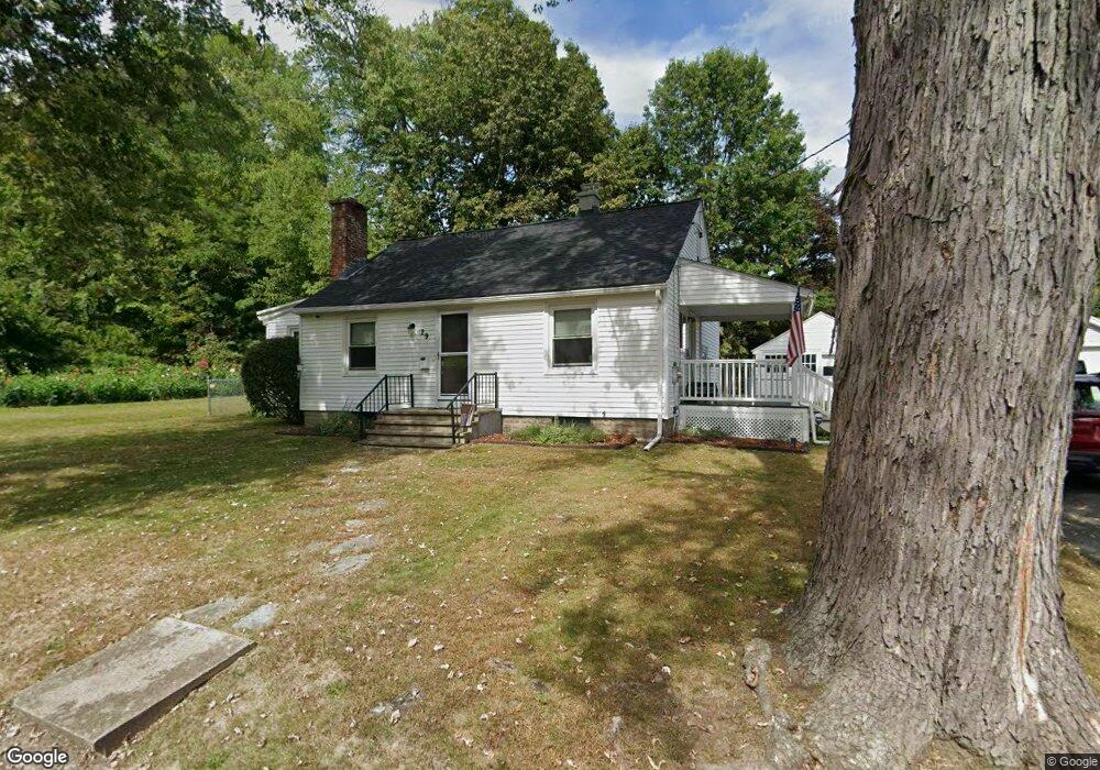
29 Concord Ave Holyoke, MA 01040
Estimated Value: $281,661 - $356,000
2
Beds
1
Bath
1,635
Sq Ft
$186/Sq Ft
Est. Value
About This Home
This home is located at 29 Concord Ave, Holyoke, MA 01040 and is currently estimated at $304,415, approximately $186 per square foot. 29 Concord Ave is a home located in Hampden County with nearby schools including Maurice A. Donahue Elementary School, Holyoke High School, and Holyoke Community Charter School.
Ownership History
Date
Name
Owned For
Owner Type
Purchase Details
Closed on
Mar 11, 2011
Sold by
Schreffler William
Bought by
Holyoke City Of
Current Estimated Value
Purchase Details
Closed on
Nov 2, 2001
Sold by
Connelly Eloise M Est and Peters
Bought by
Schreffler William
Home Financials for this Owner
Home Financials are based on the most recent Mortgage that was taken out on this home.
Original Mortgage
$89,550
Interest Rate
6.82%
Mortgage Type
Purchase Money Mortgage
Create a Home Valuation Report for This Property
The Home Valuation Report is an in-depth analysis detailing your home's value as well as a comparison with similar homes in the area
Home Values in the Area
Average Home Value in this Area
Purchase History
| Date | Buyer | Sale Price | Title Company |
|---|---|---|---|
| Holyoke City Of | $590 | -- | |
| Schreffler William | $99,500 | -- |
Source: Public Records
Mortgage History
| Date | Status | Borrower | Loan Amount |
|---|---|---|---|
| Previous Owner | Schreffler William | $15,000 | |
| Previous Owner | Schreffler William | $89,550 |
Source: Public Records
Tax History
| Year | Tax Paid | Tax Assessment Tax Assessment Total Assessment is a certain percentage of the fair market value that is determined by local assessors to be the total taxable value of land and additions on the property. | Land | Improvement |
|---|---|---|---|---|
| 2025 | $4,145 | $237,400 | $48,000 | $189,400 |
| 2024 | $3,943 | $208,100 | $45,800 | $162,300 |
| 2023 | $3,771 | $201,000 | $45,800 | $155,200 |
| 2022 | $3,631 | $188,500 | $45,800 | $142,700 |
| 2021 | $3,038 | $172,900 | $41,800 | $131,100 |
| 2020 | $3,158 | $165,500 | $41,800 | $123,700 |
| 2019 | $3,144 | $163,000 | $41,800 | $121,200 |
| 2018 | $2,737 | $156,700 | $41,800 | $114,900 |
| 2017 | $3,004 | $156,700 | $41,800 | $114,900 |
| 2016 | $2,920 | $152,700 | $42,900 | $109,800 |
| 2015 | $2,907 | $152,700 | $42,900 | $109,800 |
Source: Public Records
Map
Nearby Homes
- 1705-1707 Northampton St
- 21 Francis Ave
- 1684 Northampton St
- 268-270 Sargeant St
- 141 Saint Jerome Ave
- 41 Lynwood Ave
- 34 Maple Crest Cir Unit B
- 15 Maple Crest Cir Unit D
- 140 Sycamore St
- 201 Locust St
- 1225 Hampden St
- 60 Chapin St Unit D
- 69 Gates St
- 301-303 Linden St
- 1114 Hampden St
- 329 Beech St
- 2027-2029 Northampton St
- 165 Lincoln St
- 151 Lincoln St
- 414 South St
- 27 Concord Ave
- 112 Ridgewood Ave
- 32 Concord Ave
- 124 Ridgewood Ave
- 25 Concord Ave
- 26 Concord Ave
- 98 Ridgewood Ave
- 24 Concord Ave
- 19 Concord Ave
- 113-115 Ridgewood Ave Unit 115
- 113-115 Ridgewood Ave Unit 113
- 15 Norwood Terrace
- 15 Norwood Terrace
- 113 Ridgewood Ave Unit 115
- 92 Ridgewood Ave
- 119 Ridgewood Ave
- 109 Ridgewood Ave
- 121 Ridgewood Ave
- 15 Concord Ave
- 18 Concord Ave