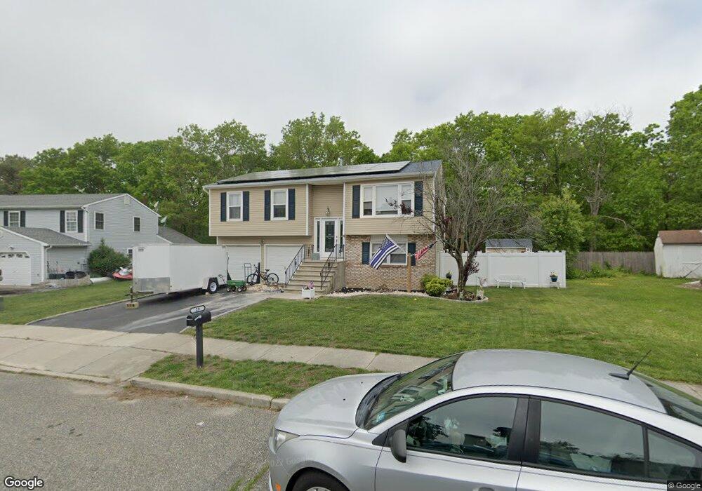
29 Deer Run Dr N Barnegat, NJ 08005
Barnegat Township NeighborhoodEstimated Value: $452,785 - $500,000
4
Beds
2
Baths
1,640
Sq Ft
$297/Sq Ft
Est. Value
About This Home
This home is located at 29 Deer Run Dr N, Barnegat, NJ 08005 and is currently estimated at $486,446, approximately $296 per square foot. 29 Deer Run Dr N is a home located in Ocean County with nearby schools including Barnegat High School.
Ownership History
Date
Name
Owned For
Owner Type
Purchase Details
Closed on
May 20, 2009
Sold by
Twaddle Thomas
Bought by
Wallin Carl and Wallin Bridget
Current Estimated Value
Home Financials for this Owner
Home Financials are based on the most recent Mortgage that was taken out on this home.
Original Mortgage
$208,080
Outstanding Balance
$131,328
Interest Rate
4.83%
Mortgage Type
Purchase Money Mortgage
Estimated Equity
$355,118
Purchase Details
Closed on
Mar 8, 2002
Sold by
Floyd Willie
Bought by
Twaddle Thomas
Home Financials for this Owner
Home Financials are based on the most recent Mortgage that was taken out on this home.
Original Mortgage
$40,000
Interest Rate
7.04%
Purchase Details
Closed on
Mar 4, 1999
Sold by
Lynch Daniel and Lynch Elizabeth
Bought by
Floyd Willie M and Floyd Yvonne E
Home Financials for this Owner
Home Financials are based on the most recent Mortgage that was taken out on this home.
Original Mortgage
$121,600
Interest Rate
6.76%
Create a Home Valuation Report for This Property
The Home Valuation Report is an in-depth analysis detailing your home's value as well as a comparison with similar homes in the area
Home Values in the Area
Average Home Value in this Area
Purchase History
| Date | Buyer | Sale Price | Title Company |
|---|---|---|---|
| Wallin Carl | $260,100 | Multiple | |
| Twaddle Thomas | $165,000 | -- | |
| Floyd Willie M | $128,000 | New Jersey Title Insurance C |
Source: Public Records
Mortgage History
| Date | Status | Borrower | Loan Amount |
|---|---|---|---|
| Open | Wallin Carl | $208,080 | |
| Previous Owner | Twaddle Thomas | $40,000 | |
| Previous Owner | Floyd Willie M | $121,600 |
Source: Public Records
Tax History Compared to Growth
Tax History
| Year | Tax Paid | Tax Assessment Tax Assessment Total Assessment is a certain percentage of the fair market value that is determined by local assessors to be the total taxable value of land and additions on the property. | Land | Improvement |
|---|---|---|---|---|
| 2025 | $7,026 | $236,000 | $85,300 | $150,700 |
| 2024 | $6,870 | $236,000 | $85,300 | $150,700 |
| 2023 | $6,648 | $236,000 | $85,300 | $150,700 |
| 2022 | $6,648 | $236,000 | $85,300 | $150,700 |
| 2021 | $6,617 | $236,000 | $85,300 | $150,700 |
| 2020 | $6,587 | $236,000 | $85,300 | $150,700 |
| 2019 | $6,490 | $236,000 | $85,300 | $150,700 |
| 2018 | $6,440 | $236,000 | $85,300 | $150,700 |
| 2017 | $6,248 | $232,800 | $85,300 | $147,500 |
| 2016 | $6,120 | $232,800 | $85,300 | $147,500 |
| 2015 | $5,927 | $232,800 | $85,300 | $147,500 |
| 2014 | $5,776 | $232,800 | $85,300 | $147,500 |
Source: Public Records
Map
Nearby Homes
- 31 Deer Run Dr N
- 27 Deer Run Dr N
- 25 Deer Run Dr N
- 32 Deer Run Dr N
- 1 Birch Ct
- 28 Deer Run Dr N
- 34 Deer Run Dr N
- 3 Birch Ct
- 23 Deer Run Dr N
- 26 Deer Run Dr N
- 5 Driftwood Ct
- 3 Driftwood Ct
- 36 Deer Run Dr N
- 5 Birch Ct
- 21 Deer Run Dr N
- 35 Deer Run Dr N
- 4 Birch Ct
- 38 Deer Run Dr N
- 7 Driftwood Ct
- 19 Deer Run Dr N