29 Delafield Island Rd Darien, CT 06820
Estimated Value: $3,333,000 - $3,903,000
5
Beds
7
Baths
5,652
Sq Ft
$638/Sq Ft
Est. Value
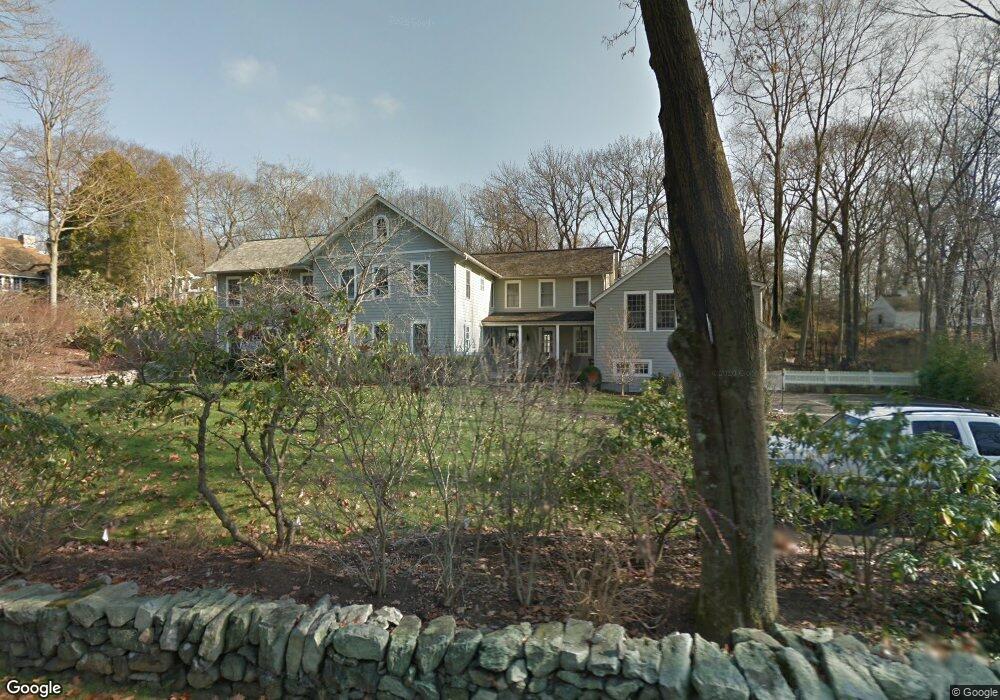
About This Home
This home is located at 29 Delafield Island Rd, Darien, CT 06820 and is currently estimated at $3,603,398, approximately $637 per square foot. 29 Delafield Island Rd is a home located in Fairfield County with nearby schools including Tokeneke Elementary School, Middlesex Middle School, and Darien High School.
Ownership History
Date
Name
Owned For
Owner Type
Purchase Details
Closed on
May 9, 2007
Sold by
Kane James B and Kane Katherine G
Bought by
Logan William Paine and Logan Laura B
Current Estimated Value
Purchase Details
Closed on
Jun 26, 1998
Sold by
Johnson Kenneth M and Howland Andrea L
Bought by
Kane James B and Kane Katherine G
Purchase Details
Closed on
Jun 17, 1997
Sold by
Hooper J Bryan and Hooper Carol M
Bought by
Johnson Kenneth M and Howland Audrea L
Create a Home Valuation Report for This Property
The Home Valuation Report is an in-depth analysis detailing your home's value as well as a comparison with similar homes in the area
Home Values in the Area
Average Home Value in this Area
Purchase History
| Date | Buyer | Sale Price | Title Company |
|---|---|---|---|
| Logan William Paine | $2,810,000 | -- | |
| Kane James B | $749,000 | -- | |
| Johnson Kenneth M | $658,000 | -- |
Source: Public Records
Mortgage History
| Date | Status | Borrower | Loan Amount |
|---|---|---|---|
| Open | Johnson Kenneth M | $708,750 | |
| Closed | Johnson Kenneth M | $1,000,000 |
Source: Public Records
Tax History Compared to Growth
Tax History
| Year | Tax Paid | Tax Assessment Tax Assessment Total Assessment is a certain percentage of the fair market value that is determined by local assessors to be the total taxable value of land and additions on the property. | Land | Improvement |
|---|---|---|---|---|
| 2025 | $28,366 | $1,832,460 | $563,290 | $1,269,170 |
| 2024 | $26,919 | $1,832,460 | $563,290 | $1,269,170 |
| 2023 | $26,542 | $1,507,240 | $469,420 | $1,037,820 |
| 2022 | $25,970 | $1,507,240 | $469,420 | $1,037,820 |
| 2021 | $3,172 | $1,507,240 | $469,420 | $1,037,820 |
| 2020 | $24,658 | $1,507,240 | $469,420 | $1,037,820 |
| 2019 | $24,824 | $1,507,240 | $469,420 | $1,037,820 |
| 2018 | $25,499 | $1,585,780 | $543,200 | $1,042,580 |
| 2017 | $25,626 | $1,585,780 | $543,200 | $1,042,580 |
| 2016 | $25,008 | $1,585,780 | $543,200 | $1,042,580 |
| 2015 | $24,342 | $1,585,780 | $543,200 | $1,042,580 |
| 2014 | $23,803 | $1,585,780 | $543,200 | $1,042,580 |
Source: Public Records
Map
Nearby Homes
- 20 Locust Hill Rd
- 17 Brushy Hill Rd
- 51 Hale Ln Unit 51
- 8 Sedgewick Village Ln
- 18 Tokeneke Trail
- 17 Pine Brook Ln Unit 17
- 45 Hecker Ave
- 10 Stony Brook Rd
- 10 Prospect Ave
- 128 West Ave
- 19 Littlebrook Rd
- 130 West Ave
- 5 Wakeman Rd
- 209 Rowayton Ave
- 53 Noroton Ave
- 166 Rowayton Ave Unit 2
- 6 Priscilla Ln
- 311 Noroton Ave
- 40 Arnold Ln
- 13 Farm Creek Rd
- 25 Delafield Island Rd
- 39 Cedar Gate Rd
- 34 Delafield Island Rd
- 35 Cedar Gate Rd
- 31 Cedar Gate Rd
- 32 Delafield Island Rd
- 43 Cedar Gate Rd
- 38 Delafield Island Rd
- 41 Delafield Island Rd
- 45 Cedar Gate Rd
- 3 Wild Rose Ln
- 3 Wild Rose Ln
- 3 Wild Rose Ln Unit COTTAGE
- 23 Cedar Gate Rd
- 4 Wild Rose Ln
- 44 Andrews Dr
- 34 Andrews Dr
- 47 Cedar Gate Rd
- 17 Delafield Island Rd
- 11 Clocks Ln