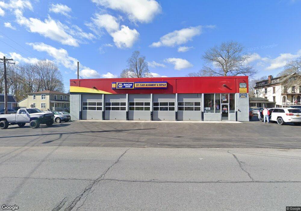
29 E Main Port Jervis, Ny, PA 12771
Estimated Value: $476,257
--
Bed
--
Bath
3,686
Sq Ft
$129/Sq Ft
Est. Value
About This Home
This home is located at 29 E Main, Port Jervis, Ny, PA 12771 and is currently estimated at $476,257, approximately $129 per square foot. 29 E Main is a home located in Orange County with nearby schools including Port Jervis High School and New Life Christian Day School.
Ownership History
Date
Name
Owned For
Owner Type
Purchase Details
Closed on
Nov 10, 2021
Sold by
Jeda South Lp
Bought by
Gen Enterprises Inc
Current Estimated Value
Home Financials for this Owner
Home Financials are based on the most recent Mortgage that was taken out on this home.
Original Mortgage
$255,000
Interest Rate
2.98%
Mortgage Type
Commercial
Purchase Details
Closed on
Jan 4, 2010
Sold by
Lichterman Carole
Bought by
Jeda South Limited Partnership
Create a Home Valuation Report for This Property
The Home Valuation Report is an in-depth analysis detailing your home's value as well as a comparison with similar homes in the area
Home Values in the Area
Average Home Value in this Area
Purchase History
| Date | Buyer | Sale Price | Title Company |
|---|---|---|---|
| Gen Enterprises Inc | $340,000 | None Available | |
| Gen Enterprises Inc | $340,000 | None Available | |
| Gen Enterprises Inc | $340,000 | None Available | |
| Jeda South Limited Partnership | -- | Stuart Gladstone | |
| Lichterman Carole | -- | Stuart Gladstone | |
| Lichterman David | -- | Stuart Gladstone | |
| Lichterman Carole | -- | Stuart Gladstone |
Source: Public Records
Mortgage History
| Date | Status | Borrower | Loan Amount |
|---|---|---|---|
| Previous Owner | Gen Enterprises Inc | $255,000 |
Source: Public Records
Tax History Compared to Growth
Tax History
| Year | Tax Paid | Tax Assessment Tax Assessment Total Assessment is a certain percentage of the fair market value that is determined by local assessors to be the total taxable value of land and additions on the property. | Land | Improvement |
|---|---|---|---|---|
| 2024 | $9,157 | $127,550 | $21,875 | $105,675 |
| 2023 | $9,157 | $127,550 | $21,875 | $105,675 |
| 2022 | $9,260 | $127,550 | $21,875 | $105,675 |
| 2021 | $10,129 | $127,550 | $21,875 | $105,675 |
| 2020 | $10,387 | $127,550 | $21,875 | $105,675 |
| 2019 | $15,339 | $127,550 | $21,875 | $105,675 |
| 2018 | $15,339 | $127,550 | $21,875 | $105,675 |
| 2017 | $10,034 | $127,550 | $21,875 | $105,675 |
| 2016 | $14,952 | $127,550 | $21,875 | $105,675 |
| 2015 | -- | $127,550 | $21,875 | $105,675 |
| 2014 | -- | $127,550 | $21,875 | $105,675 |
Source: Public Records
Map
Nearby Homes
- 25 E Broome St
- 4 Elizabeth St
- 4 Catherine St
- 105 Fowler St
- 701 United States Route 209
- 14 Kingston Ave
- 3 Delaware St
- 14 Division St
- 20 Kingston Ave
- 17 Brooklyn St
- 21 Delaware St
- 25 Pine St
- 14 Washington Ave
- 24 Washington Ave
- 39 Church St Unit 3
- 39 Church St Unit 22
- 39 Church St Unit 53
- 39 Church St Unit 4
- 51 W Main St
- 25 Bruce St