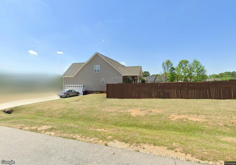
29 Eddlestone Ct Clayton, NC 27520
Estimated Value: $453,000 - $479,000
3
Beds
3
Baths
3,179
Sq Ft
$147/Sq Ft
Est. Value
About This Home
This home is located at 29 Eddlestone Ct, Clayton, NC 27520 and is currently estimated at $466,472, approximately $146 per square foot. 29 Eddlestone Ct is a home located in Johnston County with nearby schools including Powhatan Elementary School, Riverwood Middle School, and Clayton High.
Ownership History
Date
Name
Owned For
Owner Type
Purchase Details
Closed on
Jul 25, 2017
Sold by
Windle Kathy and Windle Thomas
Bought by
Sanders Victoria and Sanders Courtney
Current Estimated Value
Home Financials for this Owner
Home Financials are based on the most recent Mortgage that was taken out on this home.
Original Mortgage
$218,762
Outstanding Balance
$183,525
Interest Rate
4.25%
Mortgage Type
FHA
Estimated Equity
$282,947
Purchase Details
Closed on
Nov 27, 2007
Sold by
Build Rite Inc
Bought by
Windle Kathy and Windle Stewart
Home Financials for this Owner
Home Financials are based on the most recent Mortgage that was taken out on this home.
Original Mortgage
$205,943
Interest Rate
6.22%
Mortgage Type
FHA
Purchase Details
Closed on
Aug 22, 2007
Sold by
Jt Holdings Inc
Bought by
Build Rite Inc
Create a Home Valuation Report for This Property
The Home Valuation Report is an in-depth analysis detailing your home's value as well as a comparison with similar homes in the area
Home Values in the Area
Average Home Value in this Area
Purchase History
| Date | Buyer | Sale Price | Title Company |
|---|---|---|---|
| Sanders Victoria | $240,000 | None Available | |
| Windle Kathy | $210,000 | None Available | |
| Build Rite Inc | -- | Investors Title Insurance Co |
Source: Public Records
Mortgage History
| Date | Status | Borrower | Loan Amount |
|---|---|---|---|
| Open | Sanders Victoria | $218,762 | |
| Previous Owner | Windle Kathy | $205,943 |
Source: Public Records
Tax History Compared to Growth
Tax History
| Year | Tax Paid | Tax Assessment Tax Assessment Total Assessment is a certain percentage of the fair market value that is determined by local assessors to be the total taxable value of land and additions on the property. | Land | Improvement |
|---|---|---|---|---|
| 2025 | $2,855 | $449,600 | $85,000 | $364,600 |
| 2024 | $2,092 | $258,240 | $33,000 | $225,240 |
| 2023 | $1,988 | $258,240 | $33,000 | $225,240 |
| 2022 | $2,040 | $258,240 | $33,000 | $225,240 |
| 2021 | $2,040 | $258,240 | $33,000 | $225,240 |
| 2020 | $2,118 | $258,240 | $33,000 | $225,240 |
| 2019 | $2,118 | $258,240 | $33,000 | $225,240 |
| 2018 | $2,047 | $243,670 | $39,000 | $204,670 |
| 2017 | $2,047 | $243,670 | $39,000 | $204,670 |
| 2016 | $2,047 | $243,670 | $39,000 | $204,670 |
| 2015 | $2,047 | $243,670 | $39,000 | $204,670 |
| 2014 | $2,047 | $243,670 | $39,000 | $204,670 |
Source: Public Records
Map
Nearby Homes
- 0000 U S 70 Highway Business W
- 3226 Powhatan Rd
- 111 Innsbruck Dr
- 108 Wilson Farm Ln
- 0 Powhatan Rd Unit 10126540
- 3460 Powhatan Rd
- 153 N Chubb Ridge
- 151 N Chubb Ridge
- 149 N Chubb Ridge
- 147 N Chubb Ridge
- 145 N Chubb Ridge
- 143 N Chubb Ridge
- Firefly Plan at Wilson's Walk - Single Family Homes
- Spectra Plan at Wilson's Walk - Single Family Homes
- Voyager Plan at Wilson's Walk - Single Family Homes
- Pulsar Plan at Wilson's Walk - Townhomes
- Larissa Plan at Wilson's Walk - Single Family Homes
- Beacon Plan at Wilson's Walk - Single Family Homes
- Supernova Plan at Wilson's Walk - Single Family Homes
- 130 N Chubb Ridge
- 127 Bilston Dr
- 61 Eddlestone Ct
- 132 Bilston Dr Unit LOT19
- 138 Bilston Dr
- 138 Bilston Dr Unit 27
- 197 Bilston Dr
- 89 Bilston Dr
- 44 Eddlestone Ct
- 44 Eddlestone Ct Unit 22
- 81 Eddlestone Ct
- 81 Eddlestone Ct Unit 12
- 81 Eddleston Ct
- 118 Bilston Dr
- 160 Bilston Dr
- 66 Eddlestone Ct
- 184 Bilston Dr
- 98 Bilston Dr
- 59 Bilston Dr
- 59 Bilston Dr
- 99 Eddlestone Ct