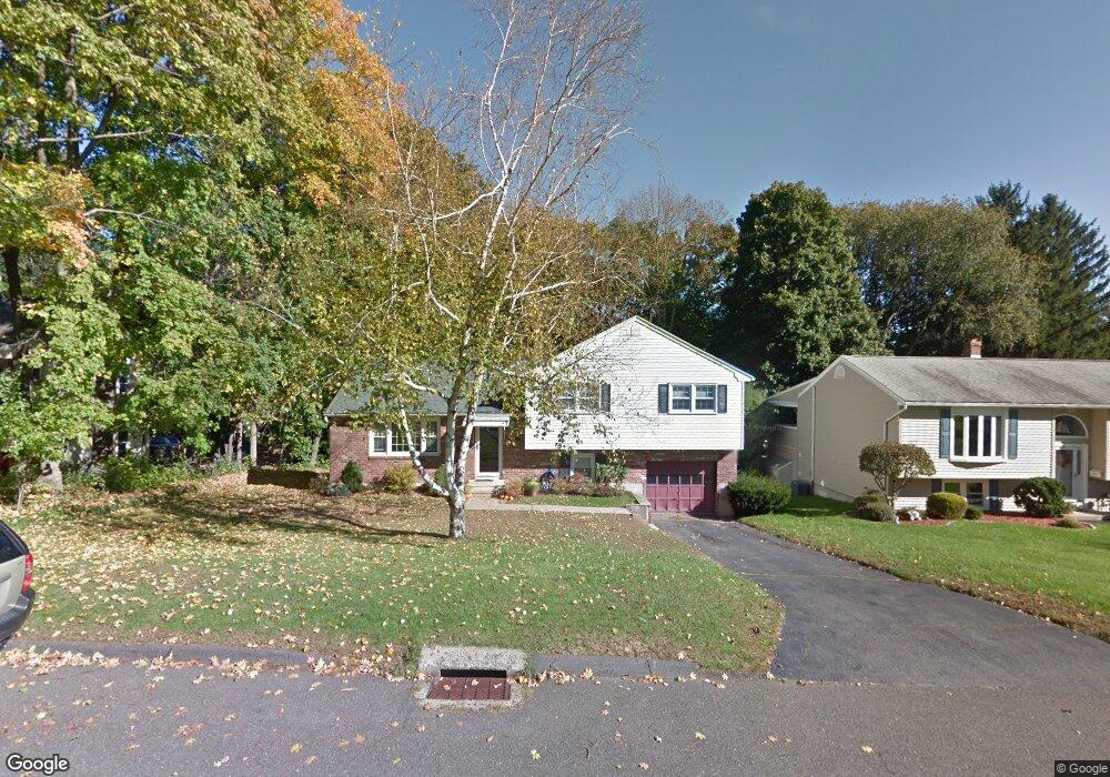
29 Elm St Plantsville, CT 06479
Estimated Value: $393,000 - $423,000
3
Beds
3
Baths
1,252
Sq Ft
$323/Sq Ft
Est. Value
About This Home
This home is located at 29 Elm St, Plantsville, CT 06479 and is currently estimated at $404,785, approximately $323 per square foot. 29 Elm St is a home located in Hartford County with nearby schools including John F. Kennedy Middle School, Southington High School, and Southington Catholic School.
Ownership History
Date
Name
Owned For
Owner Type
Purchase Details
Closed on
Nov 21, 2001
Sold by
Bednarz Bruce W and Bednarz Amy L
Bought by
Ryan Andy A and Ryan Lesley P
Current Estimated Value
Purchase Details
Closed on
Jun 30, 1999
Sold by
Roy Diane M
Bought by
Bednarz Bruce W and Bednarz Amy L
Purchase Details
Closed on
Jan 29, 1991
Sold by
Tucholski Lynne
Bought by
Roy David and Roy Diane
Create a Home Valuation Report for This Property
The Home Valuation Report is an in-depth analysis detailing your home's value as well as a comparison with similar homes in the area
Home Values in the Area
Average Home Value in this Area
Purchase History
| Date | Buyer | Sale Price | Title Company |
|---|---|---|---|
| Ryan Andy A | $164,000 | -- | |
| Bednarz Bruce W | $142,000 | -- | |
| Roy David | $145,000 | -- |
Source: Public Records
Mortgage History
| Date | Status | Borrower | Loan Amount |
|---|---|---|---|
| Open | Roy David | $204,000 | |
| Closed | Roy David | $60,000 | |
| Closed | Roy David | $152,000 |
Source: Public Records
Tax History Compared to Growth
Tax History
| Year | Tax Paid | Tax Assessment Tax Assessment Total Assessment is a certain percentage of the fair market value that is determined by local assessors to be the total taxable value of land and additions on the property. | Land | Improvement |
|---|---|---|---|---|
| 2025 | $5,887 | $177,260 | $55,210 | $122,050 |
| 2024 | $5,573 | $177,260 | $55,210 | $122,050 |
| 2023 | $5,382 | $177,260 | $55,210 | $122,050 |
| 2022 | $5,164 | $177,260 | $55,210 | $122,050 |
| 2021 | $5,146 | $177,260 | $55,210 | $122,050 |
| 2020 | $4,844 | $158,140 | $56,340 | $101,800 |
| 2019 | $4,845 | $158,140 | $56,340 | $101,800 |
| 2018 | $4,820 | $158,140 | $56,340 | $101,800 |
| 2017 | $4,820 | $158,140 | $56,340 | $101,800 |
| 2016 | $4,687 | $158,140 | $56,340 | $101,800 |
| 2015 | $4,352 | $149,340 | $53,660 | $95,680 |
| 2014 | $4,235 | $149,340 | $53,660 | $95,680 |
Source: Public Records
Map
Nearby Homes
- 36 Buckland St Unit 22
- 152 Old Turnpike Rd
- 34 Ford St
- 20 Wolf Hill Rd
- 209 W Center St
- 65 Bristol St
- 93 Bishop Ave
- 578 Old Turnpike Rd
- 59 Water St
- 500 Mill St Unit 3
- 145 Meriden Ave
- 349 Marion Ave Unit 6
- 349 Marion Ave Unit 12
- 349 Marion Ave Unit 14
- 349 Marion Ave Unit 27
- 349 Marion Ave Unit 25
- 349 Marion Ave Unit 22
- 349 Marion Ave Unit 15
- 349 Marion Ave Unit 9
- 349 Marion Ave Unit 26