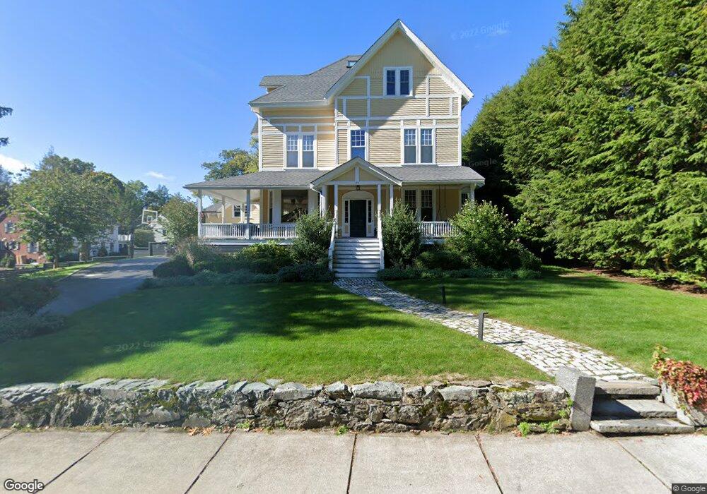
29 Forest Ave Auburndale, MA 02466
West Newton NeighborhoodEstimated Value: $3,527,000 - $7,001,000
About This Home
This home is located at 29 Forest Ave, Auburndale, MA 02466 and is currently estimated at $5,197,800, approximately $824 per square foot. 29 Forest Ave is a home located in Middlesex County with nearby schools including Peirce Elementary School, F.A. Day Middle School, and Newton North High School.
Ownership History
We collect this data history from publicly available records. To have your information removed, we recommend requesting removal directly through your county’s website.
Purchase Details
Home Financials for this Owner
Home Financials are based on the most recent Mortgage that was taken out on this home.Home Values in the Area
Average Home Value in this Area
Purchase History
We collect this data history from publicly available records. To have your information removed, we recommend requesting removal directly through your county’s website.
| Date | Buyer | Sale Price | Title Company |
|---|---|---|---|
| $2,275,000 | -- |
Mortgage History
We collect this data history from publicly available records. To have your information removed, we recommend requesting removal directly through your county’s website.
| Date | Status | Borrower | Loan Amount |
|---|---|---|---|
| Open | $750,000 |
Tax History
We collect this data history from publicly available records. To have your information removed, we recommend requesting removal directly through your county’s website.
| Year | Tax Paid | Tax Assessment Tax Assessment Total Assessment is a certain percentage of the fair market value that is determined by local assessors to be the total taxable value of land and additions on the property. | Land | Improvement |
|---|---|---|---|---|
| 2025 | $52,622 | $5,369,600 | $1,801,700 | $3,567,900 |
| 2024 | $50,881 | $5,213,200 | $1,749,200 | $3,464,000 |
| 2023 | $49,727 | $4,884,800 | $1,390,800 | $3,494,000 |
| 2022 | $47,582 | $4,523,000 | $1,287,800 | $3,235,200 |
| 2021 | $45,913 | $4,267,000 | $1,214,900 | $3,052,100 |
| 2020 | $44,547 | $4,267,000 | $1,214,900 | $3,052,100 |
| 2019 | $43,291 | $4,142,700 | $1,179,500 | $2,963,200 |
| 2018 | $38,133 | $3,524,300 | $1,052,900 | $2,471,400 |
| 2017 | $33,634 | $3,024,600 | $993,300 | $2,031,300 |
| 2016 | $32,168 | $2,826,700 | $928,300 | $1,898,400 |
| 2015 | $30,671 | $2,641,800 | $867,600 | $1,774,200 |
Map
- 189 Mount Vernon St
- 40 Greenwood Ave
- 125 Mount Vernon St Unit 2
- 123 Mount Vernon St Unit 125
- 123 Mount Vernon St Unit 1
- 22 Regent St
- 1045 Washington St Unit 2
- 10 Burnham Rd
- 70 Walker St Unit 1
- 462 Waltham St
- 68 Brooks Ave
- 66 Randlett Park
- 90 Hull St
- 710 Watertown St Unit 712
- 712 Watertown St
- 444 Lowell Ave
- 444 Lowell Ave Unit 444
- 911 Washington St Lowell Ave
- 442 Lowell Ave Unit 444
- 14 Winthrop St
- 23 Forest Ave
- 23 Forest Ave
- 29 Forest Ave
- 11 Forest Ave
- 11 Forest Ave
- 283 Highland Ave
- 245 Highland Ave
- 14 Forest Ave
- 230 Mount Vernon St
- 266 Highland Ave
- 6 Forest Ave
- 289 Highland Ave
- 6 Forest Ave
- 280 Highland Ave
- 233 Highland Ave
- 254 Highland Ave
- 188 Mount Vernon St Unit 188
- 188 Mount Vernon St
- 240 Mount Vernon St
- 240 Mount Venon St
Ask me questions while you tour the home.