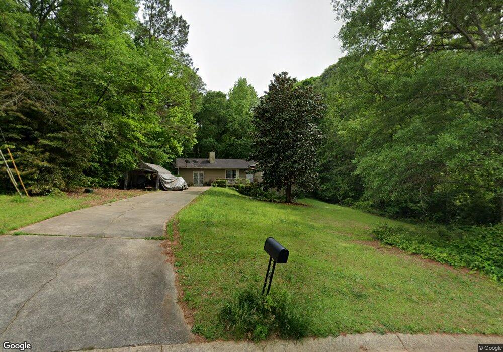
29 Forest Ln Whitesburg, GA 30185
Estimated Value: $215,000 - $276,000
4
Beds
2
Baths
1,698
Sq Ft
$144/Sq Ft
Est. Value
About This Home
This home is located at 29 Forest Ln, Whitesburg, GA 30185 and is currently estimated at $244,851, approximately $144 per square foot. 29 Forest Ln is a home located in Carroll County with nearby schools including Whitesburg Elementary School, Central Middle School, and Central High School.
Ownership History
Date
Name
Owned For
Owner Type
Purchase Details
Closed on
Jun 18, 2019
Sold by
Alley Elizabeth J
Bought by
Alley John D and Alley Merlie
Current Estimated Value
Purchase Details
Closed on
Oct 12, 2006
Sold by
Wells Fargo Bank
Bought by
Alley Elizabeth J
Home Financials for this Owner
Home Financials are based on the most recent Mortgage that was taken out on this home.
Original Mortgage
$70,800
Interest Rate
6.39%
Mortgage Type
New Conventional
Purchase Details
Closed on
Apr 4, 2006
Sold by
Nelson Ricky D
Bought by
Wells Fargo Bank
Purchase Details
Closed on
Oct 12, 1992
Sold by
Fleet Finance
Bought by
Nelson Ricky
Purchase Details
Closed on
May 13, 1992
Sold by
Richards
Bought by
Fleet Finance
Purchase Details
Closed on
Jun 23, 1990
Bought by
Richards
Create a Home Valuation Report for This Property
The Home Valuation Report is an in-depth analysis detailing your home's value as well as a comparison with similar homes in the area
Home Values in the Area
Average Home Value in this Area
Purchase History
| Date | Buyer | Sale Price | Title Company |
|---|---|---|---|
| Alley John D | -- | -- | |
| Alley Elizabeth J | $88,500 | -- | |
| Wells Fargo Bank | $105,951 | -- | |
| Nelson Ricky | $69,900 | -- | |
| Fleet Finance | $75,300 | -- | |
| Richards | $74,900 | -- |
Source: Public Records
Mortgage History
| Date | Status | Borrower | Loan Amount |
|---|---|---|---|
| Previous Owner | Alley Elizabeth J | $70,800 |
Source: Public Records
Tax History Compared to Growth
Tax History
| Year | Tax Paid | Tax Assessment Tax Assessment Total Assessment is a certain percentage of the fair market value that is determined by local assessors to be the total taxable value of land and additions on the property. | Land | Improvement |
|---|---|---|---|---|
| 2024 | $1,862 | $82,330 | $4,000 | $78,330 |
| 2023 | $1,862 | $75,461 | $4,000 | $71,461 |
| 2022 | $1,538 | $61,324 | $4,000 | $57,324 |
| 2021 | $1,361 | $53,090 | $4,000 | $49,090 |
| 2020 | $1,243 | $48,443 | $4,000 | $44,443 |
| 2019 | $165 | $44,811 | $4,000 | $40,811 |
| 2018 | $173 | $39,790 | $4,000 | $35,790 |
| 2017 | $175 | $39,790 | $4,000 | $35,790 |
| 2016 | $175 | $39,790 | $4,000 | $35,790 |
| 2015 | $176 | $28,956 | $4,000 | $24,956 |
| 2014 | $178 | $28,956 | $4,000 | $24,956 |
Source: Public Records
Map
Nearby Homes
- 15 Bailey St
- 0 Georgia 16
- 226 Long Island Dr
- 40 Coral Dr
- 61 Coral Dr
- 42 Church Ln
- 2241 Georgia 16
- 0 TRACT 2 Little New York Rd
- 840 Old Driver Rd
- 2184 Jones Mill Rd
- 439 Old Jones Rd
- 688 Main St
- 419 Tommy Thompson Way
- 255 Sally Duke Dr
- 369 Old Driver Rd
- 409 Old Driver Rd
- 501 Hollis Thompson Dr
- 570 Old Driver Rd
- 252 Moore St
- 207 Sally Duke Dr
- 0 Forest Ln Unit 7476866
- 37 Forest Ln
- 15 Forest Ln
- 34 Forest Ln
- 12 Forest Ln
- 20 Antioch Church Rd
- 45 Hanson Trail
- 49 Forest Ln
- 69 Forest Ln
- 68 Forest Ln
- 1763 N Highway 16
- 54 Hanson Trail
- 78 Hanson Trail
- 78 Hanson Trail Unit 2
- 95 Hanson Trail
- 90 Antioch Church Rd
- 98 Hanson Trail
- 83 Forest Ln
- 115 Hanson Trail
- 1683 N Highway 16