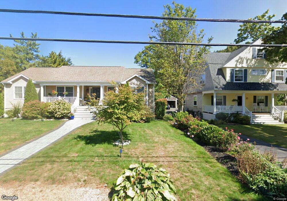
29 Gannett Rd Scituate, MA 02066
Estimated Value: $842,000 - $977,000
2
Beds
3
Baths
2,170
Sq Ft
$414/Sq Ft
Est. Value
About This Home
This home is located at 29 Gannett Rd, Scituate, MA 02066 and is currently estimated at $898,921, approximately $414 per square foot. 29 Gannett Rd is a home located in Plymouth County with nearby schools including Wampatuck Elementary School, Lester J. Gates Middle School, and Scituate High School.
Ownership History
Date
Name
Owned For
Owner Type
Purchase Details
Closed on
Jun 7, 2019
Sold by
Curtis David J Est and Mccarthy
Bought by
Mccarthy Lauren A
Current Estimated Value
Purchase Details
Closed on
Jan 20, 2017
Sold by
Hartigan Karen
Bought by
Curtis David J and Curtis Margaret M
Create a Home Valuation Report for This Property
The Home Valuation Report is an in-depth analysis detailing your home's value as well as a comparison with similar homes in the area
Home Values in the Area
Average Home Value in this Area
Purchase History
| Date | Buyer | Sale Price | Title Company |
|---|---|---|---|
| Mccarthy Lauren A | $570,000 | -- | |
| Mccarthy Lauren A | $570,000 | -- | |
| Curtis David J | -- | -- | |
| Curtis David J | -- | -- | |
| Curtis David J | -- | -- | |
| Curtis David J | -- | -- | |
| Curtis David J | -- | -- | |
| Curtis David J | -- | -- | |
| Curtis David J | -- | -- | |
| Curtis David J | -- | -- | |
| Curtis David J | -- | -- | |
| Curtis David J | -- | -- | |
| Curtis David J | -- | -- | |
| Curtis David J | -- | -- | |
| Curtis David J | -- | -- | |
| Curtis David J | -- | -- | |
| Curtis David J | -- | -- | |
| Curtis David J | -- | -- |
Source: Public Records
Tax History Compared to Growth
Tax History
| Year | Tax Paid | Tax Assessment Tax Assessment Total Assessment is a certain percentage of the fair market value that is determined by local assessors to be the total taxable value of land and additions on the property. | Land | Improvement |
|---|---|---|---|---|
| 2025 | $7,932 | $794,000 | $0 | $794,000 |
| 2024 | $7,767 | $749,700 | $0 | $749,700 |
| 2023 | $7,860 | $708,000 | $0 | $708,000 |
| 2022 | $7,860 | $622,800 | $0 | $622,800 |
| 2021 | $7,823 | $586,900 | $0 | $586,900 |
| 2020 | $7,637 | $565,700 | $0 | $565,700 |
| 2019 | $7,479 | $544,300 | $0 | $544,300 |
| 2018 | $7,250 | $519,700 | $0 | $519,700 |
| 2017 | $7,323 | $519,700 | $0 | $519,700 |
| 2016 | $6,964 | $492,500 | $0 | $492,500 |
| 2015 | $6,271 | $478,700 | $0 | $478,700 |
Source: Public Records
Map
Nearby Homes
- 29 Country Club Cir
- 27 Cherry Ln
- 10 Baileys Causeway
- 85 Glades Rd
- 7 Border St
- 6 Tilden Ave
- 151 Glades Rd
- 24 Wood Island Rd
- 16 3 Ring Rd
- 112 Hollett St
- 26 Mordecai Lincoln Rd
- 378 Tilden Rd
- 59 Captain Peirce Rd
- 70 Black Horse Ln
- 2 Windward Ln
- 17 Bradford Ave
- 68 Black Horse Ln
- 817 Country Way
- 100 Howard Gleason Rd
- 392 S Main St
- 31 Gannett Rd
- 29 Gannett Rd Unit 1
- 18 A Mitchell Ave
- 9 Pondview Ave
- 11 Pondview Ave
- 11 Pondview Ave Unit 11
- 18 Mitchell Ave
- 22 Mitchell Ave
- 16 Mitchell Ave
- 5 Pondview Ave
- 25 Gannett Rd
- 17 Pondview Ave
- 21 Gannett Rd
- 12 Mitchell Ave
- 35 Gannett Rd
- 18A Mitchell Ave
- 10 Pondview Ave
- 12 Pondview Ave
- 12 Pondview Ave Unit EXT
- 12 Mitchell Ln