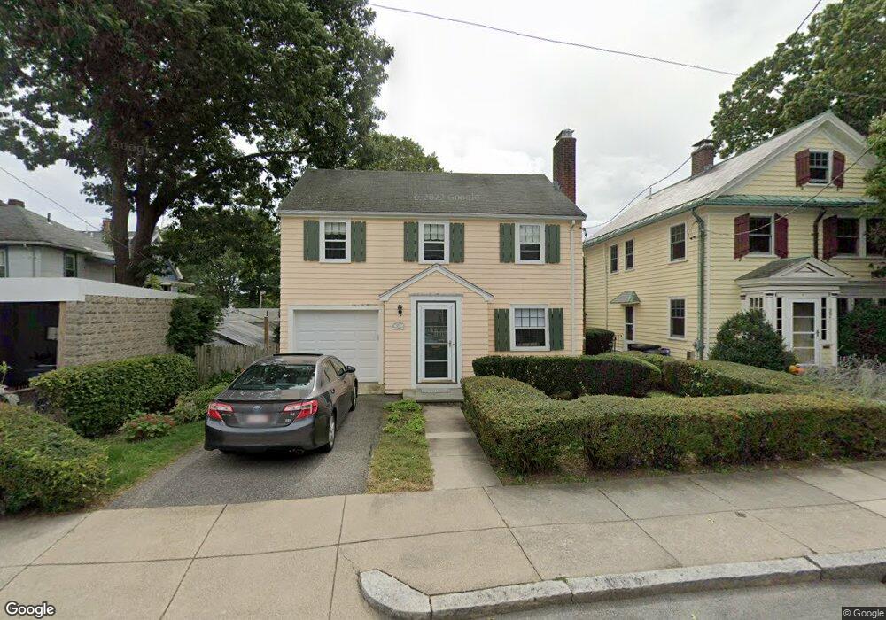
29 Goodway Rd Jamaica Plain, MA 02130
Jamaica Plain NeighborhoodEstimated Value: $656,000 - $1,107,000
3
Beds
2
Baths
1,200
Sq Ft
$692/Sq Ft
Est. Value
About This Home
This home is located at 29 Goodway Rd, Jamaica Plain, MA 02130 and is currently estimated at $830,330, approximately $691 per square foot. 29 Goodway Rd is a home located in Suffolk County with nearby schools including Brooke Charter School Roslindale, The Croft School - Jamaica Plain, and St. Clare High School.
Ownership History
Date
Name
Owned For
Owner Type
Purchase Details
Closed on
Feb 13, 2017
Sold by
Brandlen Julie A
Bought by
Julie A Brandlen Lt
Current Estimated Value
Purchase Details
Closed on
Apr 30, 1992
Sold by
Odonnell Bridget Est
Bought by
Brandlen Julie A
Create a Home Valuation Report for This Property
The Home Valuation Report is an in-depth analysis detailing your home's value as well as a comparison with similar homes in the area
Home Values in the Area
Average Home Value in this Area
Purchase History
| Date | Buyer | Sale Price | Title Company |
|---|---|---|---|
| Julie A Brandlen Lt | -- | -- | |
| Brandlen Julie A | $142,000 | -- |
Source: Public Records
Mortgage History
| Date | Status | Borrower | Loan Amount |
|---|---|---|---|
| Previous Owner | Brandlen Julie A | $60,000 | |
| Previous Owner | Brandlen Julie A | $141,000 | |
| Previous Owner | Brandlen Julie A | $102,000 |
Source: Public Records
Tax History Compared to Growth
Tax History
| Year | Tax Paid | Tax Assessment Tax Assessment Total Assessment is a certain percentage of the fair market value that is determined by local assessors to be the total taxable value of land and additions on the property. | Land | Improvement |
|---|---|---|---|---|
| 2025 | $7,366 | $636,100 | $215,100 | $421,000 |
| 2024 | $6,984 | $640,700 | $200,500 | $440,200 |
| 2023 | $6,428 | $598,500 | $187,300 | $411,200 |
| 2022 | $5,973 | $549,000 | $171,800 | $377,200 |
| 2021 | $5,687 | $533,000 | $166,800 | $366,200 |
| 2020 | $4,903 | $464,300 | $164,500 | $299,800 |
| 2019 | $4,662 | $442,300 | $134,500 | $307,800 |
| 2018 | $4,138 | $394,800 | $134,500 | $260,300 |
| 2017 | $4,100 | $387,200 | $134,500 | $252,700 |
| 2016 | $4,176 | $379,600 | $134,500 | $245,100 |
| 2015 | $4,333 | $357,800 | $141,800 | $216,000 |
| 2014 | $3,941 | $313,300 | $141,800 | $171,500 |
Source: Public Records
Map
Nearby Homes
- 50 Southbourne Rd
- 18-20 Northbourne Rd Unit 18
- 348-350 Hyde Park Ave Unit 2
- 31 Rodman St Unit 2
- 31 Rodman St Unit 1
- 71 Wyvern St
- 24 Waterman Rd
- 36 Neponset Ave Unit 1
- 158 Wachusett St Unit 3
- 105 Neponset Ave Unit 105
- 103 Neponset Ave Unit 103A
- 103-105 Neponset Ave
- 140 Wachusett St
- 178 Hyde Park Ave Unit 3
- 19 Delford St
- 19 Delford St Unit 1
- 602 Canterbury St Unit 14
- 602 Canterbury St Unit 4
- 602 Canterbury St Unit 5
- 602 Canterbury St Unit 2
- 27 Goodway Rd
- 87-89 Bourne St
- 23 Goodway Rd
- 91 Bourne St Unit 93
- 91 Bourne St Unit 221
- 91 Bourne St Unit 91
- 91-93 Bourne St Unit 93
- 1B Meyer St
- 1 Meyer St
- 1A Meyer St
- 95 Bourne St Unit 97
- 95-97 Bourne St Unit 1
- 95 Bourne St Unit 1
- 7 Wallace Park
- 19 Goodway Rd
- 2 Meyer St
- 2 Meyer St Unit 1
- 38 Goodway Rd
- 30 Goodway Rd
- 34 Goodway Rd