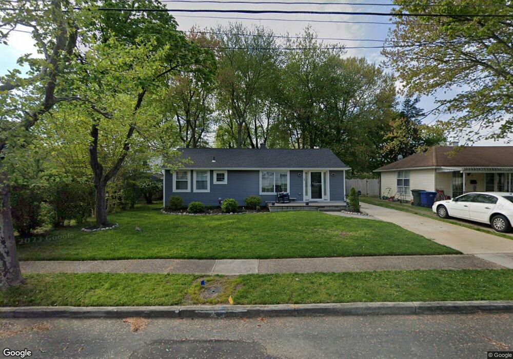
29 Hemsing Dr Lumberton, NJ 08048
Estimated Value: $286,682 - $339,000
--
Bed
--
Bath
960
Sq Ft
$327/Sq Ft
Est. Value
About This Home
This home is located at 29 Hemsing Dr, Lumberton, NJ 08048 and is currently estimated at $314,171, approximately $327 per square foot. 29 Hemsing Dr is a home located in Burlington County with nearby schools including Ashbrook Elementary School, Bobby’s Run School, and Lumberton Middle School.
Ownership History
Date
Name
Owned For
Owner Type
Purchase Details
Closed on
Jun 19, 2020
Sold by
F Pallante Llc
Bought by
Tortorello Angelo
Current Estimated Value
Home Financials for this Owner
Home Financials are based on the most recent Mortgage that was taken out on this home.
Original Mortgage
$201,286
Outstanding Balance
$178,089
Interest Rate
3.1%
Mortgage Type
FHA
Estimated Equity
$136,082
Purchase Details
Closed on
Feb 5, 2020
Sold by
Rizwan David A and Estate Of Charles D Harrison
Bought by
F Pallante Llc
Purchase Details
Closed on
Oct 30, 1986
Bought by
Harrison Charles D
Create a Home Valuation Report for This Property
The Home Valuation Report is an in-depth analysis detailing your home's value as well as a comparison with similar homes in the area
Home Values in the Area
Average Home Value in this Area
Purchase History
| Date | Buyer | Sale Price | Title Company |
|---|---|---|---|
| Tortorello Angelo | $205,000 | Sjs Title Llc | |
| F Pallante Llc | $90,000 | Surety Title Company | |
| Harrison Charles D | -- | -- |
Source: Public Records
Mortgage History
| Date | Status | Borrower | Loan Amount |
|---|---|---|---|
| Open | Tortorello Angelo | $201,286 |
Source: Public Records
Tax History Compared to Growth
Tax History
| Year | Tax Paid | Tax Assessment Tax Assessment Total Assessment is a certain percentage of the fair market value that is determined by local assessors to be the total taxable value of land and additions on the property. | Land | Improvement |
|---|---|---|---|---|
| 2025 | $4,009 | $150,600 | $55,000 | $95,600 |
| 2024 | $3,770 | $150,600 | $55,000 | $95,600 |
| 2023 | $3,770 | $150,600 | $55,000 | $95,600 |
| 2022 | $3,682 | $150,600 | $55,000 | $95,600 |
| 2021 | $3,672 | $150,600 | $55,000 | $95,600 |
| 2020 | $3,640 | $150,600 | $55,000 | $95,600 |
| 2019 | $3,599 | $150,600 | $55,000 | $95,600 |
| 2018 | $3,545 | $150,600 | $55,000 | $95,600 |
| 2017 | $3,229 | $150,600 | $55,000 | $95,600 |
| 2016 | $3,154 | $150,600 | $55,000 | $95,600 |
| 2015 | $3,128 | $150,600 | $55,000 | $95,600 |
| 2014 | $3,000 | $150,600 | $55,000 | $95,600 |
Source: Public Records
Map
Nearby Homes
- 44 Rockland Terrace
- 8 Hollybrook Ave
- 5 Beulah Ave
- 8 Easlick Ave
- 225 Ashley Ln
- 185 South Ave
- 71 Kingsbridge Dr
- 511 Hamilton Ave
- 10 Whitehaven Dr
- 5 Middleton Dr
- 18 Westminster Dr
- 15 Wellington Dr
- 48 Whitebirch Ct
- 50 Blue Spruce Ct
- 85 Madison Ave
- 15 S Hunterdon Ave
- 11 Abington Way
- 240 Pine St
- 11 S Hunterdon Ave
- 201 Lincoln Ave
- 27 Hemsing Dr
- 31 Hemsing Dr
- 25 Hemsing Dr
- 38 Rockland Terrace
- 36 Rockland Terrace
- 40 Rockland Terrace
- 34 Rockland Terrace
- 32 Rockland Terrace
- 20 Hemsing Dr
- 30 Rockland Terrace
- 42 Rockland Terrace
- 23 Hemsing Dr
- 22 Hemsing Dr
- 18 Hemsing Dr
- 16 Oak Landing Rd
- 21 Hemsing Dr
- 28 Rockland Terrace
- 2 Indian Queen Ln
- 41 Rockland Terrace
- 39 Rockland Terrace