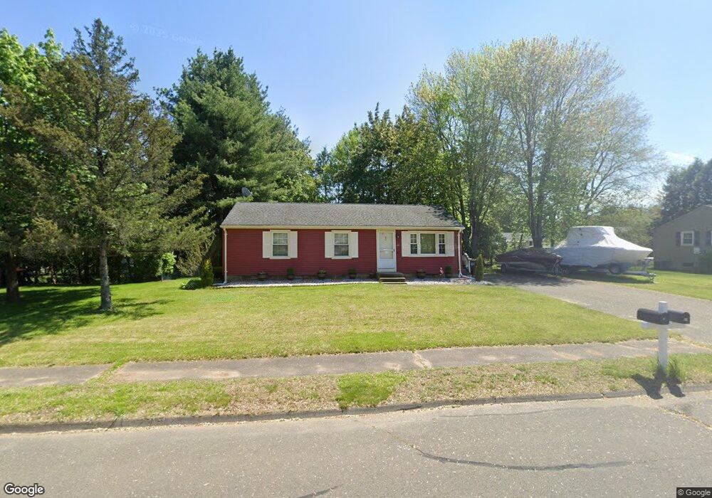
29 Hunting Ln Agawam, MA 01001
Estimated Value: $347,000 - $384,000
3
Beds
2
Baths
1,008
Sq Ft
$357/Sq Ft
Est. Value
About This Home
This home is located at 29 Hunting Ln, Agawam, MA 01001 and is currently estimated at $360,227, approximately $357 per square foot. 29 Hunting Ln is a home located in Hampden County with nearby schools including Agawam Junior High School, Agawam High School, and St Thomas The Apostle School.
Ownership History
Date
Name
Owned For
Owner Type
Purchase Details
Closed on
Jan 21, 2022
Sold by
Jackson Shirley E
Bought by
Prince Todd
Current Estimated Value
Home Financials for this Owner
Home Financials are based on the most recent Mortgage that was taken out on this home.
Original Mortgage
$252,200
Outstanding Balance
$232,434
Interest Rate
3.11%
Mortgage Type
Purchase Money Mortgage
Estimated Equity
$127,793
Purchase Details
Closed on
Nov 20, 2001
Sold by
Bobrowski Joan
Bought by
Jackson Ronald F and Jackson Shirley E
Home Financials for this Owner
Home Financials are based on the most recent Mortgage that was taken out on this home.
Original Mortgage
$128,155
Interest Rate
6.7%
Mortgage Type
Purchase Money Mortgage
Create a Home Valuation Report for This Property
The Home Valuation Report is an in-depth analysis detailing your home's value as well as a comparison with similar homes in the area
Home Values in the Area
Average Home Value in this Area
Purchase History
| Date | Buyer | Sale Price | Title Company |
|---|---|---|---|
| Prince Todd | $260,000 | None Available | |
| Jackson Ronald F | $134,900 | -- |
Source: Public Records
Mortgage History
| Date | Status | Borrower | Loan Amount |
|---|---|---|---|
| Open | Prince Todd | $252,200 | |
| Previous Owner | Jackson Ronald F | $50,000 | |
| Previous Owner | Jackson Ronald F | $128,155 | |
| Previous Owner | Jackson Ronald F | $13,000 | |
| Previous Owner | Jackson Ronald F | $45,000 |
Source: Public Records
Tax History Compared to Growth
Tax History
| Year | Tax Paid | Tax Assessment Tax Assessment Total Assessment is a certain percentage of the fair market value that is determined by local assessors to be the total taxable value of land and additions on the property. | Land | Improvement |
|---|---|---|---|---|
| 2025 | $4,528 | $309,300 | $127,700 | $181,600 |
| 2024 | $4,452 | $306,200 | $127,700 | $178,500 |
| 2023 | $4,179 | $264,800 | $115,000 | $149,800 |
| 2022 | $4,121 | $255,800 | $115,000 | $140,800 |
| 2021 | $3,831 | $225,800 | $98,200 | $127,600 |
| 2020 | $3,724 | $221,300 | $96,300 | $125,000 |
| 2019 | $3,613 | $217,000 | $93,500 | $123,500 |
| 2018 | $3,480 | $209,500 | $93,500 | $116,000 |
| 2017 | $3,337 | $204,600 | $93,500 | $111,100 |
| 2016 | $3,270 | $202,100 | $93,500 | $108,600 |
| 2015 | $3,143 | $199,700 | $93,500 | $106,200 |
Source: Public Records
Map
Nearby Homes
- 15 B Castle Hills Rd Unit B
- 20 Castle Hill Rd Unit D
- 144 Mallard Cir
- 25 Castle Hill Rd Unit E
- 4 H Castle Hills Rd Unit H
- 1 Castle Hill Rd Unit D
- 111 Cottonwood Ln
- 4H Mapleviewlane Unit 4H
- 15 Bailey St
- 0 Silver St
- 869-871 Main St
- 73 Silver Lake Dr
- 31 Cosgrove Ave
- 441 Silver St
- 48 Cosgrove Ave
- 52 Peros Dr
- 42 Lakeview Cir
- 6 Mansion Woods Dr Unit A
- 64 Woodside Dr
- 92 Dogwood Ln