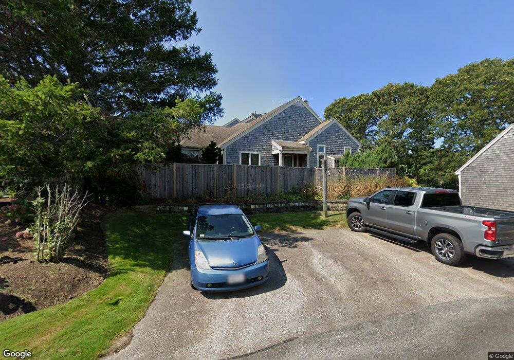
29 John Hall Cartway Unit D Yarmouth Port, MA 02675
Yarmouth Port NeighborhoodEstimated Value: $602,000 - $734,000
2
Beds
4
Baths
2,236
Sq Ft
$303/Sq Ft
Est. Value
About This Home
This home is located at 29 John Hall Cartway Unit D, Yarmouth Port, MA 02675 and is currently estimated at $678,285, approximately $303 per square foot. 29 John Hall Cartway Unit D is a home located in Barnstable County with nearby schools including Dennis-Yarmouth Regional High School.
Ownership History
Date
Name
Owned For
Owner Type
Purchase Details
Closed on
Jul 22, 2011
Sold by
Lowe Faye P Est
Bought by
Barbo S D and Barbo Linda D
Current Estimated Value
Home Financials for this Owner
Home Financials are based on the most recent Mortgage that was taken out on this home.
Original Mortgage
$222,750
Outstanding Balance
$141,900
Interest Rate
3%
Estimated Equity
$536,385
Create a Home Valuation Report for This Property
The Home Valuation Report is an in-depth analysis detailing your home's value as well as a comparison with similar homes in the area
Home Values in the Area
Average Home Value in this Area
Purchase History
| Date | Buyer | Sale Price | Title Company |
|---|---|---|---|
| Barbo S D | $297,000 | -- |
Source: Public Records
Mortgage History
| Date | Status | Borrower | Loan Amount |
|---|---|---|---|
| Open | Barbo S D | $222,750 |
Source: Public Records
Tax History Compared to Growth
Tax History
| Year | Tax Paid | Tax Assessment Tax Assessment Total Assessment is a certain percentage of the fair market value that is determined by local assessors to be the total taxable value of land and additions on the property. | Land | Improvement |
|---|---|---|---|---|
| 2025 | $4,351 | $614,600 | $0 | $614,600 |
| 2024 | $5,049 | $684,200 | $0 | $684,200 |
| 2023 | $4,539 | $559,700 | $0 | $559,700 |
| 2022 | $4,480 | $488,000 | $0 | $488,000 |
| 2021 | $4,356 | $455,700 | $0 | $455,700 |
| 2020 | $3,972 | $397,200 | $0 | $397,200 |
| 2019 | $3,723 | $368,600 | $0 | $368,600 |
| 2018 | $3,793 | $368,600 | $0 | $368,600 |
| 2017 | $3,407 | $340,000 | $0 | $340,000 |
| 2016 | $3,250 | $325,700 | $0 | $325,700 |
| 2015 | $3,430 | $341,600 | $0 | $341,600 |
Source: Public Records
Map
Nearby Homes
- 50 John Hall Cartway
- 50 John Hall Cartway Unit 50
- 42 John Hall Cartway Unit 42
- 228 Kates Path
- 64 Kates Path
- 17 Kates Path Unit A
- 34 Kates Path
- 34 Kates Path Unit 34
- 7 Forest Gate Unit 7
- 30 W Woods
- 30 W Woods Cir Unit 30
- 43 Canterbury Rd
- 44 Stratford Ln
- 25 Oak Glen Village Unit 25
- 25 Oak Glen
- 51 Bray Farm Rd N
- 2 Pine Grove
- 59 Massachusetts 6a Unit 19-2
- 86 Pompano Rd
- 59 Main St Unit 19-2
- 29 John Hall Cartway
- 27 John Hall Cartway
- 25 John Hall Cartway
- 23 John Hall Cartway
- 21 John Hall Cartway
- 19 John Hall Cartway
- 23 John Hall Cartway Unit B
- 21 John Hall Cartway Unit A
- 25 John Hall Cartway Unit 25
- 19 John Hall Cartway Unit 19
- 25 John Hall Cartway Unit B
- 27 John Hall Cartway Unit C
- 34 John Hall Cart Way Unit 34
- 42 John Hall Cartpath Unit H
- 17 John Hall Cartway
- 15 John Hall Cartway
- 13 John Hall Cartway
- 11 John Hall Cartway
- 9 John Hall Cartway
- 7 John Hall Cartway