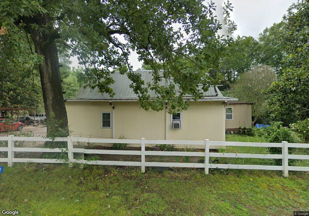
29 Joseph St Bethlehem, GA 30620
Estimated Value: $170,000 - $328,000
3
Beds
2
Baths
1,528
Sq Ft
$177/Sq Ft
Est. Value
About This Home
This home is located at 29 Joseph St, Bethlehem, GA 30620 and is currently estimated at $270,721, approximately $177 per square foot. 29 Joseph St is a home located in Barrow County with nearby schools including Bethlehem Elementary School, Haymon-Morris Middle School, and Apalachee High School.
Ownership History
Date
Name
Owned For
Owner Type
Purchase Details
Closed on
Sep 30, 2022
Sold by
Alas Deperez Gloria D
Bought by
Alas Celena Perez
Current Estimated Value
Purchase Details
Closed on
Apr 30, 2018
Sold by
Jerry D Lampp Fam Lp
Bought by
Alas-Deperez Gloria D and Alas Deperez Juan Carlos Perez
Home Financials for this Owner
Home Financials are based on the most recent Mortgage that was taken out on this home.
Original Mortgage
$68,000
Interest Rate
4.44%
Mortgage Type
New Conventional
Purchase Details
Closed on
Nov 1, 2017
Sold by
Fleeman Brenda R
Bought by
Jerry D Lampp Family Lp
Create a Home Valuation Report for This Property
The Home Valuation Report is an in-depth analysis detailing your home's value as well as a comparison with similar homes in the area
Home Values in the Area
Average Home Value in this Area
Purchase History
| Date | Buyer | Sale Price | Title Company |
|---|---|---|---|
| Alas Celena Perez | -- | -- | |
| Alas-Deperez Gloria D | $75,000 | -- | |
| Jerry D Lampp Family Lp | $28,000 | -- |
Source: Public Records
Mortgage History
| Date | Status | Borrower | Loan Amount |
|---|---|---|---|
| Previous Owner | Alas-Deperez Gloria D | $68,000 |
Source: Public Records
Tax History
| Year | Tax Paid | Tax Assessment Tax Assessment Total Assessment is a certain percentage of the fair market value that is determined by local assessors to be the total taxable value of land and additions on the property. | Land | Improvement |
|---|---|---|---|---|
| 2025 | $1,262 | $49,938 | $29,459 | $20,479 |
| 2024 | $1,271 | $49,333 | $29,459 | $19,874 |
| 2023 | $1,459 | $49,333 | $29,459 | $19,874 |
| 2022 | $1,203 | $40,683 | $29,459 | $11,224 |
| 2021 | $1,072 | $33,856 | $23,567 | $10,289 |
| 2020 | $886 | $27,803 | $17,856 | $9,947 |
| 2019 | $870 | $26,899 | $17,856 | $9,043 |
| 2018 | $361 | $24,931 | $15,888 | $9,043 |
| 2017 | $926 | $31,808 | $21,588 | $10,220 |
| 2016 | $1,028 | $31,808 | $21,588 | $10,220 |
| 2015 | $1,029 | $31,808 | $21,588 | $10,220 |
| 2014 | $652 | $20,798 | $10,578 | $10,220 |
| 2013 | -- | $20,289 | $10,578 | $9,711 |
Source: Public Records
Map
Nearby Homes
- 784 Manger Ave
- 812 Christmas Ave
- 0 Manger Ave E Unit 20154677
- 0 Manger Ave E Unit 20127001
- 14 Rowlett Place
- 54 Rowlett Place
- 13 Rowlett Place
- 724 Manger Ave
- 1050 Bethlehem Church Rd
- 449 & 455 Carl-Bethlehem Rd
- 534 Walton Dr
- 123 Regency Dr
- 898 Harrison Mill Rd
- 220 Carl Bethlehem Rd SW
- 0 Monroe Hwy Unit 7530054
- 0 Monroe Hwy Unit 10466108
- 0 J B Owens Rd Unit CL348952
- 0 J B Owens Rd Unit 10690069
- 129 Carnaby St
- 755 Harry McCarty Rd
Your Personal Tour Guide
Ask me questions while you tour the home.