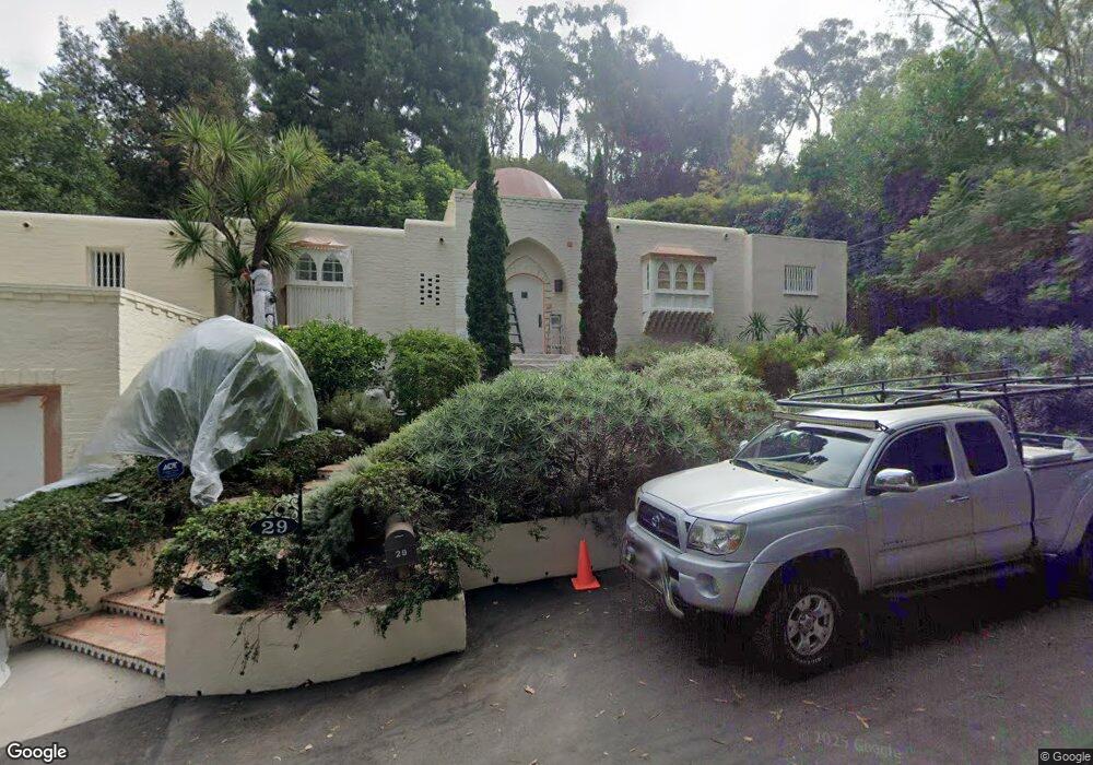
29 Latimer Rd Santa Monica, CA 90402
Estimated Value: $4,096,955 - $4,825,000
About This Home
This home is located at 29 Latimer Rd, Santa Monica, CA 90402 and is currently estimated at $4,538,652, approximately $1,839 per square foot. 29 Latimer Rd is a home located in Los Angeles County with nearby schools including Canyon Charter Elementary, Palisades Charter Elementary, and Paul Revere Charter Middle School.
Ownership History
We collect this data history from publicly available records. To have your information removed, we recommend requesting removal directly through your county’s website.
Purchase Details
Purchase Details
Home Financials for this Owner
Home Financials are based on the most recent Mortgage that was taken out on this home.Home Values in the Area
Average Home Value in this Area
Purchase History
We collect this data history from publicly available records. To have your information removed, we recommend requesting removal directly through your county’s website.
| Date | Buyer | Sale Price | Title Company |
|---|---|---|---|
| -- | None Available | ||
| -- | Fidelity National Financial |
Mortgage History
We collect this data history from publicly available records. To have your information removed, we recommend requesting removal directly through your county’s website.
| Date | Status | Borrower | Loan Amount |
|---|---|---|---|
| Previous Owner | $2,000,000 |
Tax History
We collect this data history from publicly available records. To have your information removed, we recommend requesting removal directly through your county’s website.
| Year | Tax Paid | Tax Assessment Tax Assessment Total Assessment is a certain percentage of the fair market value that is determined by local assessors to be the total taxable value of land and additions on the property. | Land | Improvement |
|---|---|---|---|---|
| 2025 | $6,206 | $504,971 | $269,339 | $235,632 |
| 2024 | $6,642 | $526,735 | $293,390 | $233,345 |
| 2023 | $6,520 | $516,408 | $287,638 | $228,770 |
| 2022 | $6,227 | $506,284 | $281,999 | $224,285 |
| 2021 | $6,137 | $496,358 | $276,470 | $219,888 |
| 2019 | $5,957 | $481,638 | $268,271 | $213,367 |
| 2018 | $5,879 | $472,195 | $263,011 | $209,184 |
| 2016 | $5,605 | $453,861 | $252,799 | $201,062 |
| 2015 | $5,524 | $447,044 | $249,002 | $198,042 |
| 2014 | $5,560 | $438,288 | $244,125 | $194,163 |
Map
- 773 Amalfi Dr
- 800 Brooktree Rd
- 957 Corsica Dr
- 919 Rivas Canyon Rd
- 14511 W Sunset Blvd
- 990 Corsica Dr
- 43 Haldeman Rd
- 1001 Rivas Canyon Rd
- 1072 Amalfi Dr
- 909 Rivas Canyon Rd
- 689 Brooktree Rd
- 1078 Villa Grove Dr
- 681 Brooktree Rd
- 921 Kagawa St
- 659 E Channel Rd
- 1028 Chautauqua Blvd
- 639 Hightree Rd
- 859 Woodacres Rd
- 1046 Chautauqua Blvd
- 630 Hightree Rd
Ask me questions while you tour the home.