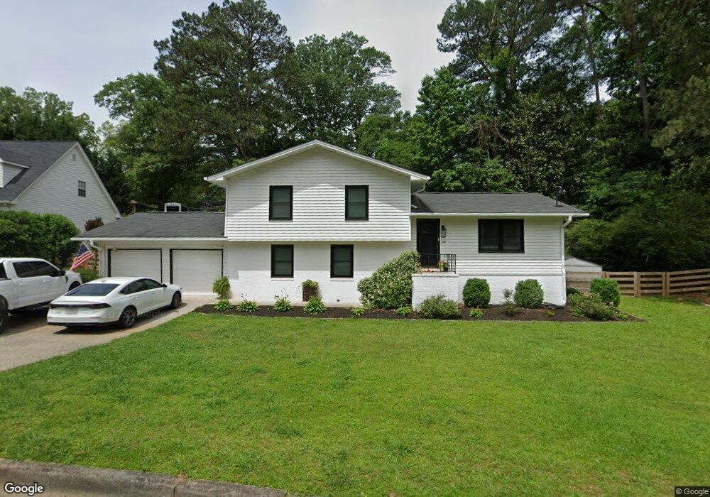
29 Mansour Cir Unit 13 C Newnan, GA 30263
Estimated Value: $400,000 - $449,000
4
Beds
3
Baths
1,912
Sq Ft
$222/Sq Ft
Est. Value
About This Home
This home is located at 29 Mansour Cir Unit 13 C, Newnan, GA 30263 and is currently estimated at $425,093, approximately $222 per square foot. 29 Mansour Cir Unit 13 C is a home located in Coweta County with nearby schools including Elm Street Elementary School, Evans Middle School, and Newnan High School.
Ownership History
Date
Name
Owned For
Owner Type
Purchase Details
Closed on
Sep 13, 2023
Sold by
Sherman Cory
Bought by
Cory W Sherman and Sherman Cory W Trust
Current Estimated Value
Purchase Details
Closed on
Jul 15, 2022
Sold by
Crosswhite Micheal Allen
Bought by
Sherman Cory and Sherman Jessica
Home Financials for this Owner
Home Financials are based on the most recent Mortgage that was taken out on this home.
Original Mortgage
$292,500
Interest Rate
5.78%
Mortgage Type
New Conventional
Purchase Details
Closed on
Mar 25, 2016
Sold by
Robinson Eugenia
Bought by
Crosswhite Michael Allen
Home Financials for this Owner
Home Financials are based on the most recent Mortgage that was taken out on this home.
Original Mortgage
$177,500
Interest Rate
3.65%
Mortgage Type
VA
Purchase Details
Closed on
Sep 13, 2015
Sold by
Robinson Christopher
Bought by
Robinson Eugenia
Purchase Details
Closed on
Aug 27, 2013
Sold by
Federal Home Loan Mortgage Corporation
Bought by
Robinson Christopher and Robinson Eugenia
Home Financials for this Owner
Home Financials are based on the most recent Mortgage that was taken out on this home.
Original Mortgage
$57,600
Interest Rate
4.37%
Mortgage Type
New Conventional
Purchase Details
Closed on
May 7, 2013
Sold by
Cenlar Fsb
Bought by
Federal Home Loan Mortgage Corporation
Purchase Details
Closed on
Dec 31, 2012
Sold by
Hayes Linda Marie
Bought by
Scott Andrea K
Purchase Details
Closed on
Mar 8, 2007
Sold by
Hayes Benny R and Hayes Dora L
Bought by
Scott Andrea K and Hayes Linda
Home Financials for this Owner
Home Financials are based on the most recent Mortgage that was taken out on this home.
Original Mortgage
$139,000
Interest Rate
6.19%
Mortgage Type
New Conventional
Purchase Details
Closed on
Jul 31, 1985
Bought by
Hayes Benny Ray and Hayes D
Create a Home Valuation Report for This Property
The Home Valuation Report is an in-depth analysis detailing your home's value as well as a comparison with similar homes in the area
Home Values in the Area
Average Home Value in this Area
Purchase History
| Date | Buyer | Sale Price | Title Company |
|---|---|---|---|
| Cory W Sherman | -- | -- | |
| Sherman Cory | $325,000 | -- | |
| Crosswhite Michael Allen | $177,500 | -- | |
| Robinson Eugenia | -- | -- | |
| Robinson Christopher | $72,000 | -- | |
| Federal Home Loan Mortgage Corporation | $72,250 | -- | |
| Cenlar Fsb | $72,250 | -- | |
| Scott Andrea K | -- | -- | |
| Scott Andrea K | $115,000 | -- | |
| Hayes Benny Ray | $59,600 | -- |
Source: Public Records
Mortgage History
| Date | Status | Borrower | Loan Amount |
|---|---|---|---|
| Previous Owner | Sherman Cory | $292,500 | |
| Previous Owner | Crosswhite Michael Allen | $177,500 | |
| Previous Owner | Robinson Christopher | $57,600 | |
| Previous Owner | Scott Andrea K | $139,000 |
Source: Public Records
Tax History Compared to Growth
Tax History
| Year | Tax Paid | Tax Assessment Tax Assessment Total Assessment is a certain percentage of the fair market value that is determined by local assessors to be the total taxable value of land and additions on the property. | Land | Improvement |
|---|---|---|---|---|
| 2025 | $4,198 | $174,766 | $32,000 | $142,766 |
| 2024 | $3,200 | $140,035 | $32,000 | $108,035 |
| 2023 | $3,200 | $141,320 | $32,000 | $109,320 |
| 2022 | $2,787 | $114,551 | $32,000 | $82,551 |
| 2021 | $2,521 | $93,808 | $32,000 | $61,808 |
| 2020 | $2,578 | $93,808 | $32,000 | $61,808 |
| 2019 | $2,053 | $68,349 | $14,000 | $54,349 |
| 2018 | $2,066 | $68,349 | $14,000 | $54,349 |
| 2017 | $1,994 | $66,258 | $14,000 | $52,258 |
| 2016 | $1,535 | $50,968 | $14,000 | $36,968 |
| 2015 | $1,286 | $46,347 | $14,000 | $32,347 |
| 2014 | $1,223 | $44,807 | $14,000 | $30,807 |
Source: Public Records
Map
Nearby Homes
- 30 Elm Cir
- 1 Ellis Way
- 3 Northside Dr
- 0 Benelli Ridge Unit 10429105
- 61 Clark St
- 144 Jackson St
- 7 N Annie St
- 33 Ray St
- 16 Hamilton Bohannon Dr
- 7 Fontaine Dr
- 0 Georgia 34 Unit 7614778
- 0 W Hwy 34 Unit 10379383
- 0 W Hwy 34 Unit 7457396
- 97 W Washington St
- 21 Fontaine Dr
- 26 Boone Dr
- 71 Spring St
- 0 N Highway 29 Unit 20115352
- 5 Casey Rd
- 68 Spring St